Chatham in Morris County, New Jersey — The American Northeast (Mid-Atlantic)
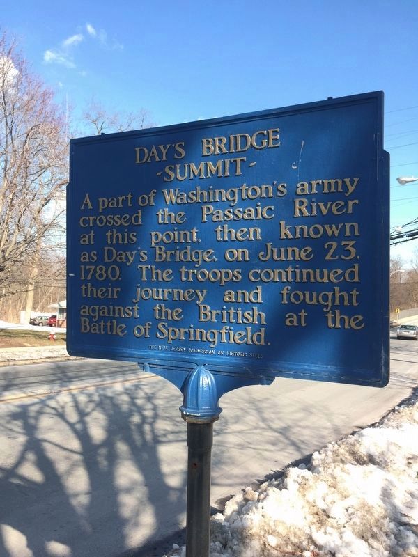
Day's Bridge Summit

Photographed By Susan Allen, circa 2016
1. Day's Bridge Summit Marker
This marker was originally located in Summit prior to construction of Route 24. In May 1982, Baldwin White, Co-Historian of the Summit Historical Society wrote to the Department of Conservation and Economic Development, requesting permission to give the road marker to Chatham to be placed on display on display at the Chatham Water Works. In May 1982, Summit turned it over to Chatham Borough on "indefinite loan". In 2014, the Morris County Heritage Commission was assisting communities with the improvement of the markers currently on the streets. It was at that time that the Day's Bridge Summit marker was located.
Erected 1932 by The New Jersey Commission on Historic Sites.
Topics. This historical marker is listed in these topic lists: Bridges & Viaducts • War, US Revolutionary. A significant historical date for this entry is June 23, 1780.
Location. 40° 44.353′ N, 74° 22.451′ W. Marker is in Chatham, New Jersey, in Morris County. Marker is at the intersection of Main Street (Old State Road 24) and University Avenue/Parrott Mill Road, on the left when traveling west on Main Street. 1698, this area of Morris County was referred to as "The Crossing". Owned by 7 the families of early settlers, in circa 1730, John Day set up home at the Passaic River's crossing and it became known as "John Day's Bridge". This bridge assisted Washington's movement throughout the area. Touch for map. Marker is in this post office area: Chatham NJ 07928, United States of America. Touch for directions.
Other nearby markers. At least 8 other markers are within 2 miles of this marker, measured as the crow flies. New Jersey Journal (here, next to this marker); Chatham Historic District (about 500 feet away, measured in a direct line); a different marker also named Chatham Historic District (approx. half a mile away); Bonnel Town - Chatham (approx. ¾ mile away); Chatham (approx. 1.2 miles away); Signal Beacon and the “Old Sow” (approx. 1.6 miles away); Summit Opera House (approx. 1.6 miles away); Summit Playhouse (approx. 1.7 miles away). Touch for a list and map of all markers in Chatham.
More about this marker. The marker was erected in 1932 by The New Jersey Commission on Historic Sites, then part of the Department of Conservation and Economic Development. It was placed at the bridge over the Passaic River between Summit and Chatham on the Morris Turnpike. The spot marks the area where Washington encamped en route to engage the British in Springfield.
Mrs. Harry A. Marshall, organizing regent of the D.A.R. and a decendant of the Day family was among the first settlers in the area.
Credits. This page was last revised on September 5, 2017. It was originally submitted on February 14, 2017, by Susan Allen of Chatham, New Jersey. This page has been viewed 419 times since then and 48 times this year. Photo 1. submitted on September 4, 2017, by Susan Allen of Chatham, New Jersey. • Bill Pfingsten was the editor who published this page.