Farragut in Knox County, Tennessee — The American South (East South Central)
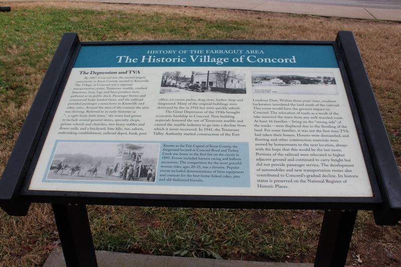
The Historic Village of Concord
The Depression and TVA
Photographed by Tom Bosse, December 26, 2016
1. The Historic Village of Concord Marker
The Great Depression on the 1930s brought economic hardship to Concord. New building materials lessened the use of Tennessee marble and caused the marble industry to go into a decline from which it never recovered. In 1941, the Tennessee Valley Authority
this page online
Known as the Fair Capital of Knox County, the fairground located at Concord Road and Turkey Creek was home to the first fair on the circuit in 1895. Events included harness racing and
Photographed by Tom Bosse, December 26, 2016
2. The Historic Village of Concord Marker
Erected by Farragut Museum.
Topics and series. This historical marker is listed in these topic lists: Industry & Commerce • Settlements & Settlers. In addition, it is included in the Tennessee - History of the Farragut Area series list.
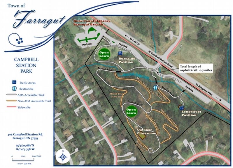
Location. 35° 53.283′ N, 84° 10.033′ W. Marker is in Farragut, Tennessee, in Knox County. It can be reached from Campbell Station Road. Marker is located on the walking trail in Campbell Station Park. Touch for map. Marker is at or near this postal address: 405 Campbell Station Road, Farragut TN 37934, United States of America. Touch for directions.

Regionally, this marker is in East Tennessee and in Greater Knoxville. It is also in the American South, specifically in the Upper South, in Appalachia, and specifically in Southern Appalachia. Globally, it is in North America, the Western Hemisphere, the Western
Photographed by Tom Bosse
3. Campbell Station Park
Other nearby markers. At least 8 other markers are within walking distance of this marker: The Battle of Campbell Station (within shouting distance of this marker); a different marker also named The Historic Village of Concord (within shouting distance of this marker); Admiral David Glasgow Farragut (within shouting distance of this marker); Farragut Schools: Early Years (about 300 feet away, measured in a direct line); Farragut Schools: Recent Years (about 400 feet away); Town of Farragut & Farragut Folklife Museum (about 400 feet away); Pleasant Forest Church & Cemetery (about 500 feet away); Native American Settlement (about 500 feet away). Touch for a list and map of all markers in Farragut.
Also see . . . Concord, Tennessee. (Submitted on January 16, 2017, by Tom Bosse of Jefferson City, Tennessee.)
Credits. This page was last revised on February 20, 2017. It was originally submitted on January 16, 2017, by Tom Bosse of Jefferson City, Tennessee. This page has been viewed 1,671 times since then and 91 times this year. Last updated on February 18, 2017, by Byron Hooks of Sandy Springs, Georgia. Photos: 1, 2, 3. submitted on January 16, 2017, by Tom Bosse of Jefferson City, Tennessee. • Bill Pfingsten was the editor who published this page.
