Lee Vining in Mono County, California — The American West (Pacific Coastal)
Upside-Down House
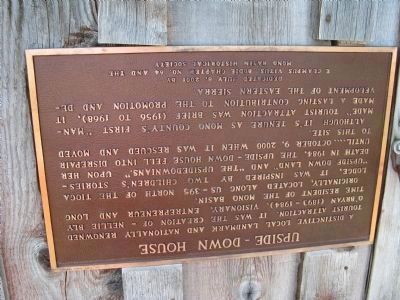
Inscription.
A distinctive local landmark and nationally renowned tourist attraction. It was the creation of - Nellie Bly O’Bryan (1893–1984), visionary, entrepreneur and long time resident of the Mono Basin.
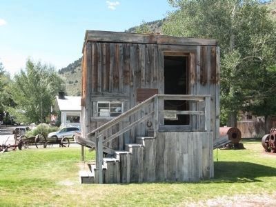
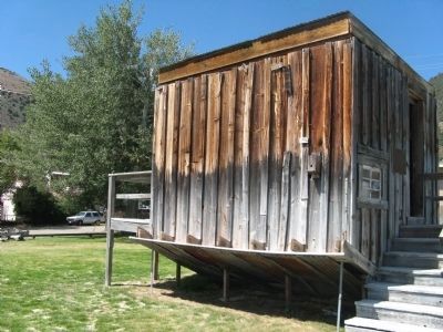
Originally, located along US-395 north of the Tioga Lodge, it was inspired by two children’s stories—“Upside Down Land” and “The Upsidedownians.” Upon her death in 1984 The Upside-Down House fell into disrepair until....October 9, 2000 when it was rescued and moved to this site.
Although its tenure as Mono County’s first “man-made” tourist attraction was brief (1956–1968), it made a lasting contribution to the promotion and development of the Eastern Sierra.
Erected 2001 by E Clampus Vitus, Bodie Chapter No. 64 and the Mono Basin Historical Society.
Topics and series. This historical marker is listed in these topic lists: Architecture • Arts, Letters, Music • Entertainment • Women. In addition, it is included in the Believe It or Not, and the E Clampus Vitus series lists. A significant historical date for this entry is October 9, 1825.
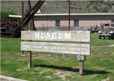
Location. 37° 57.527′ N, 119° 7.159′ W. Marker is in Lee Vining, California, in Mono County. Marker can be reached from Mattly Avenue near 1st Street. The Upside-Down house in located on the grounds of the Mono Basin Historical Society Museum at Hess Park. Touch for map. Marker is in this post office area: Lee Vining CA 93541, United States of America. Touch for directions.
Other nearby markers. At least 8 other markers are within 7 miles of this marker, measured as the crow flies. Lee Vining (approx. 0.2 miles away); Mono Lake (approx. 0.9 miles away); Sheriff James P. Dolan (approx. 1˝ miles away); Grave of Adeline Carson Stilts (approx. 4 miles away); Grave of the Unknown Prospector (approx. 5.2 miles away); Navy Beach (approx. 5.7 miles away); Would-Be Miners and Occasional Tourists (approx. 6.1 miles away); The Tioga Pass Road (approx. 6.1 miles away). Touch for a list and map of all markers in Lee Vining.
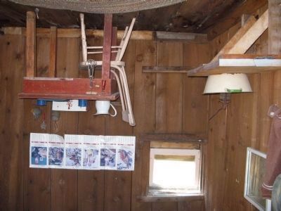
More about this marker. The marker, along with everything in and on the house, is attached upside down.
Credits. This page was last revised on February 25, 2020. It was originally submitted on August 12, 2008, by Syd Whittle of Mesa, Arizona. This page has been viewed 19,081 times since then and 109 times this year. It was the Marker of the Week August 31, 2008. Photos: 1, 2, 3. submitted on August 12, 2008, by Syd Whittle of Mesa, Arizona. 4. submitted on December 27, 2008, by Syd Whittle of Mesa, Arizona. 5. submitted on November 3, 2008, by Syd Whittle of Mesa, Arizona. • Kevin W. was the editor who published this page.
