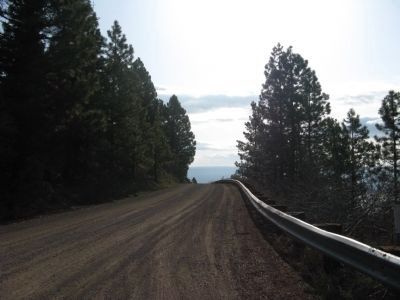
Fandango Pass in Modoc County, California — The American West (Pacific Coastal)
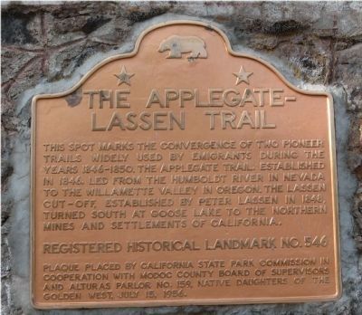
The Applegate-Lassen Trail
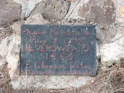
Erected 1956 by California State Park Comm. Modoc County Board of Supervisors, Alturas Parlor No. 159 Native Daughters of the Golden West July 15, 1956 Redicated By E Clampus Vitus, 1992. (Marker Number 546.)
Topics and series. This historical marker is listed in these topic lists: Landmarks • Notable Places • Settlements & Settlers. In addition, it is included in the Applegate Trail, the California Historical Landmarks, the E Clampus Vitus, the Lassen Trail and Burnett Cutoff, and the Native Sons/Daughters of the Golden West series lists. A significant historical year for this entry is 1846.
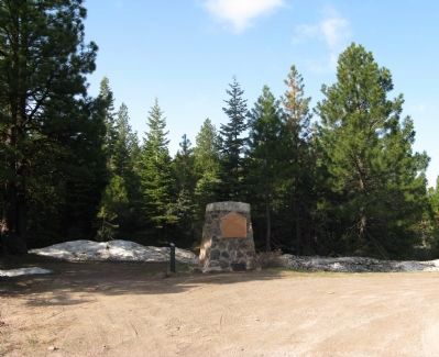
Location. 41° 48.094′ N, 120° 12.336′ W. Marker is in Fandango Pass, California, in Modoc County. Marker is on Fandango Pass Road (County Road 9) 4 miles west of Surprise Valley Road (County Road 1), on the right when traveling east. Marker is located between about 10.8 mi east of Emigrant Trails Scenic Byway (U.S. Highway 395). Touch for map. Marker is in this post office area: Lake City CA 96115, United States of America. Touch for directions.
Other nearby markers. At least 8 other markers are within 10 miles of this marker, measured as the crow flies. The Applegate Trail (here, next to this marker); Applegate Trail - Fandango Pass Descent (within shouting distance of this marker); Applegate Trail - Fandango Pass Ascent (approx. 0.4 miles away); Fort Bidwell Military Post (approx. 4.8 miles away); Applegate Trail - Through the Forest (approx. 5.4 miles away); Applegate Trail - Descent to Lassen Creek (approx. 6.9 miles away); Applegate Trail - Descent to Goose Lake (approx. 8.4 miles away); Applegate Trail - New Road to Yreka (approx. 10 miles away).
Additional commentary.
1. Fandango Pass
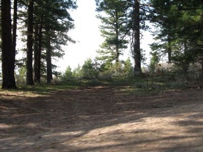
This was once a major emigrant route to Oregon and was part of Peter Lassen’s “Lassen Horn Trail”.
There are more than one story as to how the pass was named. One story states that late in 1851, a large party pf emigrants were camped here. Having made it through the Nevada desert they celebrated by dancing the fandango. Outside the circle of wagons and campfires Piute Indians gathered, attacked and slaughtered the emigrants. From then on this “Lassen Pass” was known as “Fandango Pass”.
Today historians find much to prove that this story is not true. One member of the Wolverine Rangers’ diary gives a more authentic account of the name. Their group was camped in the valley in 1849 when it grew so cold that the men danced all night to keep warm and so named the place “Fandango”.
This route was extensively traveled from 1848 until 1853. The importance of Fandango Pass declined even further after 1869 when the Cedar Pass wagon road was opened.
— Submitted December 12, 2009.
Additional keywords. -120.205600
Credits. This page was last revised on August 5, 2018. It was originally submitted on August 12, 2008, by Syd Whittle of Mesa, Arizona. This page has been viewed 3,245 times since then and 14 times this year. Photos: 1, 2, 3. submitted on August 12, 2008, by Syd Whittle of Mesa, Arizona. 4, 5. submitted on November 3, 2008, by Syd Whittle of Mesa, Arizona. • Kevin W. was the editor who published this page.
Editor’s want-list for this marker. Information about the missing marker once located on the post to the left of this marker. • Can you help?
