
Niagara Falls in Niagara County, New York — The American Northeast (Mid-Atlantic)
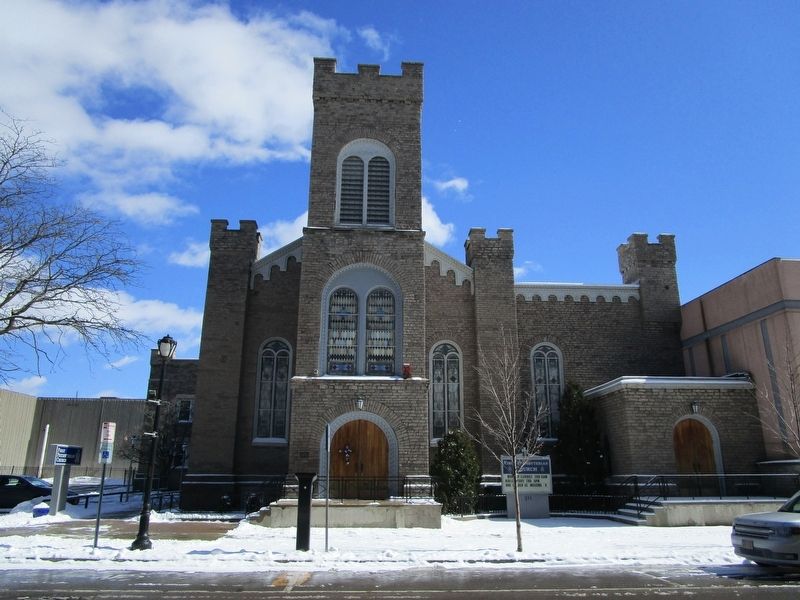
First Presbyterian Church
Photographed by Anton Schwarzmueller, March 12, 2017
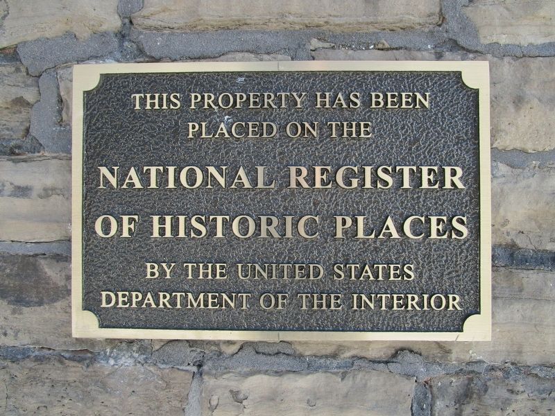
1. First Presbyterian Church Marker
placed on the
National Register
of Historic Places
by the United States
Department of the Interior
Topics. This historical marker is listed in these topic lists: Architecture • Religion & Religious Structures. A significant historical year for this entry is 1849.
Location. 43° 5.196′ N, 79° 3.694′ W. Marker is in Niagara Falls, New York, in Niagara County. It is on First Street 0.1 miles north of Old Falls Street, on the right when traveling north. Marker is fixed to the church, to the left of the center entrance. The church is on the second lot north of the intersection. Touch for map. Marker is at or near this postal address: 311 First Street, Niagara Falls NY 14303, United States of America. Touch for directions.

Regionally, this marker is in Upstate New York, specifically in Western New York, and in the Buffalo Metropolitan Area. It is also in the American Northeast and in the Mid-Atlantic. Globally, it is in North America, on the Great Lakes, in the Western Hemisphere, in the Western World, and in the Anglosphere. Historically, it finds itself in what was once the Viceroyalty
this page online
Other nearby markers. At least 8 other markers are within walking distance of this marker: Votes For Women (about 400 feet away, measured in a direct line); Protecting Our Shared Waters (about 700 feet away); a different marker also named Protecting Our Shared Waters (about 700 feet away); The Boundary Waters Treaty (about 800 feet away); Replica of the Statue of Liberty (approx. 0.2 miles away); The Ice Boom (approx. 0.2 miles away); The Red Coach Inn / Annex Building (approx. 0.2 miles away); The Grounds of this Canal (approx. 0.2 miles away). Touch for a list and map of all markers in Niagara Falls.
Another marker is no longer nearby. Niagara's Industrial Beginnings and the Establishment of the State Reservation (was approx. 0.2 miles away but has been confirmed missing).
Photographed by Anton Schwarzmueller, March 12, 2017
2. First Presbyterian Church
Credits. This page was last revised on March 23, 2017. It was originally submitted on March 12, 2017, by Anton Schwarzmueller of Wilson, New York. This page has been viewed 447 times since then and 16 times this year. Photos: 1, 2. submitted on March 12, 2017, by Anton Schwarzmueller of Wilson, New York.
