Simsbury in Hartford County, Connecticut — The American Northeast (New England)
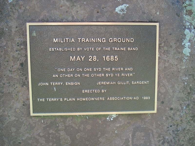
Militia Training Ground
May 28, 1685
“One day on one syd the river and
an another on the other syd ye river”
John Terry, Ensign
Jeremiah Gillit, Sargent
Erected 1993 by the Terry’s Plain Homeowners Association.
Topics. This historical marker is listed in these topic lists: Colonial Era • Patriots & Patriotism. A significant historical date for this entry is May 28, 1685.
Location. 41° 53.262′ N, 72° 46.823′ W. Marker is in Simsbury, Connecticut, in Hartford County. Marker is at the intersection of Terry's Plain Road and Goodrich Road, on the right when traveling north on Terry's Plain Road. Touch for map. Marker is at or near this postal address: 116 Terry's Plain Road, Simsbury CT 06070, United States of America. Touch for directions.
Other nearby markers. At least 8 other markers are within 2 miles of this marker, measured as the crow flies. First House and Ferry (approx. 0.3 miles away); First School House (approx. half a mile away); Constitution Oak (approx. half a mile away); Simsbury (approx. 1.2 miles away); This Elm Tree (approx. 1.2 miles away); The Landmark Building (approx. 1.4 miles away); Simsbury Veterans Memorial (approx. 1.4 miles away); Eno Memorial Hall (approx. 1.4 miles away). Touch for a list and map of all markers in Simsbury.
Regarding Militia Training Ground. Simsbury was founded in 1670. Three years later the town established a militia, then known as a "traine band" to protect against a potential attack from the Dutch. The Grand Committee of the Militia met in Hartford on August 11, 1673 to organize a militia against a potential attack.. The Committee ordered the raising of 500 dragoones (calvary) from Connecticut. At that meeting, Simon Wolcott and John Griffin of Simsbury were appointed to command the Simsbury Traine Band, made up of 7 dragoones. The Committee also ordered that each dragoon be provided with a horse, sword & belt, and a musket & pouch with 1 pound of powder and 3 pounds of bullets.
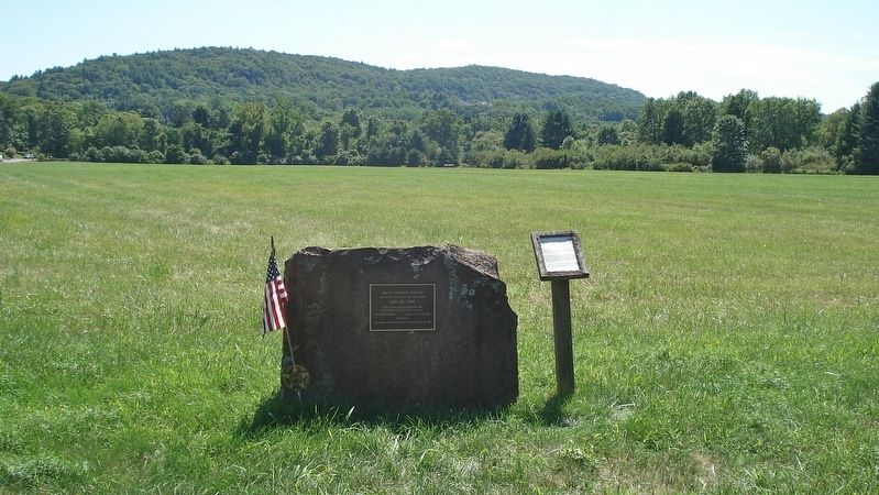
On May 28, 1685 the Traine Band decided to have their training days divided equally between the west and east side of the Farmington River. John Terry was also chosen as Ensign. The land that this monument is located on was purchased by John Terry in 1677. It is found on the east side of the river.
Also see . . .
1. Terry’s Plain Historic District. (Submitted on March 17, 2017, by Alan M. Perrie of Unionville, Connecticut.)
2. Terry’s Plain Historic District. (Submitted on March 17, 2017, by Alan M. Perrie of Unionville, Connecticut.)
Credits. This page was last revised on March 19, 2017. It was originally submitted on March 17, 2017, by Alan M. Perrie of Unionville, Connecticut. This page has been viewed 323 times since then and 34 times this year. Photos: 1, 2. submitted on March 17, 2017, by Alan M. Perrie of Unionville, Connecticut. • Bill Pfingsten was the editor who published this page.

