Mérida, Yucatán, Mexico — The Southeast (Yucatan Peninsula)
The Saint Lucia Neighborhood
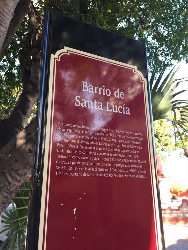
Barrio de Santa Lucía
Destinado originalmente para albergar a los esclavos negros al servicio de los españoles, el templo que dio nombre a este barrio se construye en 1575 por el encomendero D. Pedro García, destinando el terreno aledaño para el cementerio de los españoles. En 1804 el Gobernador Benito Pérez de Valdelomar manda a conformar la plaza de Santa Lucía, aunque los corredores con arcos se concluyen hasta 1873. Destinado como espacio público desde 1871 por el Gobernador Manuel Cirerol, se puede considerar que es el tercer parque más antiguo de Mérida. En 1887 se instala el obelisco al Gral. Sebastián Molas, y desde 1965 es escenario de las tradionales noches de la Serenata Yucateca.
English:
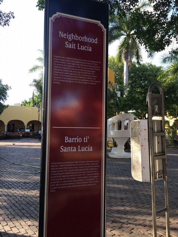
Neighborhood Saint Lucía
Originally built to lodge black slaves at the service of the Spaniards, the temple that gave name to this neighborhood was built in 1575 by a landlord named D. Pedro Garcia, who reserved the bordering land for the cemetery of the Spanish. In 1804, the Governor Benito Perez de Valdelomar ordered the construction of the Santa Lucia square, although the corridors with arches were concluded until 1875. Designated as a public space since 1871 by the Governor Manuel Cirerol, it can be labeled as the third oldest park in Merida. The monument to Gral. Sebastian Molas was established in 1887, and since 1965 it has been the stage for the traditional nights of Yucatecan Serenade.
Maya-Yucateco:
Barrio ti Santa Lucía
Le k’uj naj ba'ax yo’olal dza'ab u k'aba’ le barrioa’ yáax beetea’an ti’al u kajtal box máako’ob palitzilta’ano’ob tumeen le kastláan máako’obo’, beeta’ab tumeen Pedro Garcia, ba’ale’ p’ata’ab ti’al u beeta’al u kúuchil muksaj tu ja'abil 1575. Tu ja’abil 1804 le jala’ach Pedro Valdelomar o’ tu túuktaj beetmil u kiiwikil Santa Lucía, kex wáa le yáanal beeta’an u arrcoilo’ob dzo’okesa’ab u beeta’al tu ja’abil 1873. Tu jala’achil Manuel Cirerol tu ja'abil 1871 ti'al u meyaj ti’ tuláakal wiinike’, je’el u páajtal u ya’ala’al leti’ le u dzok oxp’éel u jach úuchbenil ti’ u noj kaajil Jo’. Tu ja’abil 1887 ka dza’ab le obelisco ti’ General Sebastián molas, ma túun tu ja’abil 1965 dzo’ok u suut u kúuchil ti’al u beeta’al serenata ti’al áak'ab.
Topics. This historical marker is listed in these topic lists: Architecture • Man-Made Features. A significant historical year for this entry is 1575.
Location. 20° 58.263′ N, 89° 37.345′ W. Marker is in Mérida, Yucatán. Marker is on Calle 60, on the left when traveling north. Touch for map. Marker is in this post office area: Mérida YU 97000, Mexico. Touch for directions.
Other nearby markers. At least 8 other markers are within walking distance of this marker. Coronel Sebastián Molas (a few steps from this marker); The Hotel Mérida (about 120 meters away, measured in a direct line); "El Colonial" (about 180 meters away); Gabriel Vicente Gahona y Pasos, "Picheta" (approx. 0.2 kilometers away); House of Mr. Andrés Quintana Roo (approx. 0.3 kilometers away); Museum and Art Gallery Juan Gamboa Guzmán (approx. 0.3 kilometers away); La Nacional Building (approx. 0.3 kilometers away); General Manuel Cepeda Peraza (approx. 0.3 kilometers away). Touch for a list and map of all markers in Mérida.
Photographed By J. Makali Bruton, January 17, 2017
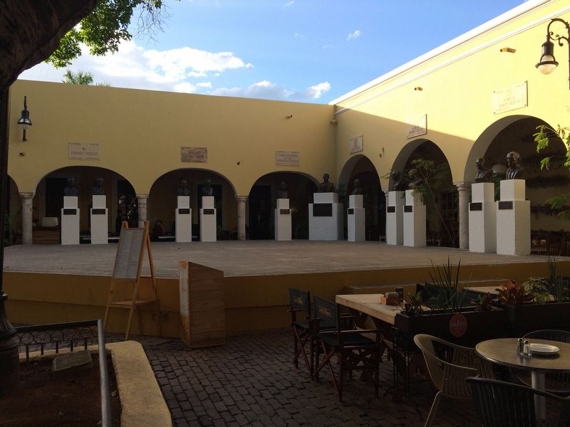
4. The "Yucatecan Serenade" Stage at the Saint Lucia Park
In the northwestern corner of the park is this stage, used for the annual "Yucatecan Serenade" event mentioned on the marker. The stage includes markers and busts from past singers and artists.
Photographed By J. Makali Bruton, January 17, 2017
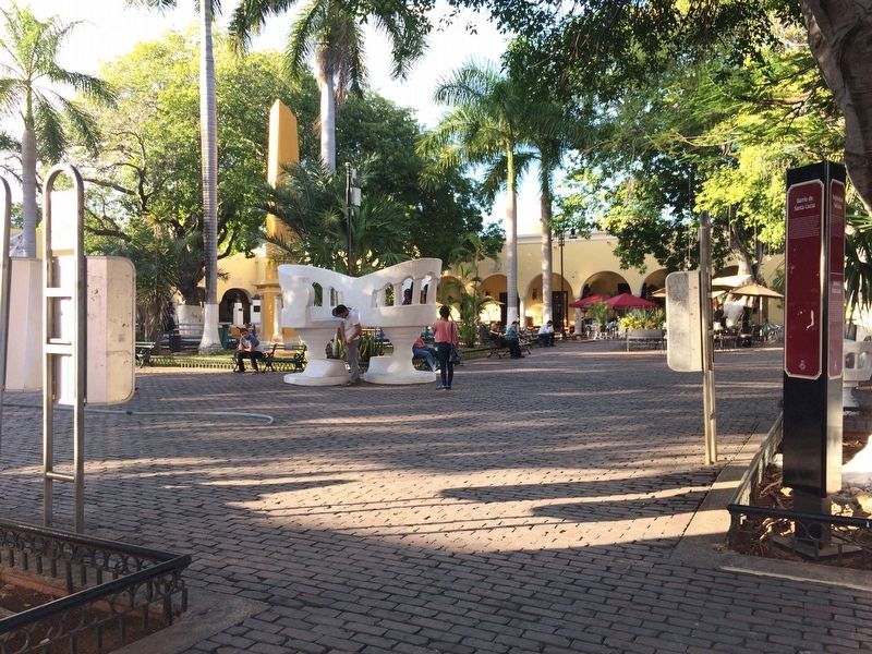
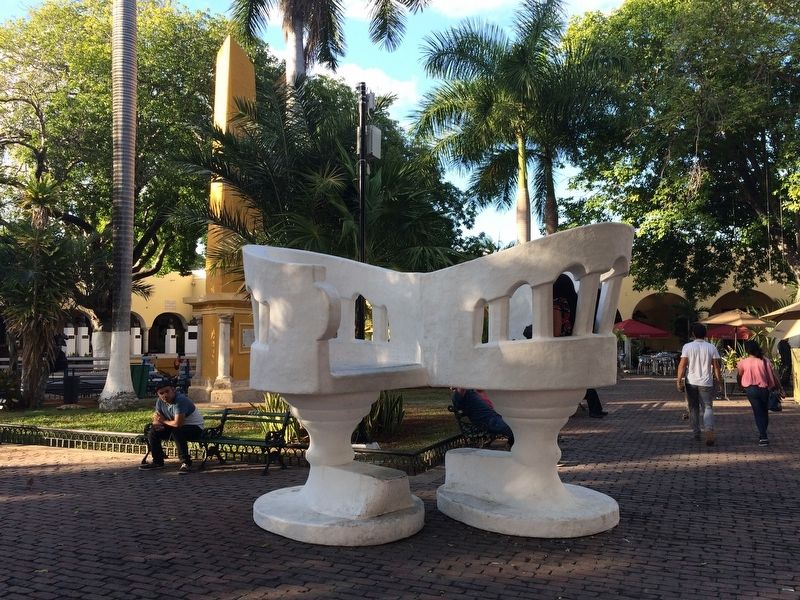
5. "Confidant" armchairs or "sillas tú y yo"
This out-sized example of the "confidant" armchairs seen in parks throughout the Yucatán are a notable feature of the Santa Lucia Park. The chairs allow two people to see each other face-to-face while chatting.
Credits. This page was last revised on December 6, 2017. It was originally submitted on March 19, 2017, by J. Makali Bruton of Accra, Ghana. This page has been viewed 151 times since then and 5 times this year. Photos: 1, 2, 3, 4, 5. submitted on March 20, 2017, by J. Makali Bruton of Accra, Ghana.
