Riverton in Barkhamsted in Northwest Hills Region, Connecticut — The American Northeast (New England)
Riverton
Farmington River: Wild & Scenic
Photographed by Alan M. Perrie, March 22, 2016
1. Riverton Marker
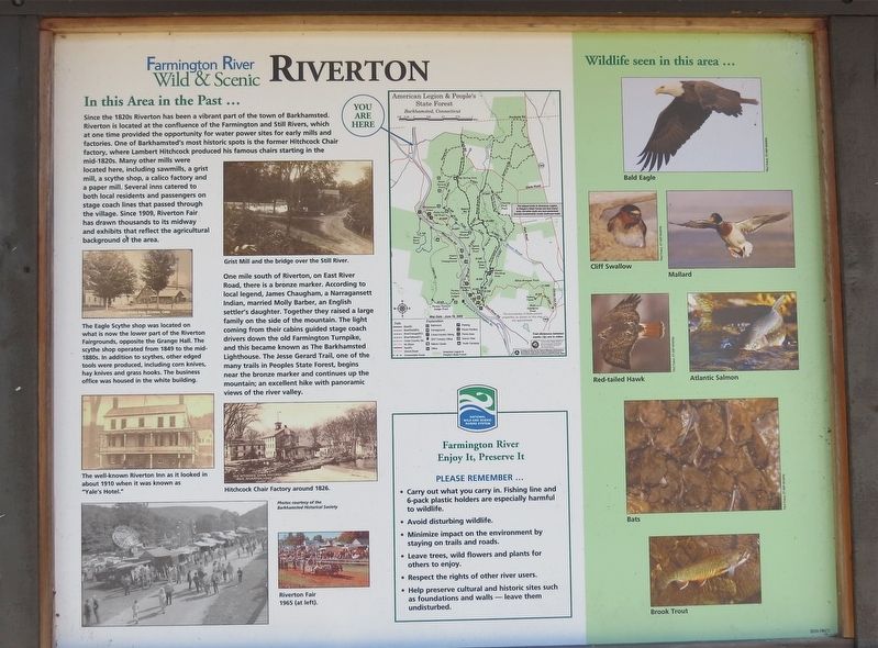
The Eagle Scythe shop was located on what is now the lower part of the Riverton Fairgrounds, opposite the Grange Hall. The scythe shop operated from 1849 to the mid-1880’s. In addition to scythes, other edged tools were produced, including corn knives, hay knives and grass hooks. The business office was housed in
this page online
One mile south of Riverton, on East River Road, there is a bronze marker. According to local legend, James Chaugham, a Narragansett Indian, married Molly Barber, an English settler’s daughter. Together they raised a large family on the side of the mountain. The light coming from their cabins guided stage coach drivers down the old Farmington Turnpike, and this became known as The Barkhamsted Lighthouse. The Jesse Gerard Trail, one of many trails in Peoples State Forest, begins near the bronze marker and continues up the mountain; an excellent hike with panoramic views of the river valley.
Erected by Farmington River Coordinating Committee.
Topics. This historical marker is listed in this topic list: Notable Places. A significant historical year for this entry is 1820.
Location. 41° 57.755′ N, 73° 1.078′ W. Marker is in Barkhamsted in Northwest Hills Region, Connecticut. It is in Riverton. It is at the intersection of Riverton Road (Connecticut Route 20) and School Street, on the right when traveling east on Riverton Road. Touch for map. Marker is at or near this postal address: 99 Riverton Road,
Photographed by Alan M. Perrie, March 22, 2016
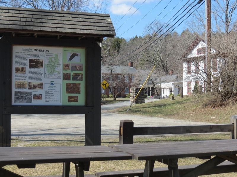
2. The marker is in the Riverton Historic District

Regionally, this marker is in Connecticut’s Berkshire Foothills and in the Litchfield Hills. It is also in the American Northeast and in New England. Globally, it is in North America, the Western Hemisphere, the Western World, and the Anglosphere. Historically, it finds itself in what was once Litchfield County and also one of the original Thirteen Colonies.
Other nearby markers. At least 8 other markers are within 2 miles of this marker, measured as the crow flies: A different marker also named Riverton (a few steps from this marker); Lambert Hitchcock (within shouting distance of this marker); In Honor of Lambert Hitchcock (about 500 feet away, measured in a direct line); Civilian Conservation Corps Fire Ponds (approx. one mile away); Henry Robinson Buck (approx. 1½ miles away); Barkhamsted Lighthouse Village Charcoal Kilns (approx. 1½ miles away); Barkhamsted Lighthouse Village (approx. 1½ miles away); Peoples State Forest (approx. 1½ miles away). Touch for a list and map of all markers in Barkhamsted.
Also see . . .
1. Riverton Historic District.
Photographed by Alan M. Perrie, March 22, 2016
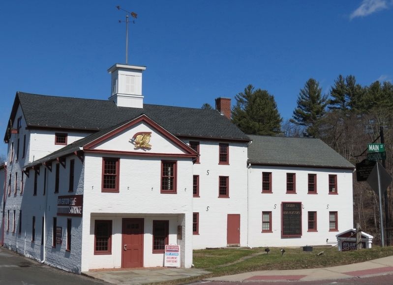
3. Hitchcock Chair factory (NRHP)
2. Farmington River Coordinating Committee. Organization website homepage (Submitted on March 21, 2017, by Alan M. Perrie of Unionville, Connecticut.)
3. Old Riverton Inn. Wikipedia entry (Submitted on March 21, 2017, by Alan M. Perrie of Unionville, Connecticut.)
4. Lambert Hitchcock. Wikipedia entry (Submitted on March 21, 2017, by Alan M. Perrie of Unionville, Connecticut.)
Photographed by Alan M. Perrie, March 22, 2016
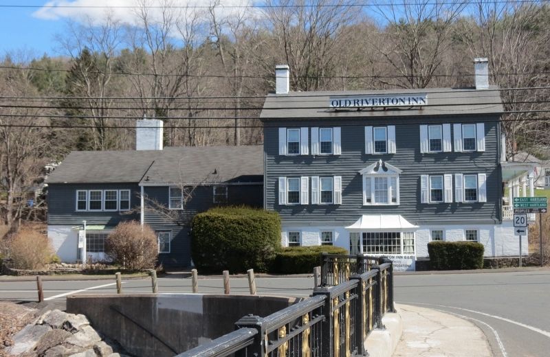
4. Old Riverton Inn (NRHP)
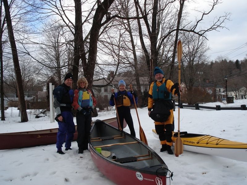
Photographed by Alan M. Perrie, February 2, 2008
5. Boating on the Farmington River
Credits. This page was last revised on May 19, 2026. It was originally submitted on March 21, 2017, by Alan M. Perrie of Unionville, Connecticut. This page has been viewed 831 times since then and 62 times this year. Photos: 1, 2, 3, 4, 5. submitted on March 21, 2017, by Alan M. Perrie of Unionville, Connecticut. • Bill Pfingsten was the editor who published this page.
