Aiken in Aiken County, South Carolina — The American South (South Atlantic)
Water Trough and Drinking Fountain
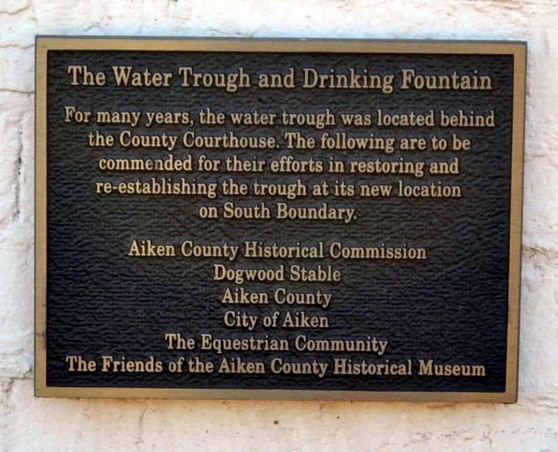
Photographed by Brian Scott, February 25, 2017
1. Water Trough and Drinking Fountain Marker
For many years, the water trough was located behind the County Courthouse. The following are to be commended for their efforts in restoring and re-establishing the trough as its new location on South Boundary.
Erected by Aiken County Historical Commission; Dogwood Stable; Aiken County; City of Aiken; The Equestrian Community; Friends of the Aiken County Museum.
Topics. This historical marker is listed in this topic list: Landmarks.
Location. 33° 33.3′ N, 81° 43.467′ W. Marker is in Aiken, South Carolina, in Aiken County. It is at the intersection of South Boundary Avenue Southwest and Newberry Street Southwest, on the right when traveling east on South Boundary Avenue Southwest. Touch for map. Marker is at or near this postal address: 433 Newberry Street Southwest, Aiken SC 29801, United States of America. Touch for directions.

Regionally, this marker is in Greater Augusta and in the Midlands. It is also in the American South and specifically in the Deep South. Globally, it is in North America, the Western Hemisphere, the Western World, and the Anglosphere.
this page online
Other nearby markers. At least 10 other markers are within walking distance of this marker: Frederick Ergle Log Cabin (here, next to this marker); The One Room Schoolhouse (within shouting distance of this marker); Ergle Family Log Cabin (within shouting distance of this marker); Banksia (within shouting distance of this marker); Coker Spring (within shouting distance of this marker); a different marker also named "Banksia" (about 300 feet away, measured in a direct line); Aiken County Museum (about 300 feet away); Aiken County Courthouse Bell (about 400 feet away); Hitchcock Woods (about 400 feet away); The Transit of Venus (about 400 feet away). Touch for a list and map of all markers in Aiken.
Another marker is no longer nearby. Aiken County Courthouse Bell (was about 400 feet away but has been replaced with another marker now near it).
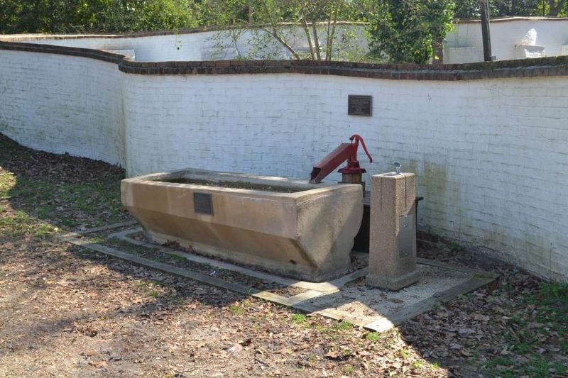
Photographed by Brian Scott, February 25, 2017
2. Water Trough, Drinking Fountain, and Marker
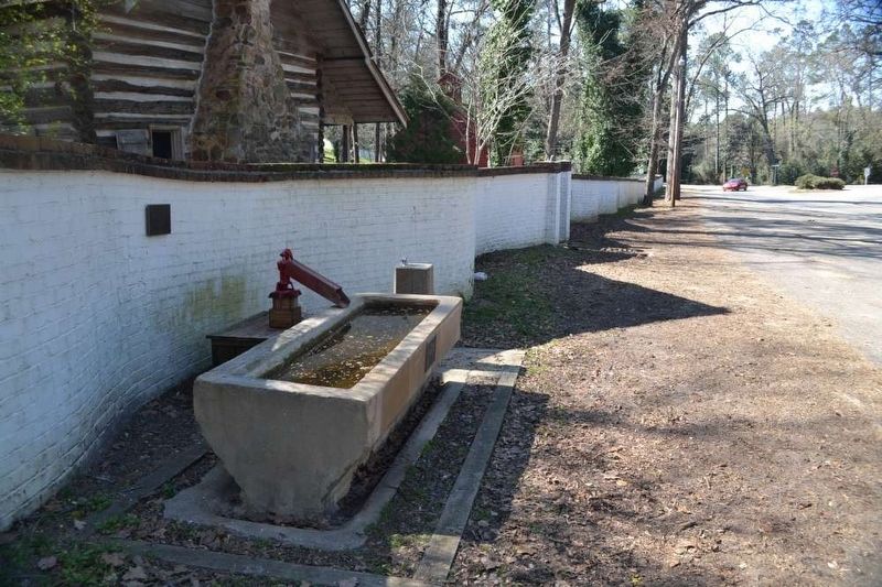
Photographed by Brian Scott, February 25, 2017
3. Water Trough, Drinking Fountain, and Marker

Photographed by Brian Scott, February 25, 2017
4. Summer Squall Memorial
Located on the Water Trough
Located on the Water Trough
Dogwood Stable's
Summer Squall
1987-2009
He could run a hole in the wind.
Click for more information.
Credits. This page was last revised on January 22, 2026. It was originally submitted on March 28, 2017, by Brian Scott of Anderson, South Carolina. This page has been viewed 966 times since then and 43 times this year. Photos: 1, 2, 3, 4. submitted on March 28, 2017, by Brian Scott of Anderson, South Carolina.
