William Penn Annex East in Philadelphia in Philadelphia County, Pennsylvania — The American Northeast (Mid-Atlantic)
History Lost & Found
The President's House
| — | Freedom and Slavery in the Making of a New Nation | — |

Photographed by William Fischer, Jr., March 23, 2017
1. History Lost & Found Marker
Archeology
Archeologists not only dig in remote places to uncover ancient civilizations, but they also look for artifacts at urban sites such as this one. Look below for remnants of the President's House foundation using the diagram as a guide.
[Captions:]
President's House Site Archeological Excavation with key. Courtesy, Independence National Historical Park.
The historic ground plan for the President's House showing the area of the excavations and the relationship of the site to the present Liberty Bell Center. Courtesy, Independence National Historical Park.
On July 11, 2007, a West African Yoruba and Pan-African libation ceremony concluded the closing of the archeological investigation.
Archeologists at work in the cold cellar area of the kitchen.
Erected by National Park Service, U.S. Department of the Interior.
Topics. This historical marker is listed in this topic list: Notable Buildings. A significant historical date for this entry is July 11, 2007.
Location. This marker has been replaced by another marker nearby. It was located near 39° 57.026′ N, 75° 9.004′ W. Marker was in Philadelphia, Pennsylvania,
this page online

Regionally, this marker was in Southeast Pennsylvania. It was also in the American Northeast and in the Mid-Atlantic. Globally, it was in North America, the Western Hemisphere, the Western World, and the Anglosphere. Historically, it found itself in what was once the Haudenosaunee (Iroquois) Confederacy, New Netherland, and one of the original Thirteen Colonies.
Other nearby markers. At least 5 other markers are within walking distance of this location: A different marker also named History Lost & Found (here, next to this marker); The President's House (here, next to this marker); The Executive Mansion (here, next to this marker); William Howe (here, next to this marker); The Ambassadors Clause (here, next to this marker). Touch for a list and map of all markers in Philadelphia.
Other
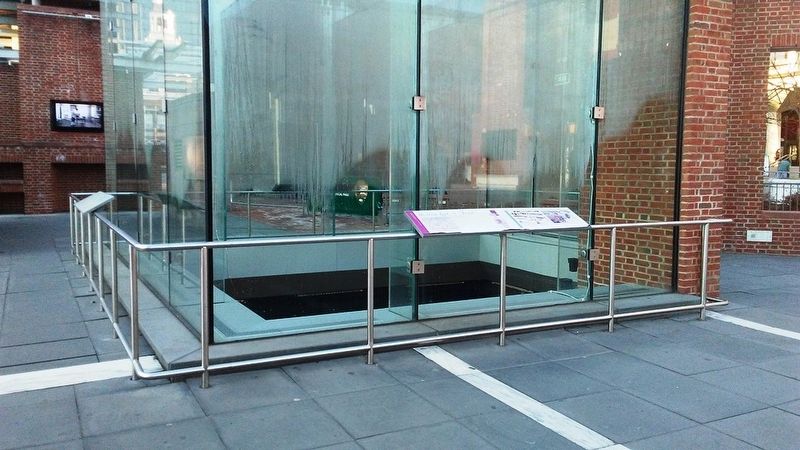
Photographed by William Fischer, Jr., March 23, 2017
2. History Lost & Found Marker
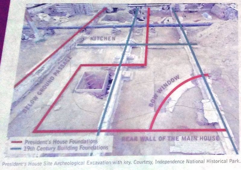
Photographed by National Park Service, circa 2007
3. Foundation Excavation Photo on History Lost & Found Marker
Also see . . .
1. History of the President's House Site. (Submitted on March 31, 2017, by William Fischer, Jr. of Reynoldsburg, Ohio.)
2. President's House Site: Uncovering the Past through Archeology. (Submitted on March 31, 2017, by William Fischer, Jr. of Reynoldsburg, Ohio.)
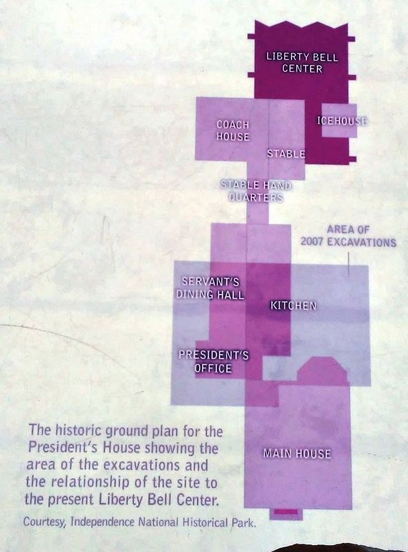
Photographed by National Park Service
4. Excavation Diagram on History Lost & Found Marker
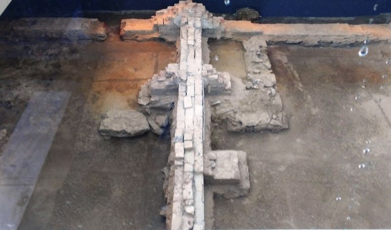
Photographed by William Fischer, Jr., March 23, 2017
5. View of Exposed Foundation From Near The History Lost & Found Marker
Credits. This page was last revised on July 28, 2026. It was originally submitted on March 31, 2017, by William Fischer, Jr. of Reynoldsburg, Ohio. This page has been viewed 689 times since then and 118 times this year. Photos: 1, 2, 3, 4, 5. submitted on March 31, 2017, by William Fischer, Jr. of Reynoldsburg, Ohio.
