Georgetown in Georgetown County, South Carolina — The American South (South Atlantic)
Rice is King
| — | Port of Georgetown | — |
Photographed by Brian Scott, March 31, 2017
1. Rice is King Marker
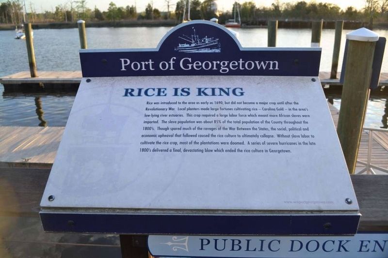
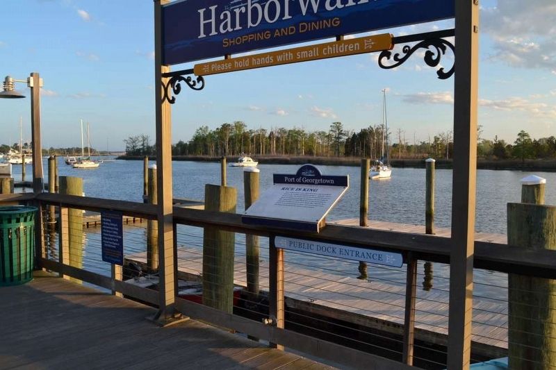
Rice was introduced to the area as early as 1690, but did not become a major crop until after the Revolutionary War. Local planters made large fortune cultivating rice - Carolina Gold - in the area's low-lying river estuaries. This crop required a large labor force which meant more African slaves were imported. The slave population was about 85% of the total population of the County throughout the 1800's. Though spared much of the ravages of the War Between the States, the social, political and economic upheaval that followed caused the rice culture to ultimately collapse. Without slave labor to cultivate the rice crop, most of the plantations were doomed. A series of severe hurricanes in the late 1900's delivered a final, devastating blow which ended the rice culture of Georgetown.
Erected by Port of Georgetown.
Topics. This historical marker is listed in these topic lists: African Americans • Agriculture. A significant historical year for this entry is 1690.
Location. 33° 21.9′ N, 79° 16.967′ W. Marker is in Georgetown, South Carolina, in Georgetown County. It can be reached from Harborwalk. Touch for map.
this page online

Regionally, this marker is in South Carolina’s Pee Dee and on Waccamaw Neck. It is also in the American South, specifically in the Deep South, and on the Eastern Seaboard. Globally, it is in the North Atlantic Region, North America, the Western Hemisphere, the Western World, and the Anglosphere. Historically, it finds itself in what was once the territory of the Mississippian Culture, one of the original Thirteen Colonies, one of the Confederate States of America, and the Antebellum South.
Other nearby markers. At least 10 other markers are within walking distance of this marker: South Carolina’s Third Oldest City (a few steps from this marker); 631 Front Street (within shouting distance of this marker); Marquis de Lafayette (within shouting distance of this marker); Town Clock / Kaminski Building (within shouting distance of this marker); Sinking Of The USS Harvest Moon (within shouting distance of this marker); 633 Front Street (within shouting distance of this marker); The Rice Museum (within shouting distance
Photographed by Brian Scott, March 31, 2017
2. Rice is King Marker
Credits. This page was last revised on May 27, 2026. It was originally submitted on April 8, 2017, by Brian Scott of Anderson, South Carolina. This page has been viewed 481 times since then and 19 times this year. Photos: 1, 2. submitted on April 8, 2017, by Brian Scott of Anderson, South Carolina.
