Newington in Rockingham County, New Hampshire — The American Northeast (New England)
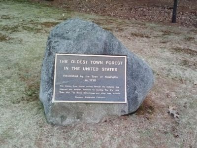
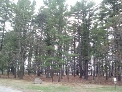
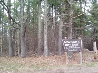
The Oldest Town Forest in the United States
Inscription.
Established by the Town of Newington in 1710
The income from timber cutting through the centuries has financed and supplied materials for building The Old 1872 Town Hall, The Stone Schoolhouse, and other town projects.
Erected by Newington Conservation Commission.
Topics. This historical marker is listed in this topic list: Environment. A significant historical year for this entry is 1710.
Location. 43° 5.829′ N, 70° 49.957′ W. Marker is in Newington, New Hampshire, in Rockingham County. Marker is on Nimble Hill Road, 0.2 miles north of Arboretum Road, on the right. Touch for map. Marker is in this post office area: Portsmouth NH 03801, United States of America. Touch for directions.
Other nearby markers. At least 8 other markers are within 4 miles of this marker, measured as the crow flies. Newington (approx. 1.3 miles away); Bloody Point Ferry (approx. 1.4 miles away); Dr. Jeremy Belknap (1744 - 1798) (approx. 2.3 miles away); The Alexander Scammell Bridge over the Bellamy River (approx. 2˝ miles away); US Route 1 Bypass of Portsmouth, NH (1940) (approx. 3.1 miles away); Russell A. Hanscom Memorial (approx. 3.1 miles away); Portsmouth Naval Shipyard Memorial (approx. 3.4 miles away); James Baxter Sergeant (approx. 3.4 miles away). Touch for a list and map of all markers in Newington.
Photographed By Jenn Wintermantel, April 29, 2014
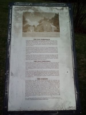
6. The Old Parsonage/The Old Town Hall/The Parade sign
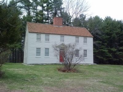
The Old Parsonage
Local folk lore handed down by generations, established the date of the building as 1699. Architect John Mead Howells, in his "Architectural Heritage of the Piscataqua" sets the date as 1710. Later researchers claim the date of 1725. The house was built by Richard Pomeroy, first sexton of the Church. His death in 1725 makes one of the earlier dates seem more likely.
The building was acquired by the Town from the Knight family in 1765. In 1788 it was put in suitable repair for occupancy by the family of the Reverend Joseph Langdon. His pastorate lasted for twenty-two years. In addition to its use as a parsonage it has served as a tavern, town farm for the poor, a school (where women were not allowed to teach) and rented to individuals. The Newington Historical Society has leased the building since 1912.
Details of the structure are illustrated in Mr. Howell's book. The Old Parsonage has been designated by the Secretary of the Interior as "being worthy of the most careful preservation for the benefit of future generations," and is documented in the Library of Congress. The photo shows the unique design of the rear entrance.
The Old Town Hall
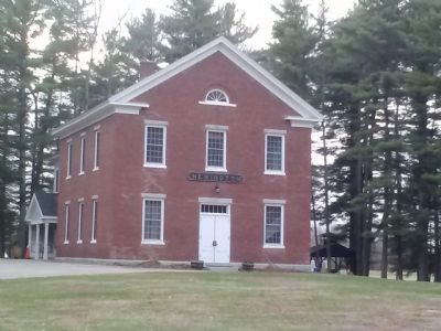
Built in 1872, the venerable building (opposite) served as the seat of government for almost a century. It also housed a two-room elementary school until 1921. In addition to the sometime stormy town meetings where everything was hotly discussed from highway appropriations to the support of indigent widows and the offspring of unwed mothers, the old building was the home of the Piscataqua Grange and the Reapers Circle.
Before the advent of radio and television, the old hall served as the social center for square dances, plays and whist parties. The sign above the door was intended for a ship of that name, one of many built on the local river bank during World War One. The Armistice of 1918 left the "Newington" and several other partially completed hulls rotting on the building ways.
The Parade
Until recent years, the section of road between the two buildings was known as the "parade," an area where Town Militia was mustered and drilled in the manual of arms. Every town in colonial New Hampshire was ordered in 1696 by the General Assembly to organize a company of militia. All able bodied males, including slaves and indentured servants, between the ages of 16 and 60, were required to equip themselves with a musket, powder and ball and to drill at least six times a year. The militia law was welcomed in the local settlement. In 1690, a party of Indians raided Fox Point where they burned several houses, killed 14 people and carried away six. Fox Point is about two miles north of here. The entire settlement, until it was set apart as a separate parish in 1712, was called Bloody Point. The settlement, surrounding five garrison houses, was under the threat of attack throughout the French and Indian Wars from 1689 to 1717.
The road was part of the ancient Post Road from Boston and Newburyport to Dover, Concord and the northern wilderness.
Credits. This page was last revised on May 29, 2023. It was originally submitted on May 3, 2014, by Mike Wintermantel of Pittsburgh, Pennsylvania. This page has been viewed 898 times since then and 50 times this year. Last updated on April 11, 2017, by James R. Murray of Elkton, Florida. Photos: 1, 2, 3, 4, 5, 6. submitted on May 3, 2014, by Mike Wintermantel of Pittsburgh, Pennsylvania. • Bill Pfingsten was the editor who published this page.
