Macon in Bibb County, Georgia — The American South (South Atlantic)
Oak Ridge Cemetery
1840 to 1865
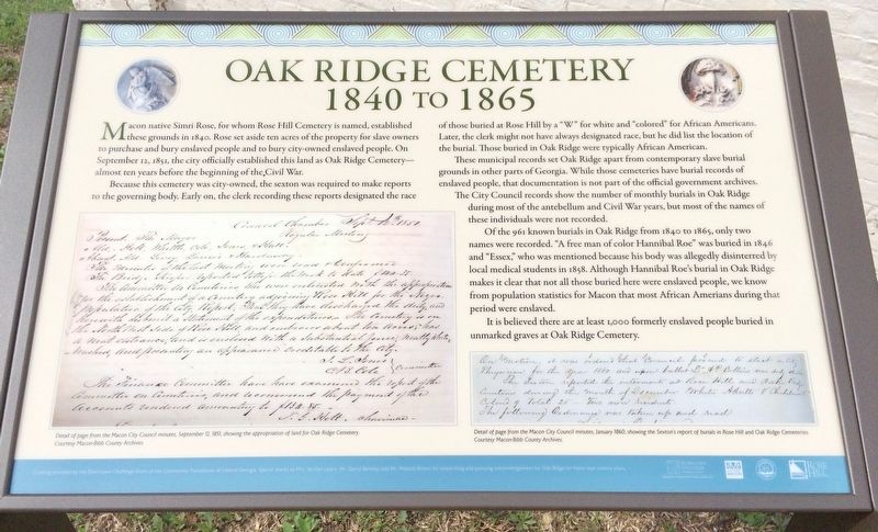
Because this cemetery was city-owned, the sexton was required to make reports to the governing body. Early on, the clerk recording these reports designated the race of those buried at Rose Hill by a "W" for white and "colored" for African Americans.
Later, the clerk might not have always designated race, but he did list the location of the burial. Those buried in Oak Ridge were typically African American.
These municipal records set Oak Ridge apart from contemporary slave burial grounds in other parts of Georgia. While those cemeteries have burial records of enslaved people, that documentation is not part of the official government archives The City Council records show the number of monthly burials in Oak Ridge during most of the antebellum and Civil War years, but most of the names of these individuals were not recorded.
Of the 961 known burials in Oak Ridge from 1840 to 1865, only two names were recorded. "A free man of color Hannibal Roe" was buried in 1846 and "Essex," who was mentioned because his body was allegedly disinterred by local medical students in 1858. Although Hannibal Roe's burial in Oak Ridge makes it clear that not all those buried here were enslaved people, we know from population statistics for Macon that most African Amerians during that period were enslaved.
It is believed there are at least 1,000 formerly enslaved people buried in unmarked graves at Oak Ridge Cemetery.
Macon City Council Minutes captions
Bottom left: Detail of page from the Macon City Council minutes, September 12, 1851, showing the appropriation of land for Oak Ridge Cemetery.
Courtesy Macon-Bibb County Archives.
Bottom right: Detail of page from the Macon City Council minutes, January 1860, showing the Sexton's report of burials in Rose Hill and Oak Ridge Cemeteries.
Courtesy Macon-Bibb County Archives.
Erected 2016 by Historic Macon Foundation.
Topics. This historical marker is listed in these topic lists: African Americans • Cemeteries & Burial Sites. A significant historical date for this entry is September 12, 1851.
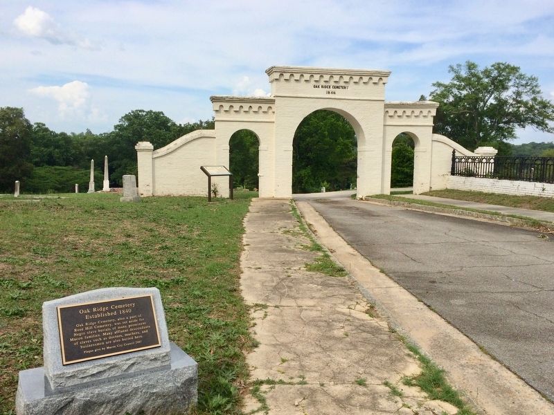
Location. 32° 50.917′ N, 83° 38.196′ W. Marker is in Macon, Georgia, in Bibb County. Marker is on Madison Street north of Riverside Drive (U.S. 23), on
the left when traveling north. Located within Oak Ridge Cemetery, between Riverside and Rose Hill Cemeteries. Touch for map. Marker is at or near this postal address: Madison Street, Macon GA 31201, United States of America. Touch for directions.
Other nearby markers. At least 8 other markers are within walking distance of this marker. A different marker also named Oak Ridge Cemetery (a few steps from this marker); Unknown, But Not Forgotten (within shouting distance of this marker); a different marker also named Oak Ridge Cemetery (about 500 feet away, measured in a direct line); General Edward Dorr Tracy, Jr. (approx. 0.2 miles away); Alfred Holt Colquitt (approx. 0.2 miles away); John Basil Lamar (approx. 0.2 miles away); Macon Defensive Fortifications (approx. 0.2 miles away); Rose Hill Cemetery (approx. ¼ mile away). Touch for a list and map of all markers in Macon.
Credits. This page was last revised on March 11, 2019. It was originally submitted on May 1, 2017, by Mark Hilton of Montgomery, Alabama. This page has been viewed 472 times since then and 23 times this year. Photos: 1, 2. submitted on May 1, 2017, by Mark Hilton of Montgomery, Alabama.

