Augusta in Richmond County, Georgia — The American South (South Atlantic)
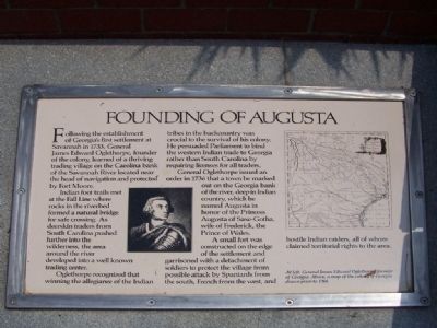
Founding of Augusta
Indian foot trails met at the Fall Line where rocks in the riverbed formed a natural bridge for safe crossing. As deerskin traders from South Carolina pushed further into the wilderness, the area around the river developed into a well known trading center. Oglethorpe recognized that winning the allegiance of the Indian tribes in the backcountry was crucial to the survival of his colony. He persuaded Parliament to bind the western Indian trade to Georgia rather than South Carolina by requiring licenses for all traders.
General Oglethorpe issued an order in 1736 that a town be marked out on the Georgia bank of the river, deep in Indian country, which he named Augusta in honor of the Princess Augusta of Saxe-Gotha,wife of Frederick, the Prince of Wales.
A small fort was constructed on the edge of the settlement and garrisoned with a detachment of soldiers to protect the village from possible attack by Spaniards from the south, French from the west, and hostile raiders, all of whom claimed territorial rights to the area.
Topics. This historical marker is listed in these topic lists: Colonial Era • Exploration • Settlements & Settlers. A significant historical year for this entry is 1733.
Location. 33° 28.696′ N, 81° 57.831′ W. Marker is in Augusta, Georgia, in Richmond County. Marker can be reached from River Walk near 8th Street, on the right when traveling west. Touch for map. Marker is in this post office area: Augusta GA 30901, United States of America. Touch for directions.
Other nearby markers. At least 8 other markers are within walking distance of this marker. Great Indian Warrior / Trading Path (a few steps from this marker); William Bartram Trail (a few steps from this marker); Cotton (a few steps from this marker); Floods (within shouting distance of this marker); De Soto In Georgia (within shouting distance of this marker); The Levee (within shouting distance of this marker); Indians (within shouting distance of this marker); Industrial Heritage (within shouting distance of this marker). Touch for a list and map of all markers in Augusta.
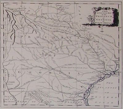
More about this marker. At left, General James Edward Oglethorpe, founder of Georgia. On the upper right is a map of colonial Georgia drawn prior to 1760.
Also see . . . History of Augusta
. The town was laid out on the flat slopes of the Savannah River, just east of the sand hills that would come to be known as "Summerville". The townspeople got along peacefully most of the time with the surrounding tribes of Creek and Cherokee
Indians. (Submitted on August 16, 2008, by Mike Stroud of Bluffton, South Carolina.)
Credits. This page was last revised on June 16, 2016. It was originally submitted on August 16, 2008, by Mike Stroud of Bluffton, South Carolina. This page has been viewed 1,930 times since then and 40 times this year. Photos: 1, 2. submitted on August 16, 2008, by Mike Stroud of Bluffton, South Carolina. • Craig Swain was the editor who published this page.

