Smithfield in Isle of Wight County, Virginia — The American South (Mid-Atlantic)
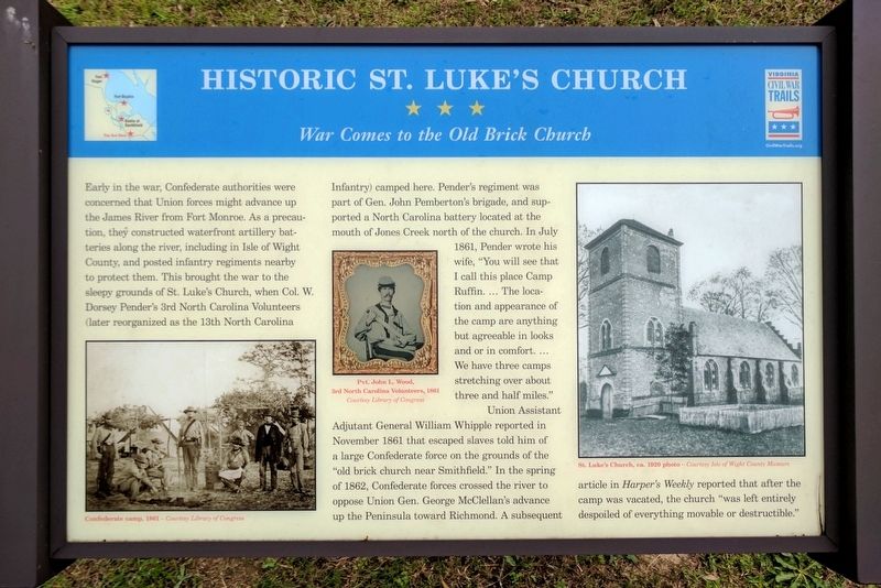
Historic St. Luke's Church
War Comes to the Old Brick Church
Photographed by Bernard Fisher, May 28, 2017
1. Historic St. Luke's Church Marker
Union Assistant Adjutant General William Whipple reported in November 1861 that escaped slaves told him of a large Confederate force on the grounds of the “old brick church near Smithfield." In the spring of 1862, Confederate
this page online
(captions)
Confederate camp, 1861 – Courtesy Library of Congress
Pvt. John L. Wood, 3rd North Carolina Volunteers, 1861 Courtesy Library of Congress
St. Luke’s Church, ca. 1920 photo – Courtesy Isle of Wight County Museum
Erected by Virginia Civil War Trails.
Topics and series. This historical marker is listed in these topic lists: Religion & Religious Structures • War, US Civil. In addition, it is included in the Virginia Civil War Trails series list. A significant historical month for this entry is July 1861.
Location. 36° 56.352′ N, 76° 35.186′ W. Marker is in Smithfield, Virginia, in Isle of Wight County. It can be reached from Benns Church Boulevard (Virginia Route 10) south of Casper Circle, on the right when traveling west. Located in the church parking lot. Touch for map. Marker is at or near this postal address: 14477 Benns Church Blvd,
Photographed by Bernard Fisher, May 28, 2017
2. Historic St. Luke's Church Marker

Regionally, this marker is in Coastal Virginia and in the Hampton Roads Metropolitan Area. It is also in the American South, specifically in the Upper South, in the Tidewater, and on the Eastern Seaboard. Globally, it is in the North Atlantic Region, North America, the Western Hemisphere, the Western World, and the Anglosphere. Historically, it finds itself in what was once the territory of the Mississippian Culture, one of the original Thirteen Colonies, one of the Confederate States of America, and the Antebellum South.
Other nearby markers. At least 8 other markers are within 3 miles of this marker, measured as the crow flies: St. Luke’s Church (about 300 feet away, measured in a direct line); Saint Luke's Church (about 500 feet away); Benn’s Church (approx. 0.2 miles away); Josiah Parker (approx. 1½ miles away); Missile Magazine and Launch Operations (approx. 2.1 miles away); People and Places, circa 1957 at N-75L (approx. 2.1 miles away); 1954 Nike-Ajax Missile Site N-75L (approx. 2.1 miles away); Nike-Ajax Missile Radar Control Site N-75C (approx.
Photographed by Bernard Fisher, May 28, 2017
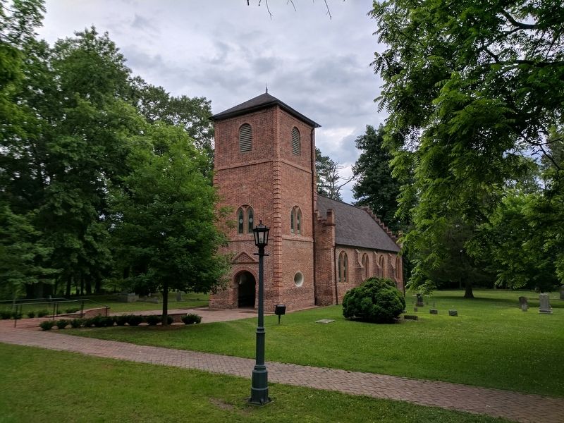
3. Historic St. Luke's Church
Also see . . . Historic St. Luke's Church. (Submitted on May 29, 2017.)
Credits. This page was last revised on May 30, 2017. It was originally submitted on May 29, 2017, by Bernard Fisher of Richmond, Virginia. This page has been viewed 727 times since then and 48 times this year. Photos: 1, 2, 3. submitted on May 29, 2017, by Bernard Fisher of Richmond, Virginia.
