Middlesex Township near Carlisle in Cumberland County, Pennsylvania — The American Northeast (Mid-Atlantic)
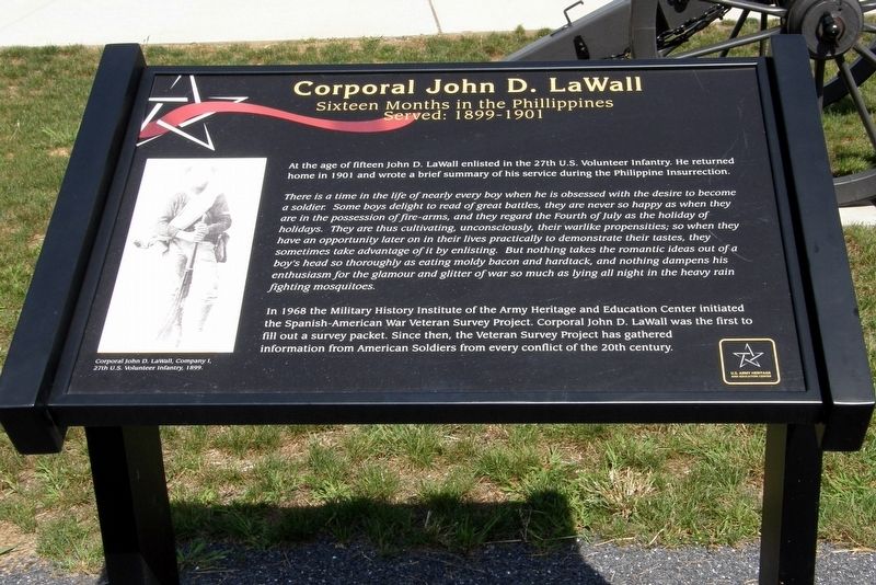
Corporal John D. LaWall
Sixteen Months in the Philippines
| — | Served: 1899-1901 | — |
Photographed by Larry Gertner, September 11, 2012
1. Corporal John D. LaWall Marker
At the age of fifteen John D. LaWall enlisted in the 27th U.S. Volunteer Infantry. He returned home in 1901 and wrote a brief summary of his service during the Philippine Insurrection.
There is a time in the life of nearly every boy when he is obsessed with the desire to become a soldier. Some boys delight to read of great battles, they are never so happy as when they are in the possession of fire-arms, and they regard the Fourth of July as the holiday of holidays. They are thus cultivating, unconsciously, their warlike propensities; so when they have an opportunity later on in their lives practically to demonstrate their tastes, they sometimes take advantage of it by enlisting. But nothing takes the romantic ideas out of a boy’s head so thoroughly as eating moldy bacon and hardtack, and nothing dampens his enthusiasm for the glamour and glitter of war so much as lying all night in the heavy rain fighting mosquitoes.
In 1968 the Military History Institute of the Army Heritage and Education Center initiated the Spanish-American War Veteran Survey Project. Corporal John D. LaWall was the first to fill out a survey
this page online
Since then, the Veteran Survey Project has gathered information from American soldiers from every conflict of the 20th century.
Erected by U.S. Army Heritage and Education Center.
Topics. This historical marker is listed in this topic list: War, Spanish-American. A significant historical year for this entry is 1899.
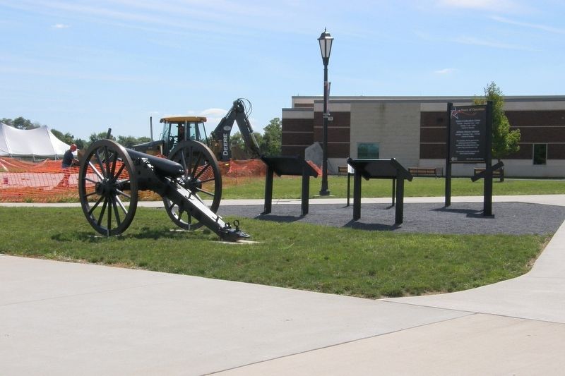
Location. Marker has been reported missing. It was located near 40° 12.433′ N, 77° 9.61′ W. Marker was near Carlisle, Pennsylvania, in Cumberland County. It was in Middlesex Township. It could be reached from Army Heritage Drive. One of two markers at the head of the path leading to the main entrance of the U.S. Army Heritage and Education Center. Touch for map. Marker was in this post office area: Carlisle PA 17013, United States of America. Touch for directions.

Regionally, this marker was in South-Central Pennsylvania and in Greater Harrisburg. It was also in the American Northeast, in the Mid-Atlantic, in Appalachia, and specifically in Northern Appalachia. Globally, it was in North America, the Western Hemisphere, the Western World, and the Anglosphere. Historically, it found itself in what
Photographed by Larry Gertner, September 11, 2012
2. Marker location
The DeWall and Shughart waysides, near a Civil War era 3" Ordinance rifle.
Other nearby markers. At least 8 other markers are within walking distance of this location: Juno Beach (a few steps from this marker); Liberation Pointe (a few steps from this marker); Sword Beach (a few steps from this marker); Utah Beach (a few steps from this marker); Gold Beach (a few steps from this marker); Ranger and Airborne Operations (a few steps from this marker); Omaha Beach (a few steps from this marker); Operation Overlord (a few steps from this marker). Touch for a list and map of all markers in Carlisle.
More about this marker. The wayside was not observed in July 2026. It may have been moved to a new location.
Also see . . . Philippine–American War. Wikipedia entry. (Submitted on April 14, 2020, by Larry Gertner of New York, New York.)
Credits. This page was last revised on August 6, 2026. It was originally submitted on May 31, 2017, by Larry Gertner of New York, New York. This page has been viewed 326 times since then and 27 times this year. Photos: 1, 2. submitted on May 31, 2017, by Larry Gertner of New York, New York. • Bill Pfingsten was the editor who published this page.
Editor’s want-list for this marker. This wayside was unobserved in July 2026. It may have been relocated elsewhere. • Can you help?
