Burlington in Racine County, Wisconsin — The American Midwest (Great Lakes)
Mormons in Early Wisconsin
Photographed by Paul F, July 1, 2010
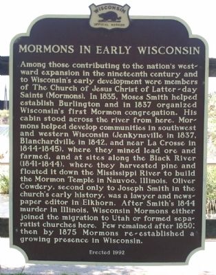
1. Mormons in Early Wisconsin Marker
Among those contributing to the nation’s westward expansion in the nineteenth century and to Wisconsin’s early development were members of The Church of Jesus Christ of Latter-day Saints (Mormons). In 1835, Moses Smith helped establish Burlington and in 1837 organized Wisconsin’s first Mormon congregation. His cabin stood across the river from here. Mormons helped develop communities in southwest and western Wisconsin (Jenkynsville in 1837, Blanchardville in 1842, and near La Crosse in 1844-1845), where they mined lead ore and farmed, and at sites along the Black River (1841-1844), where they harvested pine and floated it down the Mississippi River to build the Mormon Temple in Nauvoo, Illinois. Oliver Cowdery, second only to Joseph Smith in the church’s early history, was a lawyer and newspaper editor in Elkhorn. After Smith’s 1844 murder in Illinois, Wisconsin Mormons either joined the migration to Utah or formed separatist churches here. Few remained after 1850; then by 1875 Mormons re-established a growing presence in Wisconsin.
Erected 1992 by Wisconsin State Historical Society. (Marker Number 307.)
Topics and series.
this page online
Location. 42° 40.943′ N, 88° 16.605′ W. Marker is in Burlington, Wisconsin, in Racine County. It can be reached from Milwaukee Street 0.1 miles west of Congress Street. Marker is located in Echo Veterans Memorial Park. Touch for map. Marker is in this post office area: Burlington WI 53105, United States of America. Touch for directions.

Regionally, this marker is in Southeast Wisconsin and in Greater Milwaukee. It is also in the American Midwest and in the Corn Belt. Globally, it is in North America, on the Great Lakes, in the Western Hemisphere, in the Western World, and in the Anglosphere. Historically, it finds itself in what was once the territory of the Mississippian Culture and also the Northwest Territory.
Other nearby markers. At least 8 other markers are within 10 miles of this marker, measured as the crow flies: Veterans Memorial (about 600 feet away, measured in a direct line); Clarence H. Beaumont (approx. ¼ mile
Photographed by Paul F, July 1, 2010
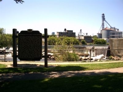
2. Mormons in Early Wisconsin Marker
Looking west toward river.
Related markers. Click here for a list of markers that are related to this marker. To better understand the relationship, study each marker in the order shown.
Also see . . . Mormons in Wisconsin: A Closer View of the Early Settlements (1835-1875). Church of Jesus Christ of Latter Day Saints web page with a much more complete summary of the early Mormon settlements in Wisconsin. (Submitted on November 22, 2021, by Joel Seewald of Madison Heights, Michigan.)
Photographed by Paul F, July 1, 2010
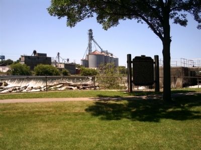
3. Mormons in Early Wisconsin Marker
Another view looking west toward river.
Credits. This page was last revised on January 19, 2024. It was originally submitted on August 9, 2010, by Paul Fehrenbach of Richfield, Wisconsin. This page has been viewed 2,367 times since then and 108 times this year. Last updated on June 1, 2017, by Paul Fehrenbach of Richfield, Wisconsin. Photos: 1, 2, 3. submitted on August 9, 2010, by Paul Fehrenbach of Richfield, Wisconsin. • Bill Pfingsten was the editor who published this page.
