Shaker Heights in Cuyahoga County, Ohio — The American Midwest (Great Lakes)
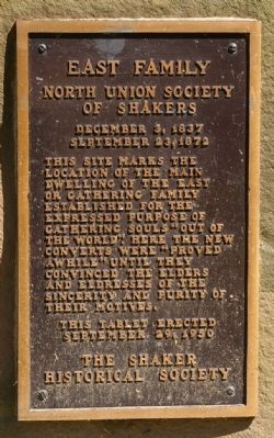
East Family
North Union Society of Shakers
— December 3, 1837 - September 23, 1872 —
This tablet erected September 29, 1950.
The Shaker Historical Society
Erected 1950 by the Shaker Historical Society.
Topics and series. This historical marker is listed in these topic lists: Churches & Religion • Notable Buildings. In addition, it is included in the Communal and Utopian Societies series list. A significant historical date for this entry is September 29, 1950.
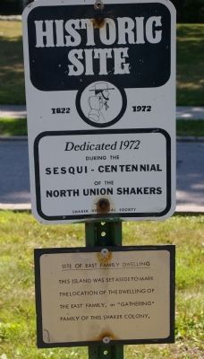
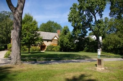
Location. 41° 28.549′ N, 81° 33.158′ W. Marker is in Shaker Heights, Ohio, in Cuyahoga County. Marker is on Fontenay Road, 0.2 miles south of Shaker Boulevard (Ohio Route 87), in the median. The marker is on an island in the middle of the road, commemorating where the house once stood, before the land was developed by the Van Sweringen brothers in the 1910s and 1920s. Touch for map. Marker is in this post office area: Cleveland OH 44120, United States of America. Touch for directions.
Other nearby markers. At least 8 other markers are within 2 miles of this marker, measured as the crow flies. Horseshoe Lake (approx. 0.6 miles away); Shaker Gate Posts (approx. ¾ mile away); Site of Center Family (approx. ¾ mile away); Jacob Russell (approx. ¾ mile away); This Tablet Marks the Final Resting Place of the Shakers of the North Union Society (approx. 0.9 miles away); Warrensville West Cemetery (approx. one mile away); Van Sweringen Demonstration House (approx. 1.3 miles away); a different marker also named Van Sweringen Demonstration House (approx. 1.4 miles away). Touch for a list and map of all markers in Shaker Heights.
Credits. This page was last revised on June 16, 2016. It was originally submitted on August 18, 2008, by Christopher Busta-Peck of Shaker Heights, Ohio. This page has been viewed 1,253 times since then and 58 times this year. Photos: 1, 2, 3. submitted on August 18, 2008, by Christopher Busta-Peck of Shaker Heights, Ohio. 4. submitted on January 31, 2012.


