Veracruz, Mexico — The Gulf Coast (North America)
The Veracruz City Museum
Photographed by J. Makali Bruton, March 24, 2017
1. The Veracruz City Museum Marker
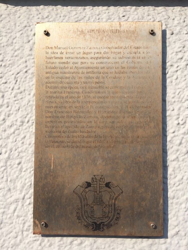
Durante una época, este inmueble se convirtió en hospital de la marina Francesa, Condición en la que subsistió hasta la retirada en el año de 1876, al quedar reestablecida la paz en el país, ya libre de la intervención extranjera se acordó poner nuevamente en servicio la construcción y el Gobernador Don Francisco Hernandez y Hernandez dispuso llevara nombre de Hospicio Zamora, decretando también que los expósitos presentados en la casa sin señas ni generales llevaran el apellido de Zamora, para de este modo perpetuar la memoria del illustre fundador.
Con motive de los 450 años de la fundación de la Villa Rica de la Veracruz, se decidió que el edificio fuera renombrado para servir como
this page online
English translation:
During a time, this property became a hospital for the French Navy. It remained so until the withdrawal of the French in 1876, when peace was reestablished in the country. Free of foreign intervention, it was agreed to put the building back into service and Governor Francisco Hernandez y Hernandez arranged to support it as the Zamora Hospital. One of the decrees related to the orphanage was that any unclaimed youth here would bear the last name of Zamora, in order to perpetuate the memory of the illustrious founder.
During the celebration of the 450 years since the founding of Villa Rica de la Veracruz, it was decided
Photographed by J. Makali Bruton, March 25, 2017
2. The Veracruz City Museum Marker
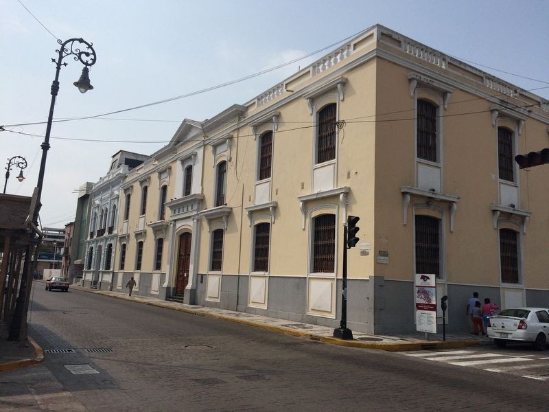
The marker is to the right of the main entrance to the Veracruz City Museum.
Topics. This historical marker is listed in these topic lists: Charity & Public Work • Education. A significant historical year for this entry is 1876.
Location. 19° 11.886′ N, 96° 8.138′ W. Marker is in Veracruz. It is on Avenida Ignacio Zaragoza just south of Calle Estéban Morales, on the right when traveling south. Touch for map. Marker is in this post office area: Veracruz 91700, Mexico. Touch for directions.

Regionally, this marker is in the Gulf Coast and in the Sierra Madre. Globally, it is in North America, specifically in Mesoamerica, in a Gulf of Mexico state, on the Ring of Fire, and in the Western Hemisphere. Historically, it finds itself in what was once New Spain, a Spanish colony, and the Aztec Empire.
Other nearby markers. At least 8 other markers are within walking distance of this marker: Lieutenant José Azueta (within shouting distance of this marker); Julio S. Montero Plaza (within shouting distance of this marker); The Convent of the Bethlehemites (about 90 meters away, measured in a direct line); The Mexican Naval Academy (about 180 meters away); Francisco Javier Clavijero Echegaray (about 180 meters away); The Bastion of Santiago (about 210 meters away); 100th Anniversary of Firefighting in Veracruz (about 210 meters away); Independence Heroes of Veracruz (about 240 meters away). Touch for a list and map of all markers in Veracruz.
Credits. This page was last revised on June 19, 2023. It was originally submitted on June 14, 2017, by J. Makali Bruton of Washington, District of Columbia. This page has been viewed 269 times since then and 12 times this year. Photos: 1, 2. submitted on June 14, 2017, by J. Makali Bruton of Washington, District of Columbia.
