Near Carthage in Moore County, North Carolina — The American South (South Atlantic)
James Rogers McConnell
Photographed by Forest McDermott, September 4, 2015
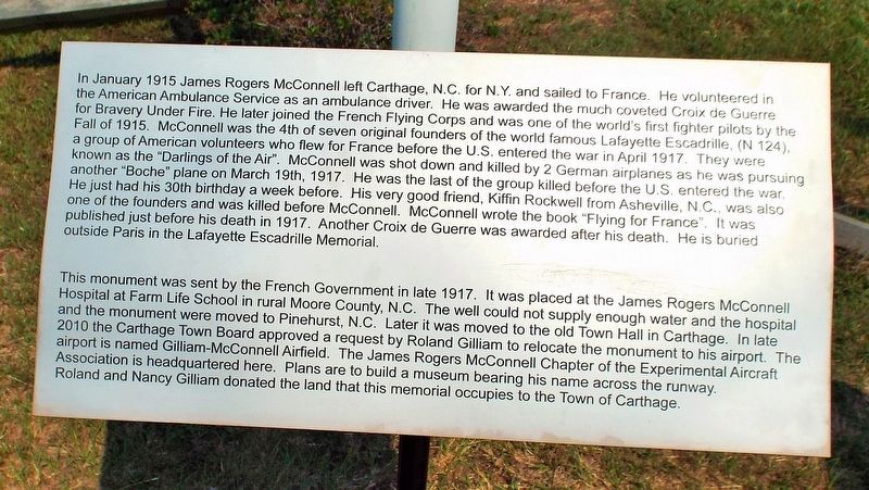
1. James Rogers McConnell Marker
This monument was sent by the French Government in late
this page online
Topics. This memorial is listed in these topic lists: Air & Space • War, World I. A significant historical date for this entry is March 19, 1917.
Location. 35° 20.45′ N, 79° 26.211′ W. Memorial is near Carthage, North Carolina, in Moore County. It is on Gilliam McConnell Road 0.2 miles west of Dowd Road, on the right when traveling west. Marker is located next to the parking lot within the Gilliam-McConnell Airfield. Touch for map. Memorial is at or near this postal address: 194
Photographed by Forest McDermott, September 4, 2015
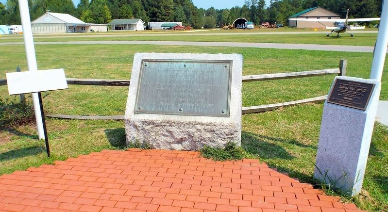
2. James Rogers McConnell Marker
This marker on the left next to the original French marker and the translation marker.

Regionally, this memorial is in North Carolina’s Piedmont. It is also in the American South and specifically in the Upper South. Globally, it is in North America, the Western Hemisphere, the Western World, and the Anglosphere. Historically, it finds itself in what was once the territory of the Mississippian Culture, one of the original Thirteen Colonies, one of the Confederate States of America, and the Antebellum South.
Other nearby markers. At least 8 other markers are within 2 miles of this marker, measured as the crow flies: James McConnell (here, next to this marker); Biography of Robert Hoyle Upchurch (here, next to this marker); Lt. Robert "Hoyle" Upchurch (here, next to this marker); East Meets West (here, next to this marker); Ret. SFC Zeb D. Harrington and The "Junkyard Dog" (a few steps from this marker); Carthage Methodist Church (approx. 1.1 miles away); Carthage Methodist Cemetery (approx. 1.1 miles away); Buggy Company (approx. 1.1 miles away). Touch for a list and map of all markers in Carthage.
Photographed by Forest McDermott, September 4, 2015
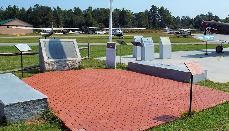
3. James Rogers McConnell Marker
Wider view of the three markers which are all related to one another.
Credits. This page was last revised on June 20, 2017. It was originally submitted on June 14, 2017, by Forest McDermott of Masontown, Pennsylvania. This page has been viewed 562 times since then and 43 times this year. Photos: 1, 2, 3. submitted on June 14, 2017, by Forest McDermott of Masontown, Pennsylvania. • Bernard Fisher was the editor who published this page.
