
Danville, Virginia — The American South (Mid-Atlantic)
North Danville
Photographed by J. J. Prats, June 8, 2017
1. North Danville Marker
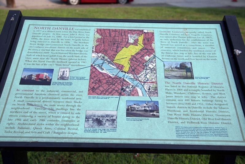
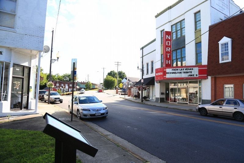
North Danville was established in 1877 as a distinct town across the Dan River from Danville proper. Its first mayor, John T. Keen, was appointed on July 13, 1880. For a brief period in the 1890s, the town went by the name Neapoils before being annexed to Danville in 1896. The Worsham Street bridge once connected North Danville to the city's tobacco warehouse district on the south side of the river, a vital link that was lost when the bridge was demolished in 2009. North Main and Worsham streets, both of which head uphill from the north bank of the river, meet near the North Theater (photos below). When this North Danville landmark opened in 1947 it was the last of the city’s “Main Street” moviehouses.
In contrast to the industrial , commercial and governmental functions clustered across the river, North Danville is a predominantly residential area. A small commercial district occupies three blocks on North Main Street, the main artery through the neighborhood. Victorian-style dwellings line the northern end of the street, which is crossed by side streets containing a variety of houses dating to the late
this page online
Leemont Cemetery, originally called North Danville Cemetery and later Neapolis Cemetery, was named after Thomas Jefferson Lee (d. 1887), an early spokesman for the establishment of the Town of North Danville. After the town was formed Lee served as a councilman, a member of numerous committees, and mayor. The cemetery, which borders the northwest corner of the district (see map at left), lies on the east side of Claiborne Street and is bounded by Clement Avenue on the north and First Street on the south.
The North Danville Historic District was listed in the National Register of Historic Places in 2004 is roughly bounded by North Main, Worsham, Claiborne, Keister, and West James Streets (see map at left). The district contains over 400 historic buildings dating to between circa 1-880 and 1955. Other designated historic districts in Danville include the Tobacco Warehouse and Residential Historic District, Dan River
Photographed by J. J. Prats, June 8, 2017
2. The North Theatre across the street from the marker
Credits: This interpretive panel was designed by The Louis Berger Group, Inc., Richmond, Virginia, as part of the historic documentation efforts stipulated by the Memorandum of Agreement concerning the demolition of the Worsham Street Bridge. Input was provided by the Virginia Department of Transportation (VDOT), the Norfolk District of the U.S. Army Corps of Engineers, the Virginia Department of Historic Resources (VDHR), the City of Danville, and the Danville Historical Society. Copies of the historical report and large-format black-and-white photographic documentation are housed with VDOT, VDHR, the Danville Historical Society, and the Library of Virginia.
Erected by the Memorandum of Agreement concerning the demolition of the Worsham Street Bridge.
Topics. This historical marker is listed in these topic lists: Notable Places • Political Subdivisions. A significant historical year for this entry is 1877.
Location. This marker has been replaced by another marker nearby. It was located near 36° 35.74′ N, 79° 23.098′ W.
Photographed by J. J. Prats, June 8, 2017
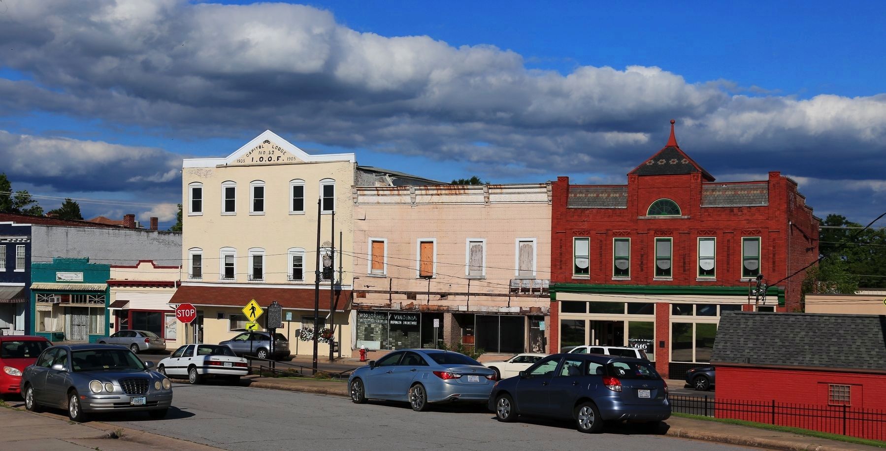
3. View of the North Danville Business District
The cream-colored building is labeled the 1905 Capital Lodge No. 52, International Order of Odd Fellows.

Regionally, this marker was in Southside Virginia and specifically in Central Virginia. It was also in the American South and specifically in the Upper South. Globally, it was in North America, the Western Hemisphere, the Western World, and the Anglosphere. Historically, it found itself in what was once the territory of the Mississippian Culture, one of the original Thirteen Colonies, one of the Confederate States of America, and the Antebellum South.
Other nearby markers. At least 8 other markers are within walking distance of this location: A different marker also named North Danville (here, next to this marker); Frederick Delius (within shouting distance of this marker); Historic Neapolis (within shouting distance of this marker); The World's Largest Magic Wand (within shouting distance of this marker); 714 North Main Street
Photographed by C. Ryan Dodson, December 24, 2024
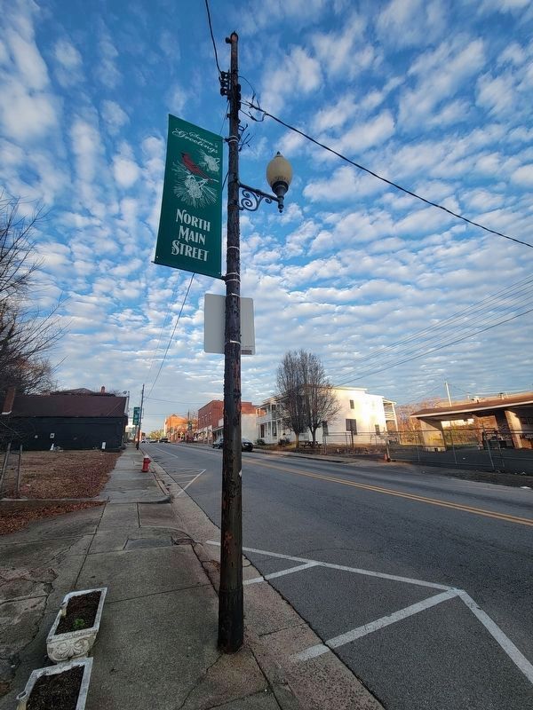
4. North Main Hill
530 N. Main St. (Ca. 1900), constructed in the Italianate style is visible in the background.
Other markers no longer nearby. Calvary United Methodist Church (was approx. ¼ mile away but has been permanently removed); The Lady Astor Rose (was approx. 0.3 miles away but has been permanently removed).

Photographed by C. Ryan Dodson, January 25, 2025
5. 719 N. Main St.
(Ca. 1881) constructed in the Italianate style

Photographed by C. Ryan Dodson, January 25, 2025
6. 913 N. Main St.
(Ca. 1880) constructed in the Italianate style.
Photographed by C. Ryan Dodson, January 25, 2025
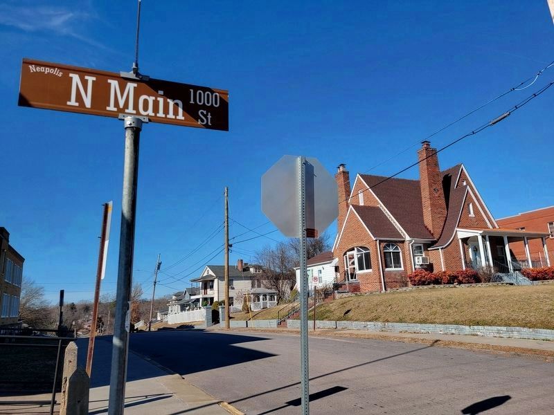
7. 1025 N. Main St.
(Ca. 1930) constructed in the Tudor Revival style

Photographed by C. Ryan Dodson, January 25, 2025
8. 1025 N. Main St.
On the north façade is a partial-width, gable roof porch with brick columns that are
connected by brick arches. The main entrance has a dentilled, arched entry with an original six-light and four wood panel door
flanked by fluted pilasters and an original transom.

Photographed by C. Ryan Dodson, January 25, 2025
9. 1117 N. Main St.
(Ca. 1930) constructed in the Tudor Revival style

Photographed by C. Ryan Dodson, January 25, 2025
10. 725 N. Main St.
(Ca. 1890) constructed in the Queen Anne style

Photographed by C. Ryan Dodson, January 25, 2025
11. 804 N. Main St.
(Ca. 1930) constructed in the Colonial Revival style.

Photographed by C. Ryan Dodson, January 25, 2025
12. 824 N. Main St.
(Ca. 1920) constructed in the American Foursquare style
Credits. This page was last revised on May 19, 2026. It was originally submitted on June 18, 2017, by J. J. Prats of Powell, Ohio. This page has been viewed 1,522 times since then and 88 times this year. Last updated on April 29, 2026, by C. Ryan Dodson of Danville, Virginia. Photos: 1, 2, 3. submitted on June 19, 2017, by J. J. Prats of Powell, Ohio. 4, 5, 6. submitted on January 28, 2025, by C. Ryan Dodson of Danville, Virginia. 7, 8, 9, 10, 11, 12. submitted on February 1, 2025, by C. Ryan Dodson of Danville, Virginia. • Devry Becker Jones was the editor who published this page.
