Drytown in Amador County, California — The American West (Pacific Coastal)
Early Day Butcher Shop
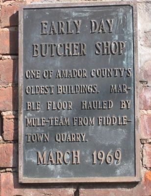
Photographed by Syd Whittle, November 11, 2005
1. Early Day Butcher Shop Marker
Erected 1969.
Topics. This historical marker is listed in these topic lists: Architecture • Industry & Commerce.
Location. 38° 26.466′ N, 120° 51.302′ W. Marker is in Drytown, California, in Amador County. It is on Hanford Street (State Highway 49), on the right when traveling south. Touch for map. Marker is in this post office area: Drytown CA 95699, United States of America. Touch for directions.

Regionally, this marker is in the Sierra Nevada. It is also in the American Mountain West. Globally, it is in North America, on the Pacific Rim, in the Western Hemisphere, in the Western World, and in the Anglosphere. Historically, it finds itself in what was once New Spain and also Mexico’s Alta California.
Other nearby markers. At least 8 other markers are within 3 miles of this marker, measured as the crow flies: Drytown (a few steps from this marker); Salute to Early Amador Miners (within shouting distance of this marker); a different marker also named
this page online
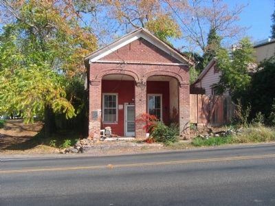
Photographed by Syd Whittle, November 11, 2005
2. Early Day Butcher Shop and Marker
Credits. This page was last revised on January 8, 2025. It was originally submitted on August 19, 2008, by Syd Whittle of Mesa, Arizona. This page has been viewed 2,068 times since then and 24 times this year. Photos: 1, 2. submitted on August 18, 2008, by Syd Whittle of Mesa, Arizona. • Kevin W. was the editor who published this page.
