Lower Garden District in New Orleans in Orleans Parish, Louisiana — The American South (West South Central)
Saint Theresa of Avila Church
Photographed by Cajun Scrambler, June 24, 2017
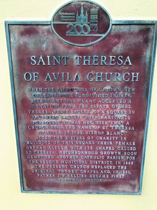
1. St. Theresa of Avila Church Marker
When the Faubourgs of uptown New Orleans were subdivided in 1838, Bishop Antoine Blanc accepted a donation from the estate of Mrs. Theresa Perie Saulet, of a square in Faubourg Saulet "for charitable purposes." It was her wish that a church bear the name of St. Theresa of Avila. In 1839, Bishop Blanc aided The Sisters of Charity in building on this square their female orphan asylum with its chapel called St. Theresa. Neighborhood growth soon demanded another Catholic Parish for the Second Municipal District. In 1848 the present church replaced the original original wooden chapel and, in 1850, Father J.P. Bellier became first resident pastor.
Erected by Archdiocesan Bicentennial Commission.
Topics. This historical marker is listed in this topic list: Religion & Religious Structures. A significant historical year for this entry is 1838.
Location. 29° 56.382′ N, 90° 4.346′ W. Marker is in New Orleans, Louisiana, in Orleans Parish. It is in the Lower Garden District. It is at the intersection of Coliseum Street and Erato Street on Coliseum Street. Touch for map. Marker is at or near this postal address: 1404 Erato Street,
this page online

Regionally, this marker is in one of Louisiana’s River Parishes. It is also in the American South, specifically in the Deep South, on the Gulf Coast, and in the Great River Road Region. Globally, it is in North America, a Gulf of Mexico state, the Western Hemisphere, the Western World, and the Anglosphere. Historically, it finds itself in what was once New Spain, the Viceroyalty of New France, the territory of the Mississippian Culture, the Louisiana Purchase, one of the Confederate States of America, and the Antebellum South.
Other nearby markers. At least 8 other markers are within walking distance of this marker: Margaret's Place and Walk / Lower Garden District (about 400 feet away, measured in a direct line); 1347 Coliseum Street (approx. 0.2 miles away); The Beginning (approx. ¼ mile away); Atlantic Wall Fragments (approx. ¼ mile away); Memorial Hall (approx. ¼ mile away); Confederate Memorial Hall (approx. ¼ mile away); 8 in. Columbaid Cannon (approx. ¼ mile away); James Surls (approx. ¼ mile away). Touch for a list and map of all
Photographed by Cajun Scrambler, June 24, 2017
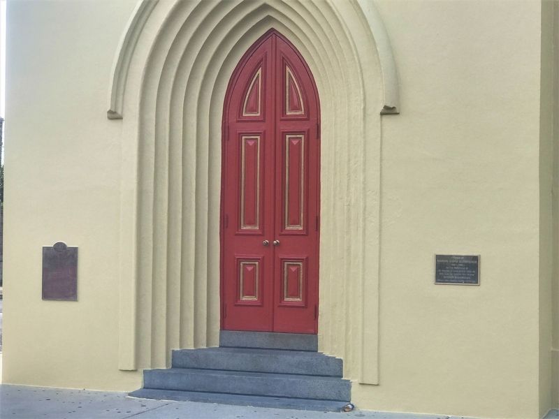
2. St. Theresa of Avila Church Marker
Other markers no longer nearby. Robert E. Lee (was approx. ¼ mile away but has been permanently removed); St. Charles Line (was approx. ¼ mile away but has been confirmed missing).
More about this marker. Church/Parish address is Erato Street, marker faces Coliseum Street.
June 24, 2017
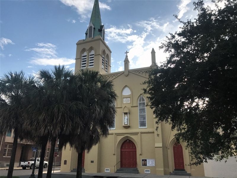
3. St. Theresa of Avila Church
Credits. This page was last revised on April 19, 2025. It was originally submitted on July 1, 2017, by Cajun Scrambler of Assumption, Louisiana. This page has been viewed 1,271 times since then and 62 times this year. Photos: 1, 2, 3. submitted on July 1, 2017.
