Auburn in Androscoggin County, Maine — The American Northeast (New England)
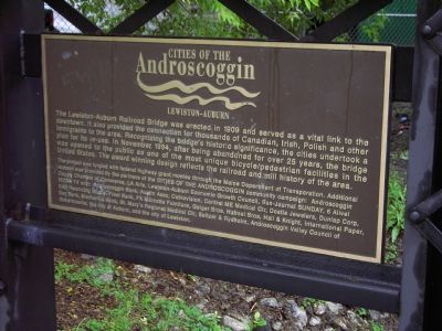
Cities of the Androscoggin
Lewiston-Auburn
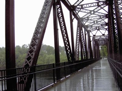
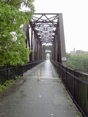
The Lewiston-Auburn Railroad Bridge was erected in 1909 and served as a vital link to the downtown. It also provided the connection for thousands of Canadian, Irish, Polish and other immigrants to the area. Recognizing the bridge’s historic significance, the cities undertook a plan for its re-use. In November 1994, after being abandoned for over 25 years, the bridge was opened to the public as one of the most unique bicycle/pedestrian facilities in the United States. The award winning design reflects the railroad and mill history of the area.
Topics. This historical marker is listed in these topic lists: Bridges & Viaducts • Railroads & Streetcars • Settlements & Settlers • Waterways & Vessels. A significant historical month for this entry is November 1994.
Location. 44° 5.539′ N, 70° 13.506′ W. Marker is in Auburn, Maine, in Androscoggin County. Marker can be reached from Main Street (Maine Route 136). Touch for map. Marker is in this post office area: Auburn ME 04210, United States of America. Touch for directions.
Other nearby markers. At least 5 other markers are within walking distance of this marker. Bonney Park (a few steps from this marker); Wabanaki History / Les Wabanaquis (a few steps from this marker); a different marker also named Bonney Park (a few steps from this marker); River Pollution and Restoration / Pollution et Restoration de la Rivière (about 300 feet away, measured in a direct line); Lewiston Falls Academy / L'Académie de Lewiston Falls (about 300 feet away). Touch for a list and map of all markers in Auburn.
More about this marker. The bridge crosses the Androscoggin River near Twenty-Mile Falls. Bonney Park is on the Auburn side of the bridge. There is also a park on the Lewiston side, where a balloon festival has been held over the last few years.
Also see . . . Museum in the Streets© L-A River History Trail. Lewiston ME website entry (Submitted on March 6, 2023, by Larry Gertner of New York, New York.)
Additional commentary.
1. The Monopoly-Busting Spur
This bridge was built to carry a spur of the Grand Trunk Railway’s Portland-Montreal line to Auburn and Lewiston. The spur terminated at the Grand Trunk Station in Lewiston on Lincoln Street, just across the river from Auburn. The cities of Lewiston and Auburn formed and funded the Lewiston Auburn Railroad in 1872 to build the 7½ mile spur from Danville Junction in order to break the freight monopoly of the Maine Central Railroad, which exclusively served the two cities. The Grand Trunk Railway, and then Canadian National Railways, operated passenger service to Auburn and Lewiston on this spur through the 1950’s. The two cities were considered to be on the line between Portland and Montreal for ticketing purposes, although it appears that shuttle trains—and later, buses—met the Portland-Montreal trains at Danville Junction.
— Submitted May 28, 2007, by J. J. Prats of Powell, Ohio.
Additional keywords. immigration
Credits. This page was last revised on March 6, 2023. It was originally submitted on May 28, 2007, by Peter Linehan of Shippensburg, Pennsylvania. This page has been viewed 2,805 times since then and 32 times this year. Photos: 1, 2, 3. submitted on May 28, 2007, by Peter Linehan of Shippensburg, Pennsylvania. • J. J. Prats was the editor who published this page.


