Folsom in Sacramento County, California — The American West (Pacific Coastal)
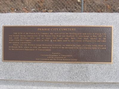
Prairie City Cemetery
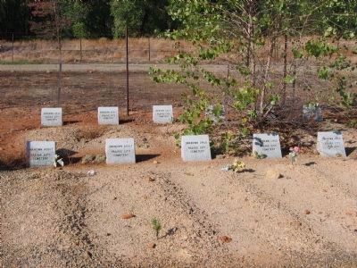
Please visit the Mormon Island Relocation Cemetery on Shadowfax Road off Green Valley Road in El Dorado Hills, where in 1998, the remains of twelve of the deceased from this cemetery were relocated by the California Department of Transportation.
Erected by California Department of Transportation, with cooperation of the Intel Corporation and the Folsom Historical Society.
Topics. This historical marker is listed in these topic lists: Cemeteries & Burial Sites • Settlements & Settlers. A significant historical month for this entry is May 1997.
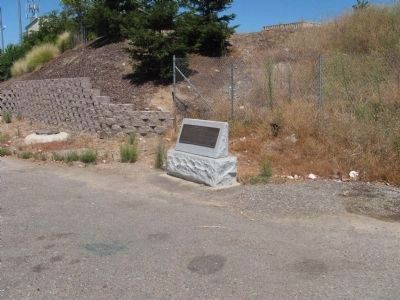
Location. 38° 38.623′ N, 121° 9.432′ W. Marker is in Folsom, California, in Sacramento County. Marker is on Prairie City Road close to U.S. 50, on the right when traveling north. Touch for map. Marker is in this post office area: Folsom CA 95630, United States of America. Touch for directions.
Other nearby markers. At least 8 other markers are within 3 miles of this marker, measured as the crow flies. Prairie City (here, next to this marker); Natomas Consolidated of California (approx. 1.6 miles away); Southern Pacific Railroad Superintendent's House (approx. 2.2 miles away); St. John the Baptist Catholic Church (approx. 2.3 miles away); The Young Wo Memorial Site (approx. 2˝ miles away); Wells Fargo and Company (approx. 2˝ miles away); Folsom Pony Express Terminus (approx. 2˝ miles away); Folsom History Museum (approx. 2˝ miles away). Touch for a list and map of all markers in Folsom.
Regarding Prairie City Cemetery. See Prairie City Cemetery Marker (El Dorado County) in the "Other nearby markers" section.

Photographed By Syd Whittle, October 30, 2005
3. Gravesites at the Mormon Island Relocation Cemetery
Located on Green Valley Road, El Dorado Hills, El Dorado County.
Click for more information.
Click for more information.
Credits. This page was last revised on March 5, 2023. It was originally submitted on August 20, 2008, by Syd Whittle of Mesa, Arizona. This page has been viewed 2,081 times since then and 35 times this year. Photos: 1. submitted on August 20, 2008, by Syd Whittle of Mesa, Arizona. 2. submitted on August 22, 2008, by Syd Whittle of Mesa, Arizona. 3. submitted on January 27, 2009, by Syd Whittle of Mesa, Arizona. • Kevin W. was the editor who published this page.

