Orchard Lake in Oakland County, Michigan — The American Midwest (Great Lakes)
Tracks Over Tracks
on the Detroit United Railway
Photographed by Joel Seewald, July 2, 2017
1. Tracks Over Tracks Marker
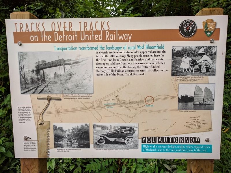
Transportation transformed the landscape of rural West Bloomfield
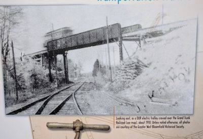
as electric trolleys and automobiles appeared around the turn of the 20th century. Many people traveled here for the first time from Detroit and Pontiac, and real estate developers sold lakefront lots. For easier access to beach communities north of the tracks, the Detroit United Railway (DUR) built an overpass to carry its trolleys to the other side of the Grand Trunk Railroad.
You Auto Know
High on the overpass bridge, trolley riders enjoyed views of Orchard Lake to the west and Pine Lake to the east.
Erected by MotorCities National Heritage Area, National Park Service.
Topics and series. This historical marker is listed in this topic list: Railroads & Streetcars. In addition, it is included in the MotorCities National Heritage Area series list.
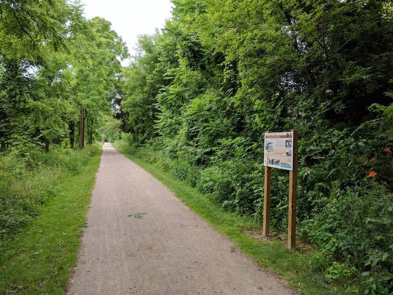
Location. 42° 35.479′ N, 83° 21.196′ W. Marker is in Orchard Lake, Michigan, in Oakland County. It can be reached from Orchard Lake Road. Marker is on the West Bloomfield Trail, a bicycling/hiking trail, about 0.1 mile south of Seminary Drive (near mile
this page online

Regionally, this marker is in Southeast Michigan and in Greater Detroit. It is also in the American Midwest. Globally, it is in North America, the Western Hemisphere, the Western World, and the Anglosphere. Historically, it finds itself in what was once the Northwest Territory.
Other nearby markers. At least 8 other markers are within walking distance of this marker: Lakes and Attractions (about 500 feet away, measured in a direct line); Waiting Room and the "Wye" (approx. 0.2 miles away); Orchard Lake Schools / Joseph Tarr Copeland (approx. 0.3 miles away); Gateway to Nature (approx. 0.3 miles away); Apple Island: A Geological Rarity (approx. 0.3 miles away); Apple Island (approx. 0.4 miles away); A Lake and a Trolley (approx. 0.6 miles away); Waiting for the Trolleys (approx. 0.6 miles away). Touch for a list and map of all markers in Orchard Lake.
Photographed by Joel Seewald, July 2, 2017
2. Upper Left Image
Looking east, as a DUR electric trolley crossed over the Grand Trunk Railroad (see map), about 1910. Unless noted otherwise, all photos are courtesy of the Greater West Bloomfield Historical Society.
Photographed by Joel Seewald, July 2, 2017
3. Lower Left Image
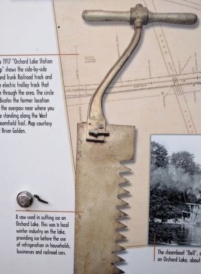
A saw used in cutting ice on Orchard Lake. This was a local winter industry on the lake, providing ice before the use of refrigeration in households, businesses and railroad cars.
Photographed by Joel Seewald, July 2, 2017
4. Lower Middle Left Image
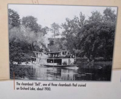
The steamboat "Dell", one of three steamboats that cruised on Orchard Lake, about 1900.
Photographed by Joel Seewald, July 2, 2017
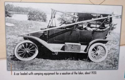
5. Lower Middle Right Image
A car loaded with camping equipment for a vacation at the lakes, about 1920.
Photographed by Joel Seewald, July 2, 2017
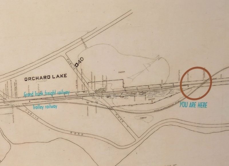
6. Map (detail)
This 1917 "Orchard Lake Station Map" shows the side-by-side Grand Trunk Railroad track and the electric trolley track that ran through the area. The circle indicates the former location of the overpass near where you are standing along the West Bloomfield Trail. Map courtesy of Brian Golden.
Photographed by Joel Seewald, July 2, 2017
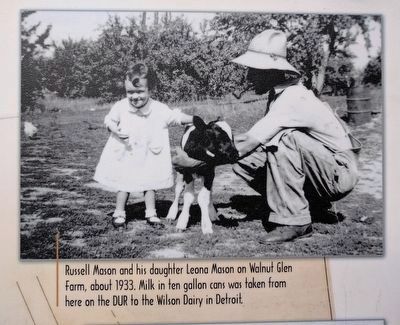
7. Upper Right Image
Russell Mason and his daughter Leona Mason on Walnut Glen farm, about 1933. Milk in ten gallon cans was taken from here on the DUR to the Wilson Dairy in Detroit.
Photographed by Joel Seewald, July 2, 2017
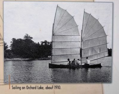
8. Middle Right Image
Sailing on Orchard Lake, about 1910.
Photographed by Joel Seewald, July 2, 2017
9. Tracks Over Tracks Marker
Credits. This page was last revised on September 6, 2020. It was originally submitted on July 6, 2017, by Joel Seewald of Madison Heights, Michigan. This page has been viewed 405 times since then and 25 times this year. Photos: 1, 2, 3, 4, 5, 6, 7, 8, 9. submitted on July 6, 2017, by Joel Seewald of Madison Heights, Michigan.
