Near Emigrant Gap in Placer County, California — The American West (Pacific Coastal)
Forest Gift Shop, Cisco Grove
Hwy 40 Scenic Bypass
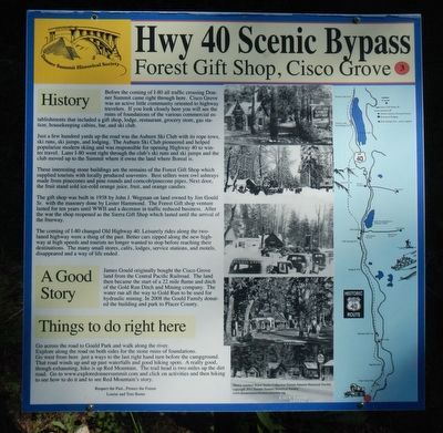
Before the coming of I-80 all traffic crossing Donner Summit came right through here. Cisco Grove was an active little community oriented to highway travelers. If you look closely here you will see the ruins of foundations of the various commercial establishments that included a gift ship, lodge, restaurant, grocery store, gas station, housekeeping cabins, bar, and ski club.
Just a few hundred yards up the road was the Auburn Ski Club with its rope tows, ski runs, ski jumps and lodging. The Auburn Ski Club pioneered and helped popularize modern skiing and was responsible for opening Highway 40 to winter travel. Later I-80 went right through the club's ski runs and ski jumps and the club moved up to the Summit where it owns the land where Boreal is.
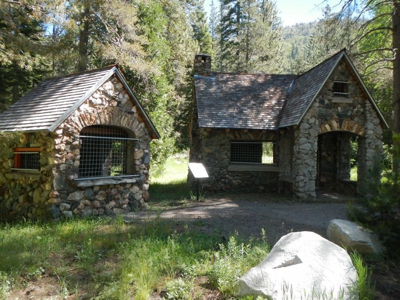
The interesting stone buildings are the remains of the Forest Gift Shop which supplied tourists with locally produced souvenirs. Best sellers were owl ashtrays made from pinecones and pine rounds and corncob/pinecone pipes. Next door, the fruit stand sold ice-cold orange juice, fruit, and orange candies.
The gift shop was built in 1938 by John J. Wegman on land owned by Jim Gould Sr. with the masonry done by Lester Hammond. The Forest Gift shop venture lasted for ten years until WW II and a decrease in traffic reduced business. After the war the shop reopened as the Sierra Gift Shop which lasted until the arrival of the Freeway.
The coming of I-80 changed Old Highway 40. Leisure rides along the two-lane highway were a thing of the past. Better cars zipped along the new highway at high speeds and tourists no longer wanted to stop before reaching their destinations. The many small stores, cafés, lodges, service stations, and motels, disappeared and a way of life ended.
James Gould originally bought the Cisco Grove land from the Central Pacific Railroad. The land then became the start of a 22 mile flume and ditch of the Gold Run Ditch and Mining company. The water ran all the way to Gold Run to be used for hydraulic mining. In 2008 the Gould Family donated the building and park to Placer County.
Go across the road to Gould Park and walk along the river. Explore along the road on both sides for the stone ruins and foundations. Go west from here just a ways to the last right hand turn before the campground. That road winds up and up past waterfalls and good hiking spots. A really good, though exhausting, hike is up Red Mountain. The trail head is two miles up the dirt road. Go to www.exploredonnersummit.com and click on activities and then hiking to see how to do it and to see Red Mountain's story.
Erected by Donner Summit Historical Society. (Marker Number 3.)
Topics and series. This historical marker is listed in this topic list: Industry & Commerce. In addition, it is included in the Donner Summit Historical Society series list. A significant historical year for this entry is 1938.
Location. 39° 18.687′ N, 120° 32.547′ W. Marker is near Emigrant Gap, California, in Placer County. Marker is on Hampshire Rocks Road near Cisco Road, on the left when traveling east. Touch for map. Marker is at or near this postal address: 48605 Hampshire Rocks Road, Emigrant Gap CA 95715, United States of America. Touch for directions.
Other nearby markers. At least 8 other markers are within 2 miles of this marker, measured as the crow flies. Susan's Spot (within shouting distance of this marker); Lincoln Highway (approx. 1.1 miles away); Truckee Trail - Ascent to Lake and Valley (approx. 1.3 miles away); Big Bend (approx. 1.4 miles away); Red Mountain (approx. 1.4 miles away); Overland Emigrant Trail (approx. 1.4 miles away); Stephens-Townsend-Murphy Party (approx. 1.4 miles away); a different marker also named The Lincoln Highway (approx. 1.4 miles away). Touch for a list and map of all markers in Emigrant Gap.
Credits. This page was last revised on July 7, 2017. It was originally submitted on July 7, 2017, by Barry Swackhamer of Brentwood, California. This page has been viewed 887 times since then and 49 times this year. Photos: 1, 2. submitted on July 7, 2017, by Barry Swackhamer of Brentwood, California.

