New Era Park in Sacramento in Sacramento County, California — The American West (Pacific Coastal)
Captain John A. Sutter's Landing
[Main Marker]:
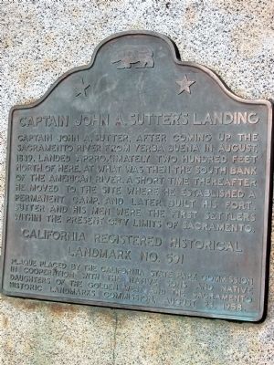
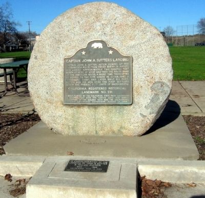
Captain John A. Sutter, after coming up the Sacramento River from Yerba Buena in August 1839, landed approximately two hundred feet north of here, at what was then the south bank of the American River. A short time thereafter he moved to the site where he established a permanent camp, and later built his fort. Sutter and his men where the first settlers within the present city limits of Sacramento.
[Smaller Marker]:
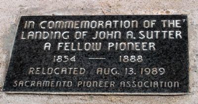
A Fellow Pioneer
1854-1888
Relocated August 13, 1989
Sacramento Pioneer Association
Erected 1958 by California State Park Commission in Cooperation with the Native Sons and Native Daughters of the Golden West and The Sacramento Historic Landmarks Commission (August 24, 1958). (Marker Number 591.)
Topics and series. This historical marker is listed in these topic lists: Forts and Castles • Settlements & Settlers • Waterways & Vessels. In addition, it is included in the California Historical Landmarks, and the Native Sons/Daughters of the Golden West series lists. A significant historical year for this entry is 1839.
Location. 38° 34.89′ N, 121° 27.955′ W. Marker is in Sacramento , California, in Sacramento County. It is in New Era Park. Marker is at the intersection of C Street and 28th Street, on the right when traveling west on C Street. Touch for map. Marker is in this post office area: Sacramento CA 95816, United States of America. Touch for directions.
Other nearby markers. At least 8 other markers are within walking distance of this marker. Solander's (approx. 0.3 miles away); William McKinley Park (approx. 0.4 miles away); McKinley Rose Garden (approx. half a mile away); New Helvetia Cemetery (approx. 0.6 miles away); California State Indian Museum (approx. 0.7 miles away); Sutter's Fort (approx. 0.7 miles away); The Coloma Road (approx. 0.7 miles away); California Almond Growers Exchange (approx. ¾ mile away). Touch for a list and map of all markers in Sacramento.
Regarding Captain John A. Sutter's Landing. This site is a California Registered Historical Landmark (No. 591).
Also see . . . PBS-The West - John Augustus Sutter. (Submitted on August 20, 2008, by Syd Whittle of Mesa, Arizona.)
July 4, 2008
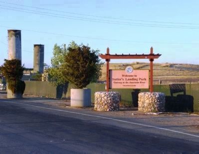
5. Sutter's Landing Park
The actual site where Sutter landed, as well as the original location of the marker, are located in Sutter's Landing Park. In 1989 the marker was moved roughly 2,000 feet south to Fremont Park.
The tall cylindrical objects in the left of the picture are related to the collection of natural gas - Sutter's Landing was used as a landfill for decades, and consequently there is still an amount of methane being produced as a byproduct of landfill decomposition.
Credits. This page was last revised on February 7, 2023. It was originally submitted on August 20, 2008, by Syd Whittle of Mesa, Arizona. This page has been viewed 2,753 times since then and 58 times this year. Photos: 1, 2, 3. submitted on August 20, 2008, by Syd Whittle of Mesa, Arizona. 4. submitted on December 12, 2008, by Syd Whittle of Mesa, Arizona. 5. submitted on August 22, 2008. • Kevin W. was the editor who published this page.
