Zona Centro in San Miguel de Allende, Guanajuato, Mexico — The Central Highlands (North America)
María del Refugio Aguilar y Torres
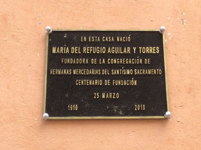
Photographed by J. Makali Bruton, June 11, 2017
1. María del Refugio Aguilar y Torres Marker
En esta casa nació
Maria del Refugio Aguilar y Torres
Fundadora de la Congregación de
Hermanas Mercedarias del Santísimo Sacramento
Centenario de Fundación
25 de Marzo
1910 2010
María del Refugio Aguilar y Torres
Founder of the Congregation of
The Mercedarian Sisters of the Most Holy Sacrament
100th Anniversary of Our Foundation
March 25
1910- 2010
Erected 2010.
Topics. This historical marker is listed in these topic lists: Charity & Public Work • Religion & Religious Structures. A significant historical date for this entry is March 25, 1910.
Location. 20° 54.926′ N, 100° 44.655′ W. Marker is in San Miguel de Allende, Guanajuato. It is in Zona Centro. It is on Calle Hidalgo just south of Calle Mesones, on the right when traveling south. Touch for map. Marker is in this post office area: San Miguel de Allende GTO 37700, Mexico. Touch for directions.

Regionally, this marker is in Central Mexico and in the Bajío. Globally, it is in North America, on the Ring of Fire, and in the Western Hemisphere. Historically, it finds itself in what was once New Spain, a Spanish colony, and the Aztec
this page online
Other nearby markers. At least 8 other markers are within walking distance of this marker: General Mariano Escobedo (within shouting distance of this marker); The Francisco I. Madero Fountain (about 90 meters away, measured in a direct line); First Independent Municipality of Mexico (about 120 meters away); Narciso María Loreto de la Canal (about 120 meters away); House of the Primogeniture of de la Canal (about 120 meters away); Allende's Independence Meetings (about 120 meters away); Carmen Masip Echazarreta (about 120 meters away); Here Independence was Planned (about 120 meters away). Touch for a list and map of all markers in San Miguel de Allende.
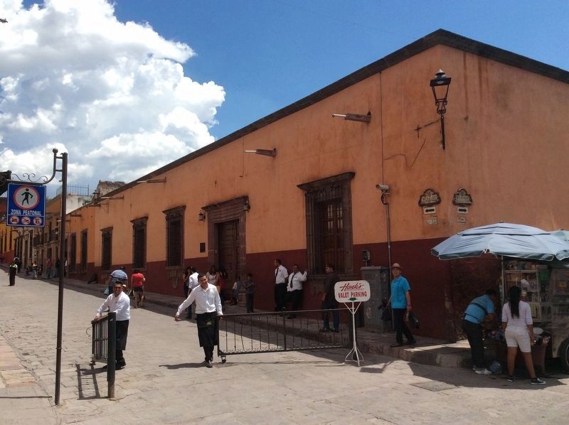
Photographed by J. Makali Bruton, June 11, 2017
2. María del Refugio Aguilar y Torres Marker
The marker is along the facade of this building, next to Hank's New Orleans Style Restaurant.
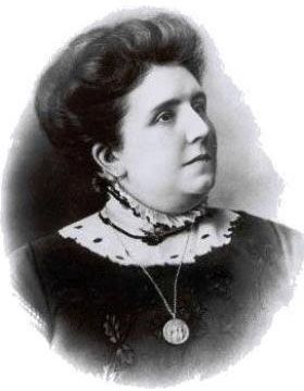
3. María del Refugio Aguilar y Torres
Credits. This page was last revised on September 1, 2020. It was originally submitted on July 14, 2017, by J. Makali Bruton of Washington, District of Columbia. This page has been viewed 795 times since then and 45 times this year. Photos: 1, 2, 3. submitted on July 14, 2017, by J. Makali Bruton of Washington, District of Columbia.
