Thomaston in Knox County, Maine — The American Northeast (New England)
Encampment Site
Knox Museum
| — | Thomaston, Maine | — |
Photographed by Bill Coughlin, July 13, 2017
1. Encampment Site Marker
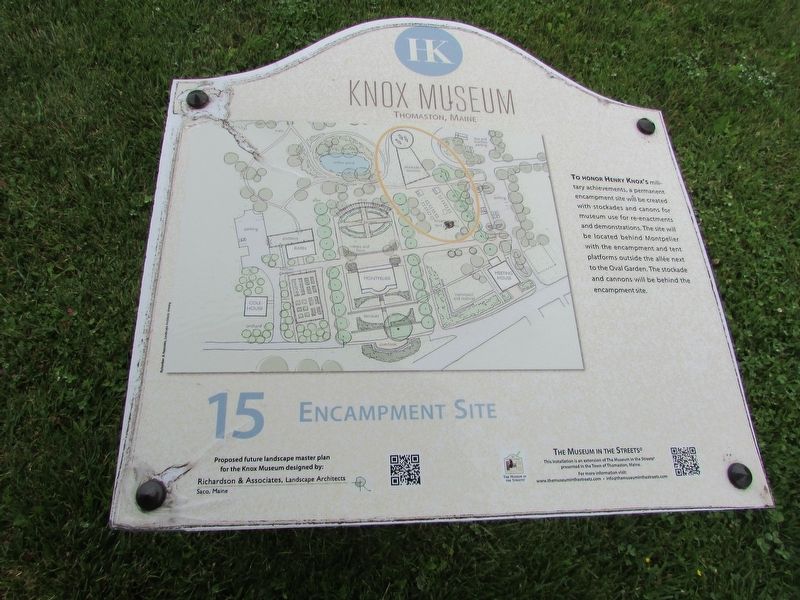
To honor Henry Knox’s military achievements, a permanent encampment site will be created with stockades and cannons for museum use for re-enactments and demonstrations. The site will be located behind Montpelier with the encampment and tent platforms outside the allée next to the Oval Garden. The stockade and cannons will be behind the encampment site.
Erected by The Museum in the Streets®. (Marker Number 15.)
Topics. This historical marker is listed in this topic list: Notable Places.
Location. 44° 4.851′ N, 69° 10.076′ W. Marker is in Thomaston, Maine, in Knox County. It is at the intersection of High Street (Maine Route 131) and Main Street (U.S. 1), on the left when traveling south on High Street. Marker is located near the parking lot at the Knox Estate. Touch for map. Marker is at or near this postal address: 30 High Street, Thomaston ME 04861, United States of America. Touch for directions.

Regionally, this marker is in Midcoast Maine and on Penobscot Bay. It is also in the American Northeast, in New England, and on the Eastern Seaboard. Globally, it
this page online
Other nearby markers. At least 8 other markers are within walking distance of this marker: The Meeting House (within shouting distance of this marker); The Revere Bell (within shouting distance of this marker); General Henry Knox's Estate / La Propriété du General Henry Knox (within shouting distance of this marker); The Oval Garden and Willow Pond (about 300 feet away, measured in a direct line); Terraces, Overlook and Allées (about 400 feet away); Heirloom Vegetable and Fruit Garden, Barn and Orchard (about 400 feet away); Father of the United States Patent Office / Le "Pere du Bureau des Brevets Americains" (approx. ¼ mile away); Main Street in 1871 (approx. 0.3 miles away). Touch for a list and map of all markers in Thomaston.
More about this marker. A plan for the Knox estate showing the location of the encampment site appears on the marker.
Also see . . . Henry Knox Museum. (Submitted on July 15, 2017, by Bill Coughlin of Woodland Park, New Jersey.)
Photographed by Bill Coughlin, July 13, 2017
2. Encampment Site Marker
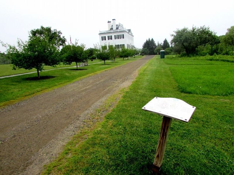
Gen. Knox's mansion, Montpelier, can be seen behind the marker.
Credits. This page was last revised on December 3, 2021. It was originally submitted on July 15, 2017, by Bill Coughlin of Woodland Park, New Jersey. This page has been viewed 385 times since then and 16 times this year. Photos: 1, 2. submitted on July 15, 2017, by Bill Coughlin of Woodland Park, New Jersey.
