Franklin in Franklin County, Idaho — The American West (Mountains)
Franklin Historic District
Pioneer Historic Byway

Photographed By Barry Swackhamer, June 21, 2017
1. Franklin Historic District Marker
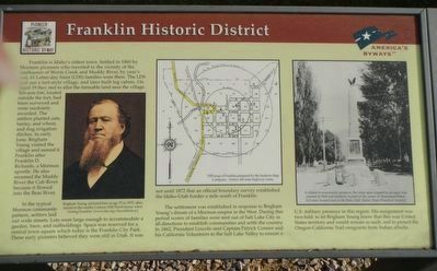
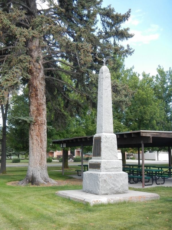
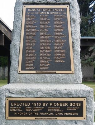
Captions: (left) Brigham Young, pictured here at age 75 in 1875, often stayed in the nearby Lorenzo Hill Hatch house when visiting Franklin (www.lds.org/churchhistory); (center) 1929 map of Franklin prepared by Sunburn Map Company. Notice old state highway route.; (right) A tribute to community pioneers, the stone spire toped by an eagle was erected in 1910 and formerly located in the center of Monument Street. It is now located next to the Relic Hall. (Idaho State Historical Society).
Franklin is Idaho's oldest town. Settled in 1860 by Mormon pioneers who traveled to the vicinity of the confluence of Worm Creek and Muddy River, by year's end, 61 Latter-day Saints (LDS) families were there. The LDS laid out a fort-style village, and later built log cabins. On April 19 they met to allot the farmable land near the village. Ten-acre lots, located outside the fort, had been surveyed and were randomly awarded. The settlers planted oats, barley, and wheat, and dug irrigation ditches. In early June, Brigham Young visited the village and named it Franklin after Franklin D. Richards, a Mormon apostle. He also renamed the Muddy River the Cub River because it flowed into the Bear River.
In the typical Mormon community pattern, settlers laid out wide streets. Lots were large enough to accommodate a garden, barn, and outbuildings. Space was reserved for a central town square which today is the Franklin City Park. These early pioneers believed they were still in Utah. It was not until 1872 that an official boundary survey established the Idaho-Utah border a mile south of Franklin.
The settlement was established in response to Brigham Young's dream of a Mormon empire in the West. During this period scores of families were sent out of Salt Lake City in all directions to establish communities and settle the country. In 1862, President Lincoln sent Captain Patrick Connor and his California Volunteers to the Salt Lake Valley to ensure a U.S. military presence in this region. His assignment was two-fold: to let Brigham Young know that this was United States territory and would remain as such, and to protect the Oregon-California Trail emigrants from Indian raids.
Topics and series. This historical marker is listed in this topic list: Settlements & Settlers. In addition, it is included in the Former U.S. Presidents: #16 Abraham Lincoln series list. A significant historical year for this entry is 1860.
Location. 42° 1.039′ N, 111° 48.046′ W. Marker is in Franklin, Idaho, in Franklin County. Marker is on East Main Street near 1st Street East, on the left when traveling east. Touch for map. Marker is at or near this postal address: 121 East Main Street, Franklin ID 83237, United States of America. Touch for directions.
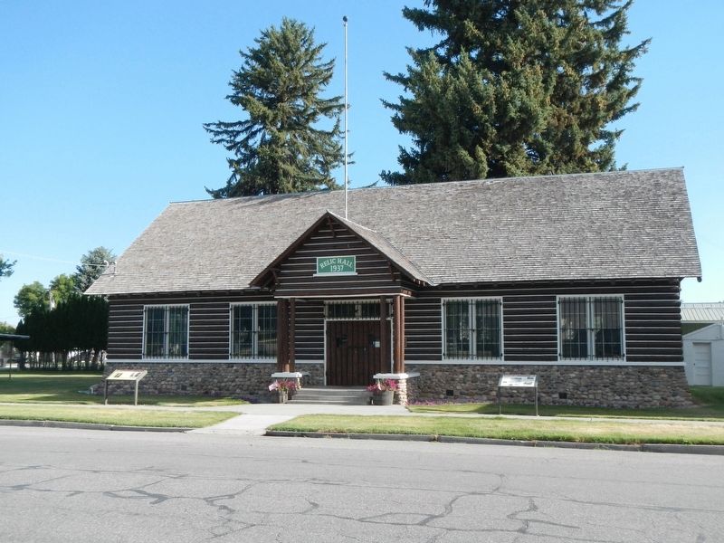
Other nearby markers. At least 8 other markers are within walking distance of this marker. ZCMI Co-op Building (a few steps from this marker); Franklin Relic Hall - 1937 (a few steps from this marker); FCMI Store 1858 (a few steps from this marker); Hatch House (within shouting distance of this marker); Lorenzo Hill Hatch & John Doney Houses (within shouting distance of this marker); Franklin's Pioneer School House 1860 (about 400 feet away, measured in a direct
line); The Birthplace of Samuel P. Cowley (approx. 0.2 miles away); Old Fort of Franklin (approx. 0.2 miles away). Touch for a list and map of all markers in Franklin.
Credits. This page was last revised on August 3, 2020. It was originally submitted on July 15, 2017, by Barry Swackhamer of Brentwood, California. This page has been viewed 379 times since then and 55 times this year. Photos: 1, 2, 3, 4. submitted on July 15, 2017, by Barry Swackhamer of Brentwood, California.


