
Binnenstad in Amsterdam, North Holland, Netherlands — Northwestern Europe
Anthoniespoort
⎯⎯⎯
St. Anthony's Gate
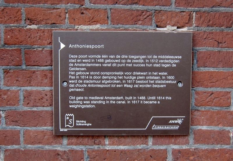
Photographed by Andrew Ruppenstein, June 18, 2017
1. Anthoniespoort Marker
Het gebouw stond oorspronkelijk voor driekwart in het water. Pas in 1614 is door demping het huidige plein ontstaan. In 1600 werd de stadsmuur afgebroken, in 1617 besloot het stadsbestuur dat d'oude Antoniespoort tot een Waag zal worden bequam gemaect.
[English translation of the Dutch portion of the marker text:]
This gate was one of three access points to the medieval city and was built on the water in 1488. In 1512, from this point the Amsterdammers successfully defended their city against the Geldersen (attackers from the Utrecht and Gelderland areas).
The building originally stood three-quarters in the water. Only in 1614 was the current surrounding square created by filling in the area. In 1600 the city walls were broken down, and in 1617 the city council decided that the
this page online
Erected by Stichting Sciltraminghe, ANWB, Zimmermanfonds.
Topics. This historical marker is listed in these topic lists: Forts and Castles • Industry & Commerce.
Location. 52° 22.361′ N, 4° 54.027′ E. Marker is in Amsterdam, Noord-Holland (North Holland). It is in Binnenstad. It is at the intersection of Nieuwmarkt and Koningsstraat, on the left when traveling north on Nieuwmarkt. Touch for map. Marker is at or near this postal address: Nieuwmarkt 4, Amsterdam, Noord-Holland 1012 CR, Netherlands. Touch for directions.

Regionally, it is in Europe, the European Union, Atlantic Europe, the Benelux Low Countries, the Schengen Area, Western Europe, and the Western World. Historically, it finds itself in what was once the Holy Roman Empire.
Other nearby markers. At least 8 other markers are within walking distance of this marker: Gerard Reve (about 120 meters away, measured in a direct line); Long-time Apothecary (about 180 meters away); Lucebert (about 180 meters away); Peter Schat (about 210 meters away);
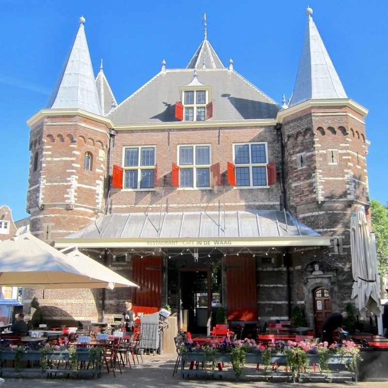
Photographed by Andrew Ruppenstein, June 18, 2017
2. Anthoniespoort Marker - Wide View
The marker is visible here in the shadows, just to the right of the red door. Viewing the marker is probably best accomplished during times when the cafe is closed.
Also see . . .
1. Haag, Amsterdam (Wikipedia). The Waag ("weigh house") is a 15th-century building on Nieuwmarkt square in Amsterdam. It was originally a city gate and part of the walls of Amsterdam. The building has also served as a guildhall, museum, fire station and anatomical theatre, among others. The Waag is the oldest remaining non-religious building in Amsterdam. The building has held rijksmonument status since 1970....Originally, the building was one of the gates in the city wall, the Sint Antoniespoort (Saint Anthony's Gate). The gate was located at the end of the Zeedijk dike, which continued beyond the gate as the Sint Antoniesdijk... (Submitted on July 16, 2017.)
2. From City Gate to Weigh House (Café in de Waag). The weigh house was originally built in 1488 as one of Amsterdam’s city gates, St Anthony’s Port. A stone incorporated in the tower facing Zeedijk recalls the date in an inscription: In MCCCCLXXXVIII [1488] on the XXVII [27th] day of April the first stone of this port was laid.... St
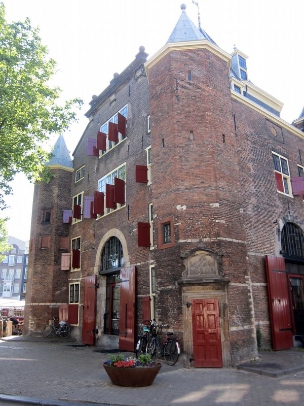
Photographed by Andrew Ruppenstein, June 18, 2017
3. Anthoniespoort - Northwest Side
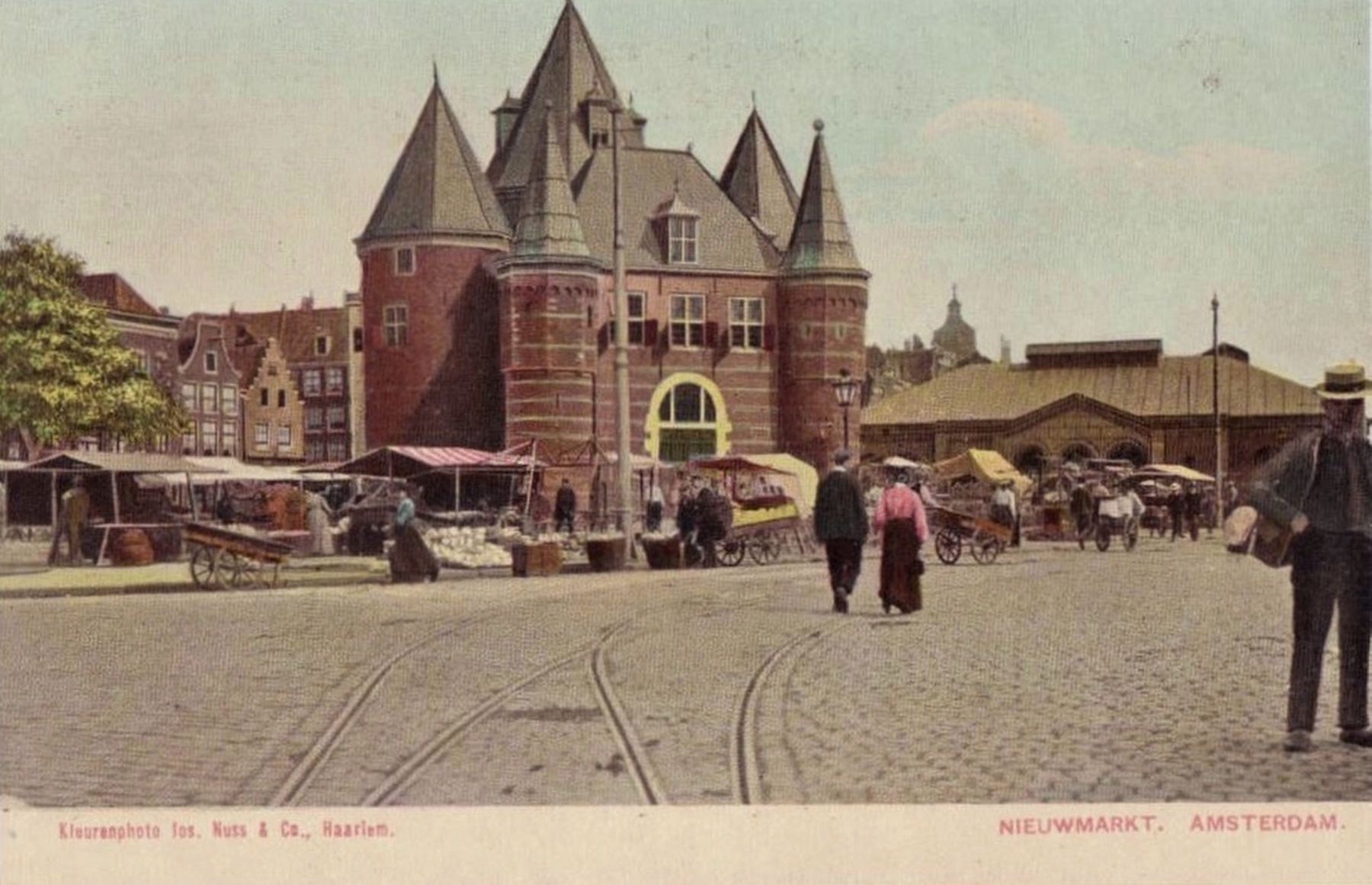
Postcard published by Kieurenphotos los. Nuss. & Co., Haarlem, circa 1910
4. Nieuwmarkt. Amsterdam.
Credits. This page was last revised on February 3, 2023. It was originally submitted on July 15, 2017, by Andrew Ruppenstein of Lamorinda, California. This page has been viewed 1,179 times since then and 88 times this year. Photos: 1, 2. submitted on July 15, 2017, by Andrew Ruppenstein of Lamorinda, California. 3, 4. submitted on July 16, 2017, by Andrew Ruppenstein of Lamorinda, California.
