Downtown in Reykjavík in Reykjavíkurborg, Höfuðborgarsvæðið, Iceland — North Atlantic and Artic Oceans (a Nordic Island)
Skólavörðustígur 13
Photographed by Andrew Ruppenstein, June 8, 2017
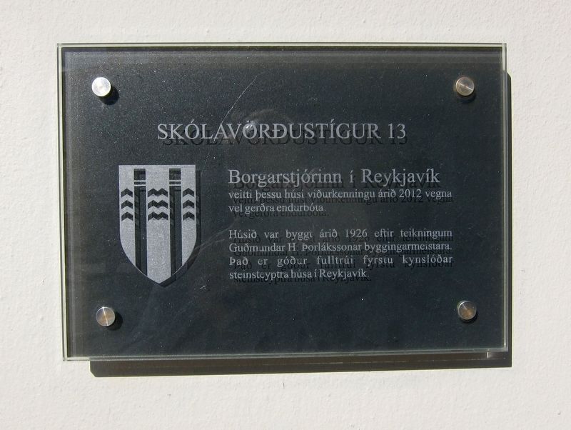
1. Skólavörðustígur 13 Marker
Húsið var byggt árið 1926 eftir teikningum Guðmundar H. Þorlákssonar byggingmeistara. Það er góður fulltrúi fyrstu kynslóðar steinsteyptra húsa í Reykajavík.
In 2012 the Mayor of Reykjavik granted this house recognition for well-done improvements.
The building was built in 1926 according to Guðmundur H. Þorláksson's architectural drawings, and is a good representative of the first generation of concrete buildings in Reykajavík.
Topics. This historical marker is listed in this topic list: Architecture.
Location. 64° 8.699′ N, 21° 55.863′ W. Marker is in Reykjavík, Capital Region (Höfuðborgarsvæðið), in Reykjavíkurborg. It is in Downtown. It is on Skólavörðustígur just south of Óðinsgata, on the right when traveling north. Touch for map. Marker is at or near this postal address: Skólavörðustígur 13, Reykjavík, Capital Region 101, Iceland. Touch for directions.

Regionally, it is on the Atlantic Ocean, in the North Atlantic Region, on
this page online
Other nearby markers. At least 8 other markers are within walking distance of this marker: Tobbukot (within shouting distance of this marker); Skólavörðustígur 11 (within shouting distance of this marker); Laugavegur 15 (about 120 meters away, measured in a direct line); Founding of the Reykjavik Water Utility / Uphaf vatnsveitu (about 180 meters away); Torfhildur Hólm (about 180 meters away); Laugavegur (about 210 meters away); Þingholtsstræti 17 (about 210 meters away); Þingholtsstræti 13 (about 210 meters away). Touch for a list and map of all markers in Reykjavík.
Photographed by Andrew Ruppenstein, June 8, 2017
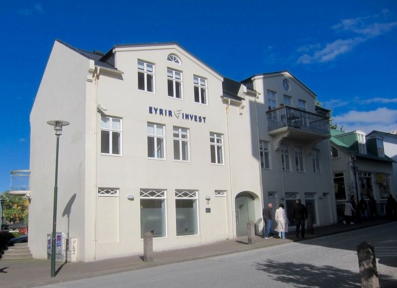
2. Skólavörðustígur 13 and Marker
The marker can be seen beneath the "13".
Credits. This page was last revised on August 18, 2020. It was originally submitted on July 17, 2017, by Andrew Ruppenstein of Lamorinda, California. This page has been viewed 410 times since then and 19 times this year. Photos: 1, 2. submitted on July 17, 2017, by Andrew Ruppenstein of Lamorinda, California.
