
Moran Township near St. Ignace in Mackinac County, Michigan — The American Midwest (Great Lakes)
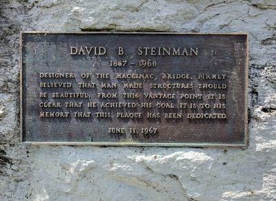
David B. Steinman
1887 - 1960
Photographed by Joel Seewald, June 11, 2017
1. David B. Steinman Marker
June 11, 1967
Erected 1967.
Topics. This historical marker is listed in this topic list: Bridges & Viaducts. A significant historical date for this entry is June 11, 1967.
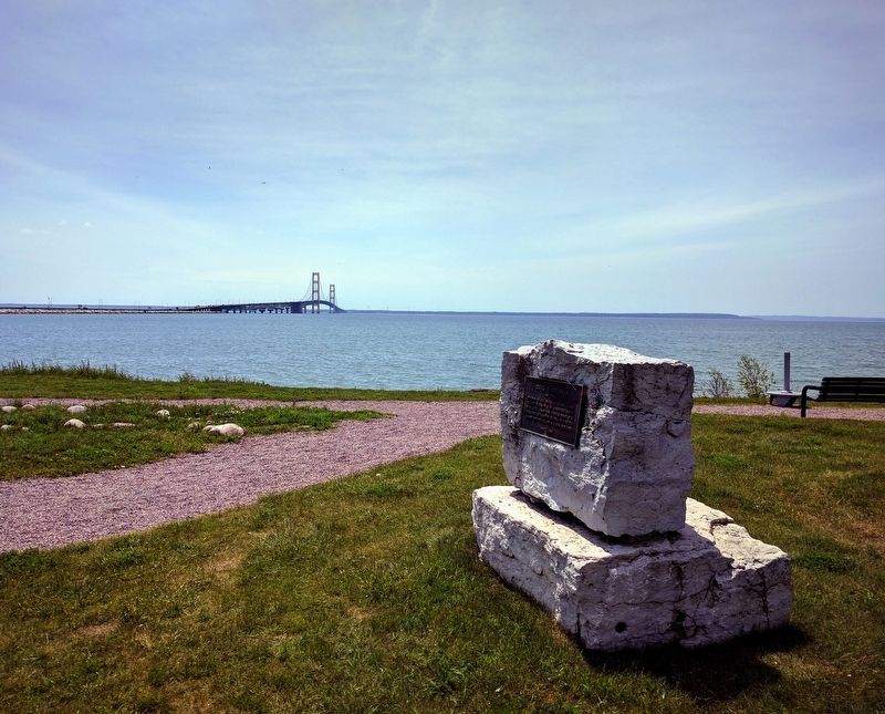
Location. 45° 50.807′ N, 84° 43.586′ W. Marker is near St. Ignace, Michigan, in Mackinac County. It is in Moran Township. It can be reached from Boulevard Drive. The marker is in Bridge View Park and can be seen from the parking lot just past the observation building. Touch for map. Marker is in this post office area: Saint Ignace MI 49781, United States of America. Touch for directions.

Regionally, this marker is on Michigan’s Upper Peninsula and on the Straits of Mackinac. It is also in the American Midwest. Globally, it is in North America, in the Great North Woods, on the Great Lakes, in the Western Hemisphere, in the Western World, and in the Anglosphere. Historically, it finds itself in what was once the Viceroyalty of
this page online
Other nearby markers. At least 8 other markers are within 2 miles of this marker, measured as the crow flies: Mackinac Bridge Monument (within shouting distance of this marker); South Tower Fog Bell (within shouting distance of this marker); Mackinac Bridge, Michigan (within shouting distance of this marker); Prentiss M. Brown, Michigan Lawyer, Mackinac Visionary (within shouting distance of this marker); Honoring James P. Pitz (approx. 0.3 miles away); Mackinac Straits (approx. 0.3 miles away); A Trail to Adventure (approx. 0.3 miles away); Veterans Memorial (approx. 1.2 miles away). Touch for a list and map of all markers in St. Ignace.
Photographed by Joel Seewald, June 11, 2017
2. David B. Steinman Marker
Credits. This page was last revised on June 27, 2025. It was originally submitted on July 18, 2017, by Joel Seewald of Madison Heights, Michigan. This page has been viewed 567 times since then and 67 times this year. Photos: 1, 2. submitted on July 18, 2017, by Joel Seewald of Madison Heights, Michigan.
