Beekmantown in Clinton County, New York — The American Northeast (Mid-Atlantic)
Point Au Roche Methodist Episcopal Church
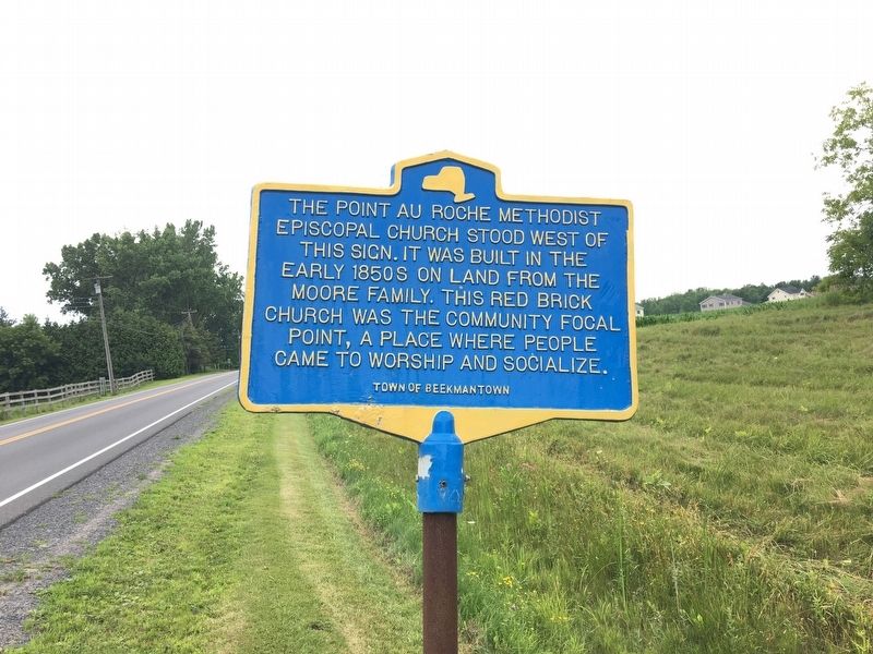
Photographed by Ellen Adams, July 19, 2017
1. Point Au Roche Methodist Episcopal Church Marker
Erected by Town of Beekmantown.
Topics. This historical marker is listed in this topic list: Religion & Religious Structures.
Location. 44° 47.094′ N, 73° 23.466′ W. Marker is in Beekmantown, New York, in Clinton County. It is on Lake Shore Road north of Point Au Roche Road, on the right when traveling south. Touch for map. Marker is in this post office area: Plattsburgh NY 12901, United States of America. Touch for directions.

Regionally, this marker is in Upstate New York, in the Adirondacks & North Country, and in the Champlain Valley. It is also in the American Northeast and in the Mid-Atlantic. Globally, it is in North America, the Great North Woods, the Western Hemisphere, the Western World, and the Anglosphere. Historically, it finds itself in what was once the Viceroyalty of New France, New Netherland, and
this page online
Other nearby markers. At least 8 other markers are within 5 miles of this marker, measured as the crow flies: Philip Farnsworth's Tavern (approx. 1.8 miles away); Benjamin Franklin (approx. 2.3 miles away); A. Vantine Farm (approx. 3.1 miles away); Benedict Arnold (approx. 3.3 miles away); East Beekmantown (approx. 4.4 miles away); Theodore Roosevelt's Visit to Isle La Motte (approx. 4½ miles away in Vermont); Culver Hill Memorial (approx. 4.7 miles away); The War of 1812 (approx. 4.7 miles away). Touch for a list and map of all markers in Beekmantown.
Credits. This page was last revised on July 21, 2017. It was originally submitted on July 20, 2017, by Ellen Adams of Plattsburgh, New York. This page has been viewed 474 times since then and 32 times this year. Photo 1. submitted on July 20, 2017, by Ellen Adams of Plattsburgh, New York. • Bill Pfingsten was the editor who published this page.
