Cullman in Cullman County, Alabama — The American South (East South Central)
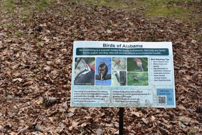
Birds of Alabama
Pileated Woodpecker • Red-tailed Hawk • Yellow-bellied Sapsucker • Cardinal • Bluebird • American Robin
Bird-watching Tips
• Don’t disturb nests • Move slowly and quietly • Use binoculars to view from a distance • Leave pets at home • Wear neutral colored clothes • Don’t feed the birds
Decreasing bird populations can indicate serious environmental problems that will eventually affect humans. We can protect birds by protecting and maintaining a healthy diverse ecosystem.
To learn more about birds and bird identification visit the following websites purchase a field guide.
• www.birds.cornell.edu
• birds.audubon.org
Topics. This historical marker is listed in these topic lists: Animals • Environment.
Location. 34° 12.448′ N, 86° 59.452′ W. Marker is in Cullman, Alabama, in Cullman County. Marker is on County Road 1043. Located in Clarkson Covered Bridge Park. Touch for map. Marker is at or near this postal address: 1240 Co Rd 1043, Cullman AL 35057, United States of America. Touch for directions.
Other nearby markers. At least 8 other markers are within 2 miles of this marker, measured as the crow flies. Where does your drinking water come from? (here, next to this marker); Alabama's Aquatic Biodiversity (here, next to this marker); What happens to my wastewater? (here, next to this marker); Alabama's Physical Diversity (within shouting distance of this marker); Land-Use and Water Quality (within shouting distance of this marker); Clarkson Covered Bridge (within shouting distance of this marker); Streight’s Raid (approx. 1.9 miles away); a different marker also named Streight’s Raid (approx. 1.9 miles away). Touch for a list and map of all markers in Cullman.
Also see . . . Clarkson Covered Bridge Park. One of Cullman's most well known attractions and historically rich sites, Clarkson Covered Bridge, originally built in 1904, and was once used regularly by farmers and travelers to cross Crooked Creek, the weatherworn bridge is now closed to traffic, the centerpiece of a park built in period fashion to showcase the bridge and its historical significance. (Submitted on July 25, 2017, by Sandra Hughes Tidwell of Killen, Alabama, USA.)
Credits. This page was last revised on December 24, 2021. It was originally submitted on July 25, 2017, by Sandra Hughes Tidwell of Killen, Alabama, USA. This page has been viewed 283 times since then and 18 times this year. Photo 1. submitted on July 25, 2017, by Sandra Hughes Tidwell of Killen, Alabama, USA. • Bill Pfingsten was the editor who published this page.
