
Woodland in Southeast Washington in Washington, District of Columbia — The American Northeast (Mid-Atlantic)
Battery Ricketts
Civil War Defenses of Washington
| — | 1861-1865 | — |
Photographed by Craig Swain, August 7, 2008
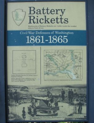
1. Battery Ricketts Marker
Earthworks of Battery Ricketts are visible inside the wooded area in front of you.
Battery Ricketts, built to defend an area in front of Fort Stanton, was named for Maj. Gen. James B. Ricketts.
Erected by National Park Service, U.S. Department of the Interior.
Topics and series. This historical marker is listed in these topic lists: Forts and Castles • War, US Civil. In addition, it is included in the Defenses of Washington series list. A significant historical year for this entry is 1861.
Location. 38° 51.401′ N, 76° 58.512′ W. Marker is in Southeast Washington in Washington, District of Columbia. It is in Woodland. It is at the intersection of Bruce Place Southeast and Raynolds Place Southeast, on the right when traveling north on Bruce Place Southeast. Located in Fort Stanton Park. Touch for map. Marker is at or near this postal address: 2782 Bruce Place Southeast, Washington DC 20020, United States of America. Touch for directions.

Regionally, this marker is in the Washington Metropolitan Area. It is also in the American Northeast, in the Upper South, in the Mid-Atlantic, in the Tidewater, and in the
this page online
Other nearby markers. At least 8 other markers are within walking distance of this marker: A Museum Without Walls (about 400 feet away, measured in a direct line); The Litter Bell (about 500 feet away); The Anacostia River: People and Places (about 500 feet away); The Anacostia River: Pride and Preservation (about 500 feet away); a different marker also named A Museum Without Walls (about 500 feet away); Welcome to the Demonstration Garden (about 600 feet away); Allen Chapel AME Church Stormwater Features (approx. ¼ mile away); Freedom Grove (1838) (approx. 0.3 miles away). Touch for a list and map of all markers in Southeast Washington.
Another marker is no longer nearby. Thurgood Marshall (was about 500 feet away but has been permanently removed).
More about this marker. The marker displays a plan of Battery Ricketts from U.S. Army Corps of Engineers drawing. A map shows other Civil War fortifications surrounding Washington, D.C. administered by the park service. The bottom of the marker is a
Photographed by Craig Swain, August 7, 2008
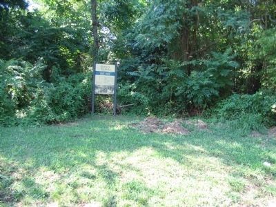
2. Battery Ricketts Marker
The remains of Battery Ricketts are behind the marker in the overgrowth.
Also see . . .
1. Fort Ricketts. National Park Service page on the fort. (Submitted on August 22, 2008, by Craig Swain of Leesburg, Virginia.)
2. Fort Stanton. Wikipedia entry covering Fort Stanton and surrounding fortifications. (Submitted on August 22, 2008, by Craig Swain of Leesburg, Virginia.)
3. James Brewerton Ricketts, U.S. Army. (Submitted on March 13, 2011, by Richard E. Miller of Oxon Hill, Maryland.)
Additional commentary.
1. Battery Ricketts Particulars
From "Mr. Lincoln's Forts: A Guide to the Civil War Defenses of Washington," by Benjamin Franklin Cooling III and Walton H. Owen II:
Noted as a "Fort" in some references, this work had a perimeter of 123 yards. The form was an enclosed battery or redoubt. Its purpose was to defend an exposed ravine, which was a blind side to nearby Fort Stanton. Thus Forts Stanton, Ricketts, and Fort Snyder (further to the south) defended the approaches to the Navy Yard Bridge.
The fort's armament evolved
Photographed by Richard E. Miller, August 19, 2011
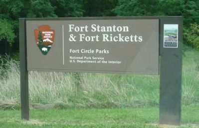
3. Fort Stanton and Fort Ricketts
- signage on Fort Place, SE (around the corner from the Ricketts marker), reflecting the contiguous situation of the two Fort Circle Park units.
Units stationed at different times at the fort included the 59th New York Infantry, 4th, 9th, and 10th New York Heavy Artillery, 88th and 99th Pennsylvania Infantry, 9th Rhode Island Infantry, 17th and 19th Maine Infantry, 3rd Massachusetts Heavy Artillery, Batteries F and G Independent Pennsylvania Artillery, and the 1st Maine Heavy Artillery.
The fort was likely named for General James B. Ricketts. But may also have been named for Captain R. Bruce Ricketts, later chief of artillery of the IX Corps.
— Submitted August 22, 2008, by Craig Swain of Leesburg, Virginia.
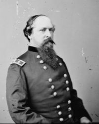
Brady (Library of Congress)
4. General Ricketts
Photographed by Richard E. Miller, August 19, 2011
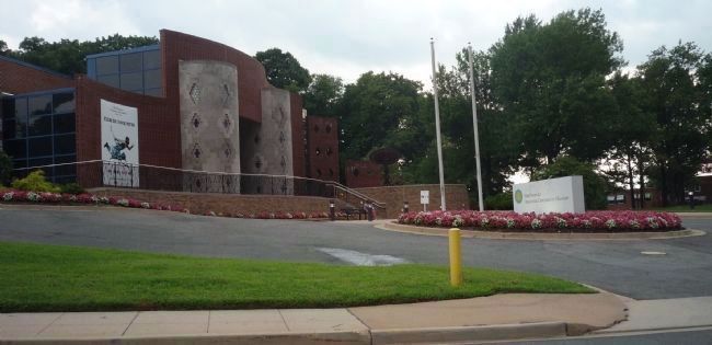
5. Anacostia Community Museum
1901 Fort Place, SE - the neighborhood's main attraction - across the street from the Fort Circle Parks.

National Archives
6. Rickett's Battery
Plan and Section of Battery Ricketts and Plan and Section of Fort Wagner - NAID: 117886829, Drawer 170, Sheet 022, Maps and Charts.

courtesy of U.S. Geological Survey, U.S. Department of the Interior, January 16, 2026
7. Battery Ricketts 3DEP LiDAR Imagery
Battery Ricketts is the angular, semi-crescent-shaped form in the center of this screenshot from 3DEP, overlooking the intersection of Fort Place & Bruce Place.

Photographed by Evan Dwyer, January 17, 2026
8. Battery Ricketts
The battery's remains are noticeably overgrown and lie in the nest of thorns at the top of this low hill.

Photographed by Evan Dwyer, January 17, 2026
9. Battery Ricketts
There is almost nothing to see at Battery Ricketts because of the thorny overgrowth. Through one small break in the thorns facing Fort Place, one can just see the exterior of the south parapet during the fall and winter months. The thorns at right completely fill the exterior defensive ditch, as well as the interior of the battery, and thorns surrounding the remaining sides made all of its features virtually indiscernible. This is the most neglected site in the entirety of the Defenses of Washington NPS holdings.
Credits. This page was last revised on March 18, 2026. It was originally submitted on August 22, 2008, by Craig Swain of Leesburg, Virginia. This page has been viewed 3,510 times since then and 43 times this year. Photos: 1, 2. submitted on August 22, 2008, by Craig Swain of Leesburg, Virginia. 3. submitted on August 30, 2011, by Richard E. Miller of Oxon Hill, Maryland. 4. submitted on March 13, 2011, by Richard E. Miller of Oxon Hill, Maryland. 5. submitted on August 30, 2011, by Richard E. Miller of Oxon Hill, Maryland. 6. submitted on March 22, 2024, by Allen C. Browne of Silver Spring, Maryland. 7, 8, 9. submitted on March 12, 2026, by Evan Dwyer of Richmond, Virginia.
