
First Diamond Drill Hole in the State of Minnesota
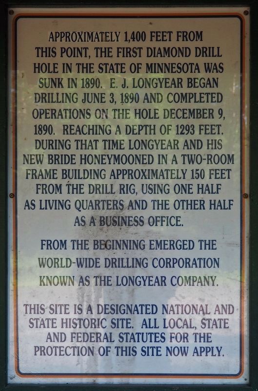
From the beginning emerged the world-wide drilling corporation known as the Longyear Company.
This site is a designated national and state historic site. All local, state and federal statutes for the protection of this site now apply.
Erected 1976 by Iron Range Historical Society.
Topics. This historical marker is listed in this topic list: Industry & Commerce. A significant historical date for this entry is June 3, 1890.
Location. 47° 33.25′ N, 92° 7.192′ W. Marker is in Hoyt Lakes, Minnesota, in Saint Louis County. It is on County Road 666, on the right when traveling north. In parking pullout on northeast side of road. Touch for map. Marker is at or near this postal address: 6500 County Road 666, Hoyt Lakes MN 55750, United States of America. Touch for directions.
Regionally, this marker is in Minnesota’s Arrowhead Region and in the Iron Range. It is also in the American Midwest and in the Corn Belt. Globally, it is in North America, in the Great North Woods, on the Great Lakes, in the Western Hemisphere, in the Western World, and in the Anglosphere. Historically, it finds itself in what was once the Viceroyalty of New France, Rupert’s Land, the territory of the Mississippian Culture, and the Northwest Territory.
Other nearby markers. At least 8 other markers are within 11 miles of this marker, measured as the crow flies: Edmund J. Longyear
this page online
Credits. This page was last revised on August 8, 2017. It was originally submitted on August 6, 2017, by McGhiever of Minneapolis, Minnesota. This page has been viewed 422 times since then and 30 times this year. Photos: 1, 2. submitted on August 6, 2017, by McGhiever of Minneapolis, Minnesota. • Bill Pfingsten was the editor who published this page.
