Presidio of San Francisco in San Francisco City and County, California — The American West (Pacific Coastal)
Fort Point
Photographed by Syd Whittle, November 3, 2007
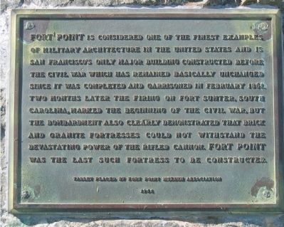
1. Fort Point Marker
Erected 1966 by Fort Point Museum Association.
Topics. This historical marker is listed in these topic lists: Forts and Castles • Landmarks • Military. A significant historical month for this entry is February 1861.
Location. 37° 48.581′ N, 122° 28.586′ W. Marker is in San Francisco, California, in San Francisco City and County. It is in Presidio of San Francisco. It is on Marine Drive, on the left when traveling north. Marker is located on the left side of walkway between parking area and entrance to the Fort. Touch for map. Marker is in this post office area:
this page online

Regionally, this marker is on California’s Coast Ranges. It is also on the American Pacific Coast. Globally, it is in North America, on the Ring of Fire, on the Pacific Rim, in the Western Hemisphere, in the Western World, and in the Anglosphere. Historically, it finds itself in what was once New Spain and also Mexico’s Alta California.
Other nearby markers. At least 8 other markers are within walking distance of this marker: Castillo de San Joaquin (about 300 feet away, measured in a direct line); Fort Point National Historic Site (about 300 feet away); Defending the Golden Gate (about 400 feet away); Fort Point Light (about 400 feet away); a different marker also named Defending the Golden Gate (about 400 feet away); The Golden Gate Bridge (about 600 feet away); A Lasting Monument (about 600 feet away); All in a Day's Work (about 600 feet away). Touch for a list and map of all markers in San Francisco.
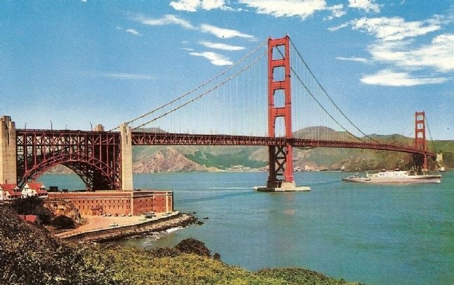
Regarding Fort Point. Fort Point is located under the south end of the Golden Gate Bridge
Also see . . .
1. California State Military Museum Fort Point.
Photographed by Syd Whittle, November 3, 2007
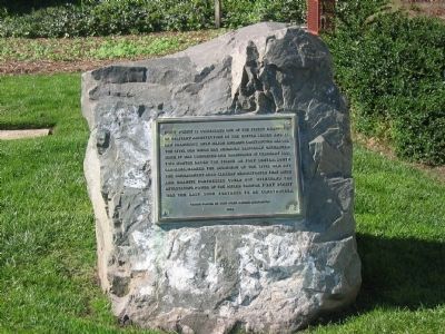
2. Fort Point Marker
2. Fort Point National Historic Site. National Park Service site (Submitted on August 24, 2008, by Syd Whittle of Mesa, Arizona.)
Photographed by Konrad R Summers, August 18, 2012
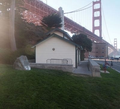
3. Fort Point Marker
This identifies where the Fort Point Marker is located. The Rock in the foreground is where the marker is mounted.
Photographed by Syd Whittle, November 3, 2007
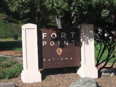
4. Fort Point National Historic Site
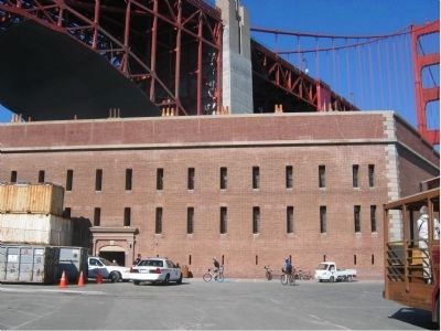
Photographed by Syd Whittle, November 3, 2007
5. Outside View of Fort Point
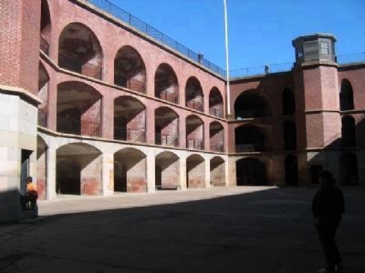
Photographed by Syd Whittle, November 3, 2007
6. Inside View of Fort Point
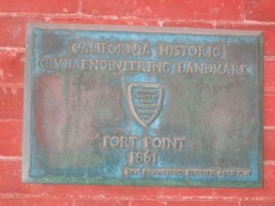
Photographed by Syd Whittle, November 3, 2007
7. California Historic Civil Engineering Landmark
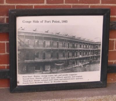
Photographed by Syd Whittle, November 3, 2007
8. Photo on Display
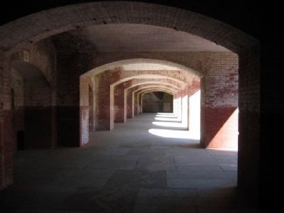
Second Floor: Privies, officer's mess, officer's quarters, and hospital.
Third Floor: Privies, enlisted men's mess, and enlisted men's quarters.
Fourth Floor: (Barbette): Eleven 32 - Pounder cannon.
Photographed by Syd Whittle, November 3, 2007
9. Fort Point
Photographed by Syd Whittle, November 3, 2007
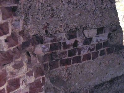
10. Wall Demolition
In 1913, work began to convert Fort Point into a Detention Barracks as a result of a Congressional proposal to turn over Alcatraz Island to the Department of Labor for use by the Bureau if Immigration and Naturalization. Soldier prisoners at Alcatraz were to be sent to Fort Point. This portion of the wall was removed at that time. The demolition reveals the brick courses, rubble fill and concrete work used in the construction of the fort.
Photographed by Evan Reader, February 19, 2011
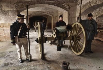
11. Artillery Battery at Fort Point
Re-enactment by 20th Maine Volunteer Infantry, Company G
Mike Roberts, Berkeley, Ca. Distributed by E.F. Clements-S.F., Ca
12. Vintage Postcard of Fort Point under southern base of the Golden Gate Bridge
Credits. This page was last revised on February 7, 2023. It was originally submitted on August 24, 2008, by Syd Whittle of Mesa, Arizona. This page has been viewed 2,435 times since then and 50 times this year. Photos: 1, 2. submitted on August 24, 2008, by Syd Whittle of Mesa, Arizona. 3. submitted on September 7, 2012, by Konrad R Summers of Santa Clarita, California. 4. submitted on January 23, 2009, by Syd Whittle of Mesa, Arizona. 5, 6. submitted on August 24, 2008, by Syd Whittle of Mesa, Arizona. 7. submitted on December 8, 2008, by Syd Whittle of Mesa, Arizona. 8, 9. submitted on January 23, 2009, by Syd Whittle of Mesa, Arizona. 10. submitted on January 24, 2009, by Syd Whittle of Mesa, Arizona. 11. submitted on October 28, 2011, by Evan Reader of San Mateo, California. 12. submitted on September 5, 2008, by Syd Whittle of Mesa, Arizona. • Craig Swain was the editor who published this page.
