East Lansing in Ingham County, Michigan — The American Midwest (Great Lakes)
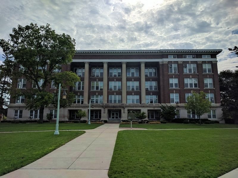
Justin S. Morrill Hall of Agriculture
Photographed by Joel Seewald, July 19, 2017
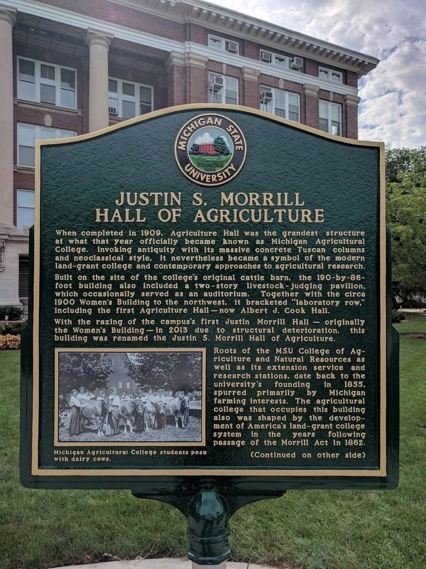
1. Justin S. Morrill Hall of Agriculture Marker - Side 1
Built on the site of the college's original cattle barn, the 190-by-86-foot building also included a two-story livestock-judging pavilion, which occasionally served as an auditorium. Together with the circa 1900 Women's Building to the northwest, it bracketed "laboratory row," including the first Agriculture Hall — now Albert J. Cook Hall.
With the razing of the campus's first Justin Morrill Hall — originally the Women's Building — in 2013 due to structural deterioration, this building was renamed the Justin S. Morrill Hall of Agriculture.
Roots of the MSU College of Agriculture and Natural Resources as well as its extension service and research stations, date back to the university's founding in 1855, spurred primarily by Michigan farming interests.
this page online
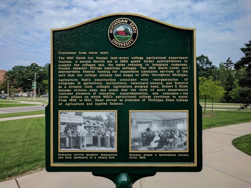
Agriculture Hall's construction coincided with reorganization of programs in agriculture, horticulture, veterinary science, and forestry as a division (now, college). Agriculture program head, Robert S. Shaw, became division dean and noted that the work of most departments included elements of education, experimentation, and extension—the three pillars on which MSU's agricultural college continues to stand. From 1928 to 1941, Shaw served as president of Michigan State College of Agriculture and Applied Science.
Erected by Michigan
Photographed by Joel Seewald, July 19, 2017
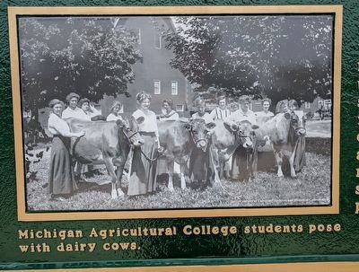
2. Justin S. Morrill Hall of Agriculture Marker - Side 1 Image
Michigan Agricultural College students pose with dairy cows.
Topics. This historical marker is listed in this topic list: Education. A significant historical year for this entry is 1909.
Location. 42° 43.861′ N, 84° 28.798′ W. Marker is in East Lansing, Michigan, in Ingham County. It is at the intersection of West Circle Drive and Auditorium Road, on the right when traveling east on West Circle Drive. Touch for map. Marker is at or near this postal address: 446 West Circle Drive, East Lansing MI 48824, United States of America. Touch for directions.

Regionally, this marker is in Mid-Michigan and in Greater Lansing. It is also in the American Midwest. Globally, it is in North America, the Western Hemisphere, the Western World, and the Anglosphere. Historically, it finds itself in what was once the Northwest Territory.
Other nearby markers. At least 8 other markers are within walking distance of this marker: Dora Hall Stockman (within shouting distance of this marker); Saints' Rest / Saints' Rest Excavation (about 300 feet away, measured in a direct line); Harry J. Eustace Hall (about 600 feet away); Michigan State University (about 700 feet away); The Rededication of the Beaumont Tower Bells
Photographed by Joel Seewald, July 19, 2017
3. Justin S. Morrill Hall of Agriculture Marker - Side 2
Also see . . .
1. Morrill Land Grant Acts. Wikipedia article (Submitted on August 11, 2017, by Joel Seewald of Madison Heights, Michigan.)
2. Hatch Act of 1887. Wikipedia article (Submitted on August 11, 2017, by Joel Seewald of Madison Heights, Michigan.)
3. Smith-Lever Act of 1914. Wikipedia article (Submitted on August 11, 2017, by Joel Seewald of Madison Heights, Michigan.)
4. Robert S. Shaw (b. 1871 d. 1953). Article from the Michigan State University Archives & Historical Collections. (Submitted on August 11, 2017, by Joel Seewald of Madison Heights, Michigan.)
Photographed by Joel Seewald, July 19, 2017
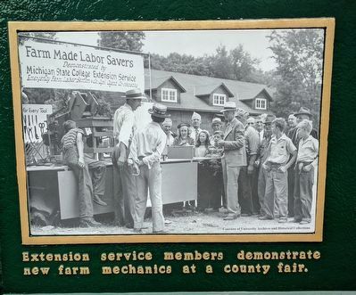
4. Justin S. Morrill Hall of Agriculture Marker - Side 2, Left Image
Extension service members demonstrate new farm mechanics at a county fair.
Photographed by Joel Seewald, July 19, 2017
5. Justin S. Morrill Hall of Agriculture Marker - Side 2, Right Image
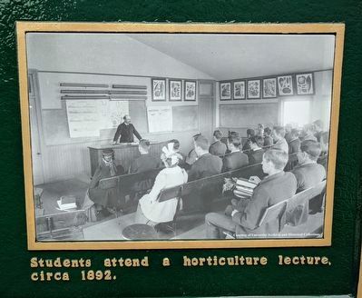
Students attend a horticulture lecture, circa 1892.
Photographed by Joel Seewald, July 19, 2017
6. Justin S. Morrill Hall of Agriculture and Marker
Credits. This page was last revised on August 11, 2017. It was originally submitted on August 11, 2017, by Joel Seewald of Madison Heights, Michigan. This page has been viewed 1,409 times since then and 98 times this year. Photos: 1, 2, 3, 4, 5, 6. submitted on August 11, 2017, by Joel Seewald of Madison Heights, Michigan.
