Near Woodside in San Mateo County, California — The American West (Pacific Coastal)
Town of Searsville
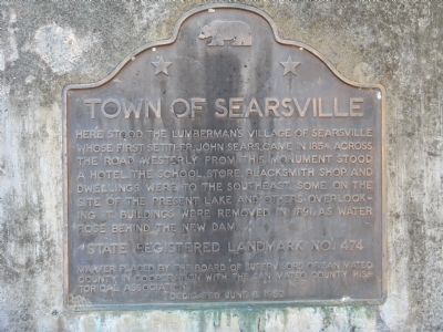
Here stood the lumbermanís village of Searsville whose first settler, John Sears, came in 1854. Across the road westerly from this monument stood a hotel. The school, store, blacksmith shop, and dwellings were to the southeast. Some on the site of the present lake and others overlooking it. Buildings were removed in 1891, as water rose behind the new dam.
Erected 1952 by The Board of Supervisors of San Mateo County in cooperation with the San Mateo County Historical Society (June 8, 1952). (Marker Number 474.)
Topics and series. This historical marker is listed in these topic lists: Landmarks • Settlements & Settlers. In addition, it is included in the California Historical Landmarks series list. A significant historical year for this entry is 1854.
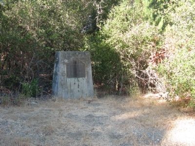
Location. 37° 24.159′ N, 122° 14.715′ W. Marker is near Woodside, California, in San Mateo County. Marker is at the intersection of Sand Hill Road and Portola Road, on the left when traveling east on Sand Hill Road. Touch for map. Marker is in this post office area: Redwood City CA 94062, United States of America. Touch for directions.
Other nearby markers. At least 8 other markers are within 2 miles of this marker, measured as the crow flies. First Saw Mill (approx. 0.6 miles away); The Chinese Walls (approx. one mile away); Folger Stable c.1905 (approx. one mile away); Our Lady of the Wayside (approx. 1.4 miles away); Hallidie Tramway (approx. 1.6 miles away); Portola Primary School (approx. 1.7 miles away); Independence Hall (approx. 1.8 miles away); Pioneer Hotel (approx. 1.8 miles away). Touch for a list and map of all markers in Woodside.
Also see . . .
1. A Look at Searsville's Past. The Almanac website entry (Submitted on August 24, 2008, by Syd Whittle of Mesa, Arizona.)
2. Dredging Up the Lost Spirit of Searsville. East Bay Times website entry (Submitted on August 24, 2008, by Syd Whittle of Mesa, Arizona.)
3. Ghosts of Searsville. San Mateo County Genealogy, "Tales of the San Francisco Peninsula" website entry (Submitted on August 24, 2008, by Syd Whittle of Mesa, Arizona.)
Credits. This page was last revised on April 28, 2021. It was originally submitted on August 24, 2008, by Syd Whittle of Mesa, Arizona. This page has been viewed 1,825 times since then and 37 times this year. Photos: 1, 2. submitted on August 24, 2008, by Syd Whittle of Mesa, Arizona. • Kevin W. was the editor who published this page.

