Near New Kent in New Kent County, Virginia — The American South (Mid-Atlantic)
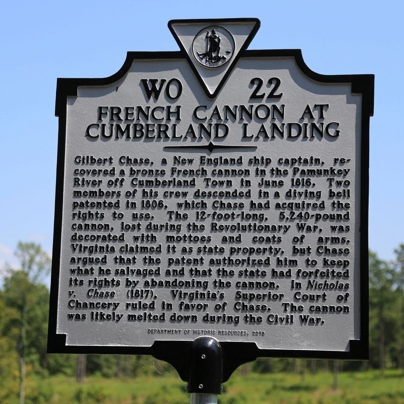
French Cannon at Cumberland Landing
Erected 2016 by Department of Historic Resources. (Marker Number WO-22.)
Topics and series. This historical marker is listed in this topic list: War, US Revolutionary. In addition, it is included in the Virginia Department of Historic Resources (DHR) series list. A significant historical year for this entry is 1816.
Location. 37° 32.171′ N, 76° 58.774′ W. Marker is near New Kent, Virginia, in New Kent County. Marker is on Cumberland Road (County Route 637) 1½ miles north of New Kent Highway (Virginia Route 249), on the right when traveling north. Touch for map. Marker is in this post office area: New Kent VA 23124, United States of America. Touch for directions.
Other nearby markers. At least 8 other markers are within 2 miles of this marker, measured as the crow flies. McClellan’s Camp at Cumberland Landing (here, next to this marker); Cumberland Town (a few steps from this marker); Samuel Wilson Crump (1919-1995) (approx. 1.3 miles away); John Parke Custis / Martha Dandridge (approx. 1.3 miles away); Confederate Memorial (approx. 1.3 miles away); Martha Washington's Birthplace (approx. 1.3 miles away); James Lafayette (approx. 1.3 miles away); New Kent Courthouse (approx. 1.3 miles away). Touch for a list and map of all markers in New Kent.
Also see . . . Nicholas v Chase & the Diving Bell of Richard Tripe. “The case of Nicholas v. Chase was certainly a historic case if not a precedential one. This was one of the first recorded salvage case in the United States outside of the admiralty court. Although the cannon was arrested by a federal marshal, Virginia chose to litigate in their own Superior Court of Chancery.”
“The court ruled that that the cannon was never the property of the state. Evidence had been submitted that the cannon at the State Armory were cannon imported on the French ship and were clearly property o f the state. Apparently the court determined that while the cannon were on board the sloop, they were still property of France. Since the subject cannon was never landed onto Virginia soil, Virginia never took title. The cannon were not
delivered according to a contract but were a gift from France. This gift could have been recalled at anytime before delivery. It can easily be inferred now that the cannon on the bottom of the Pamunkey either still belonged to France or was considered abandoned and belonged to no one, even though it lay partially embedded in the submerged lands of the Commonwealth of Virginia for thirty-six years.” (Submitted on August 23, 2017.)
Credits. This page was last revised on August 23, 2017. It was originally submitted on August 23, 2017, by J. J. Prats of Powell, Ohio. This page has been viewed 347 times since then and 17 times this year. Photos: 1, 2. submitted on August 23, 2017, by J. J. Prats of Powell, Ohio.

