Macon County War Memorial
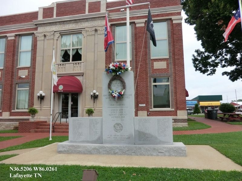
World War I, World War II, Korean Conflict, Vietnam Era 1917-1975.
“If we break faith we shall have died in vain”
Erected 1984.
Topics. This memorial is listed in these topic lists: War, Korean • War, Vietnam • War, World I • War, World II.
Location. 36° 31.243′ N, 86° 1.57′ W. Memorial is in Lafayette, Tennessee, in Macon County. It is at the intersection of Public Square and West Locust Street on Public Square. The marker is on the lawn of the Macon County Courthouse. Touch for map. Memorial is in this post office area: Lafayette TN 37083, United States of America. Touch for directions.
Regionally, this memorial is in Middle Tennessee and in the Highland Rim. It is also in the American South and specifically in the Upper South. Globally, it is in North America, the Western Hemisphere, the Western World, and the Anglosphere. Historically, it finds itself in what was once the territory of the Mississippian
this page online
Other nearby markers. At least 8 other markers are within 3 miles of this marker, measured as the crow flies: Macon County (a few steps from this marker); Macon County Confederate Soldiers Monument (a few steps from this marker); Woodmore Hotel (a few steps from this marker); Macon County in the Civil War (within shouting distance of this marker); Russell Smith (within shouting distance of this marker); Key Park (approx. 0.2 miles away); World War II Maneuvers (approx. 1.7 miles away); A Family Tragedy (approx. 2½ miles away). Touch for a list and map of all markers in Lafayette.
Credits. This page was last revised on August 30, 2017. It was originally submitted on August 29, 2017, by Don Morfe of Baltimore, Maryland. This page has been viewed 587 times since then and 62 times this year. Photo 1. submitted on August 29, 2017, by Don Morfe of Baltimore, Maryland. • Bill Pfingsten was the editor who published this page.
