Conneaut Lake in Crawford County, Pennsylvania — The American Northeast (Mid-Atlantic)
This Tablet
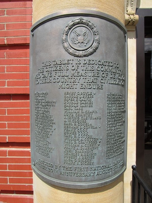
Photographed by Anton Schwarzmueller, August 26, 2017
1. Left Tablet
[two tablets, identical heading]
the citizens of this community
who gave full measure of devotion
to their country that civilization
might endure.
Erected 1923 by First National Bank.
Topics. This memorial is listed in this topic list: Military.
Location. 41° 36.202′ N, 80° 18.184′ W. Memorial is in Conneaut Lake, Pennsylvania, in Crawford County. It is at the intersection of Water Street (U.S. 322) and North 2nd Street, on the left when traveling east on Water Street. Touch for map. Memorial is at or near this postal address: 210 Water Street, Conneaut Lake PA 16316, United States of America. Touch for directions.

Regionally, this memorial is in Northwestern Pennsylvania and in Greater Erie. It is also in the American Northeast, in the Mid-Atlantic, in Appalachia, and specifically in Northern Appalachia. Globally, it is in North America, the Western Hemisphere, the Western World, and the Anglosphere. Historically, it finds itself in what was once the Haudenosaunee (Iroquois) Confederacy and also one of the original Thirteen
this page online
Other nearby markers. At least 8 other markers are within 7 miles of this marker, measured as the crow flies: To the Memory of the Brave (within shouting distance of this marker); Geology (about 600 feet away, measured in a direct line); The Ice Industry and the Ice Houses (about 600 feet away); The Railroads (about 800 feet away); This Carousel (approx. 2.3 miles away); Erie Extension Canal (approx. 4.2 miles away); a different marker also named Erie Extension Canal (approx. 5 miles away); French Creek Feeder (approx. 6.9 miles away). Touch for a list and map of all markers in Conneaut Lake.
Other markers no longer nearby. Conneaut Reservoir (was approx. 0.6 miles away but has been confirmed missing); Blue Streak (was approx. 2.3 miles away but has been confirmed missing).
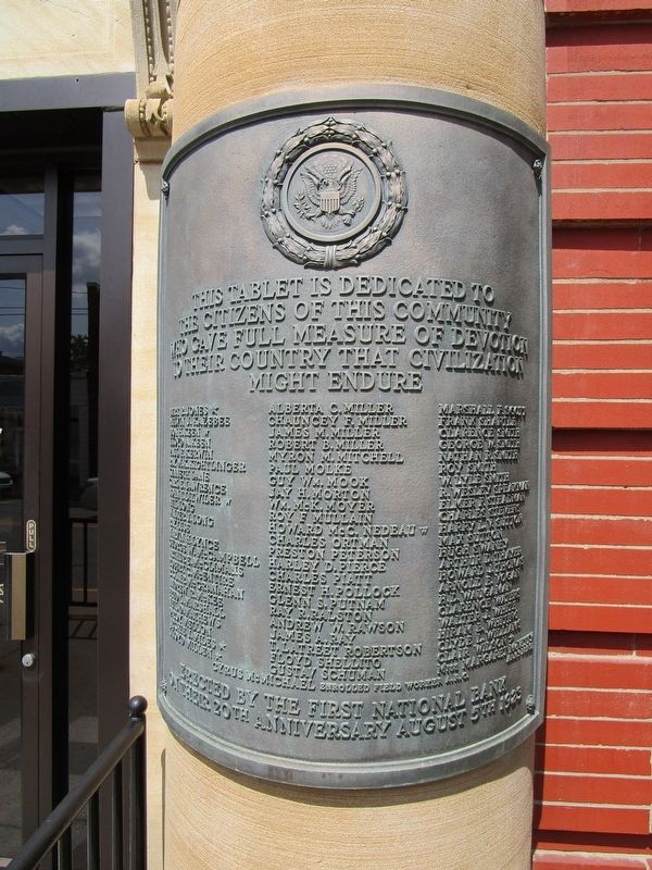
Photographed by Anton Schwarzmueller, August 26, 2017
2. Right Tablet
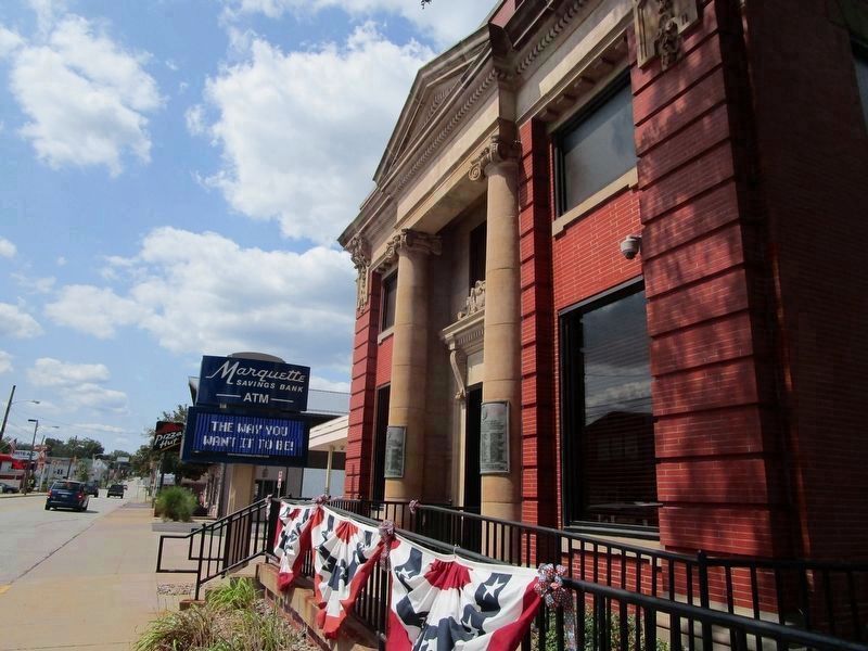
Photographed by Anton Schwarzmueller, August 26, 2017
3. Tablets on Columns
The building is now Marquette Savings Bank. View is westward. US routes 6 and 322 are multiplexed here.
Credits. This page was last revised on August 30, 2017. It was originally submitted on August 30, 2017, by Anton Schwarzmueller of Wilson, New York. This page has been viewed 418 times since then and 25 times this year. Photos: 1, 2, 3. submitted on August 30, 2017, by Anton Schwarzmueller of Wilson, New York.
