Helena in Phillips County, Arkansas — The American South (West South Central)
Battery C Revealed
— Battle of Helena —
Calling in the Professionals
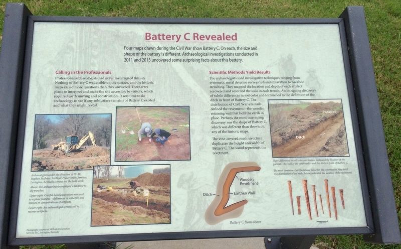
Professional archaeologists had never investigated this site. Nothing of Battery C was visible on the surface, and the historic maps raised more questions than they answered. There were plans to interpret and make the site accessible to visitors, which required earth moving and construction. It was time to do archaeology to see if any subsurface remains of Battery C existed and what they might reveal.
Scientific Methods Yield Results
The archaeologists used investigative techniques ranging from systematic metal detector surveys to hand excavation to backhoe trenching. They mapped the location and depth of each artifact recovered and recorded the soils in each trench. An intriguing discovery of subtle differences in soil color and texture led to the definition of the ditch in front of Battery C. The distribution of Civil War-era nails defined the revetment—the wooden retaining wall that held the earth in place. Perhaps the most interesting discovery was the shape of Battery C, which was different than shown on any of the historic maps.
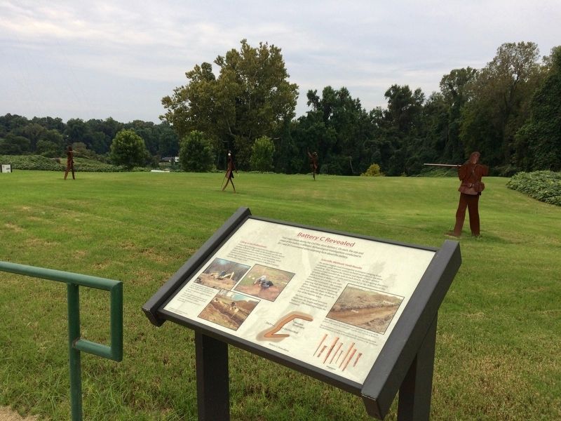
The vine-covered mesh structure duplicates the height and width of Battery C. The wood represents the revetment.
[Photo captions]
Bottom left:
Archaeologists under the direction of Dr. W. Stephen McBride, McBride Preservation Services, Lexington, Kentucky, conducted the field work.
Above: The archaeologists employed a backhoe to dig trenches.
Upper right: Careful hand excavation was used to explore features-differences in soil color and texture or concentrations of artifacts.
Lower right: An archaeologist screens soil to recover artifacts.
Right side:
Slight differences in soil color and texture indicated the location of the parapet-the wall of the earthwork-and the ditch in front of Battery C.
The most common of artifacts have value for the information they hold. The distribution of cut nails, below, indicated the location of the revetment.
Topics. This historical marker is listed in these topic lists: Exploration • War, US Civil. A significant historical year for this entry is 2011.
Location. 34° 31.564′ N, 90° 35.817′ W. Marker is in Helena, Arkansas, in Phillips County. Marker can be reached from Yorkshire Drive, 0.1 miles east of Audubon Drive. Touch for map. Marker is at or near this postal address: 1100 Yorkshire Drive, Helena AR 72342, United States of America. Touch for directions.
Other nearby markers.
At least 8 other markers are within walking distance of this marker. The 33rd Missouri Spikes the Guns (a few steps from this marker); A Short Lived Confederate Victory (a few steps from this marker); A Cemetery Becomes a Battleground (a few steps from this marker); "We are well fortified" (a few steps from this marker); The Avenging Fire of the Gunboat (within shouting distance of this marker); Their Guns Pounded Graveyard Hill (within shouting distance of this marker); Coming to the Aid of Fort Curtis (within shouting distance of this marker); Battle of Helena (within shouting distance of this marker). Touch for a list and map of all markers in Helena.
Credits. This page was last revised on September 4, 2017. It was originally submitted on September 4, 2017, by Mark Hilton of Montgomery, Alabama. This page has been viewed 250 times since then and 16 times this year. Photos: 1, 2, 3. submitted on September 4, 2017, by Mark Hilton of Montgomery, Alabama.


