Hagerstown in Washington County, Maryland — The American Northeast (Mid-Atlantic)
West Baltimore Street
Photographed by Allen C. Browne, August 22, 2017
1. West Baltimore Street Marker
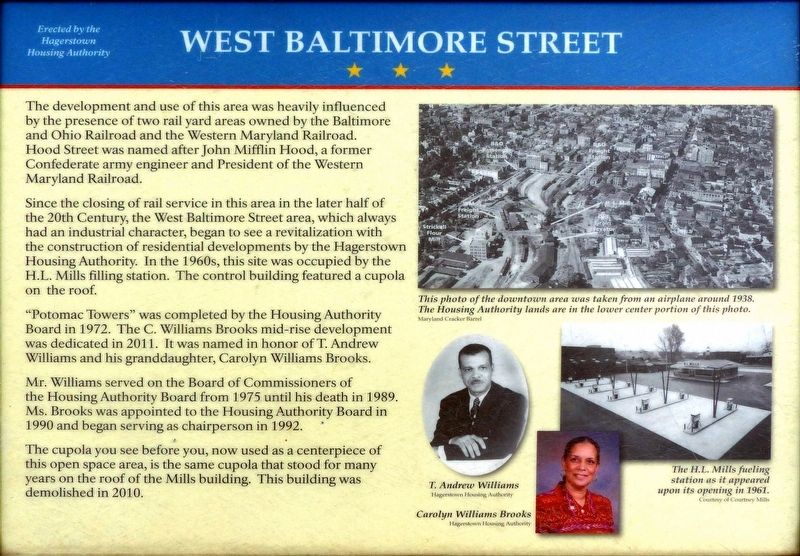
The development and use of this area was heavily influenced by the presence of two rail yard areas owned by the Baltimore and Ohio Railroad and the Western Maryland Railroad. Hood Street was named after John Mifflin Hood, a former Confederate army engineer and President of the Western Maryland Railroad.
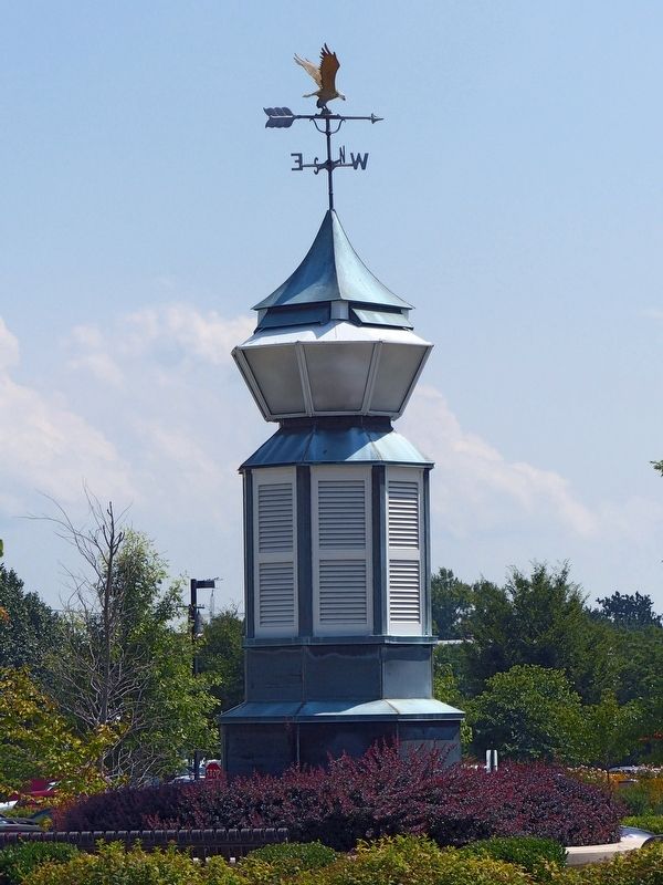
Since the closing of rail service in this area in the later half of the 20th Century, the West Baltimore Street area, which always had an industrial character, began to see a revitalization with the construction of residential developments by the Hagerstown Housing Authority. In the 1960s, this site was occupied by the H.L. Mills filling station. The control building featured a cupola on the roof.
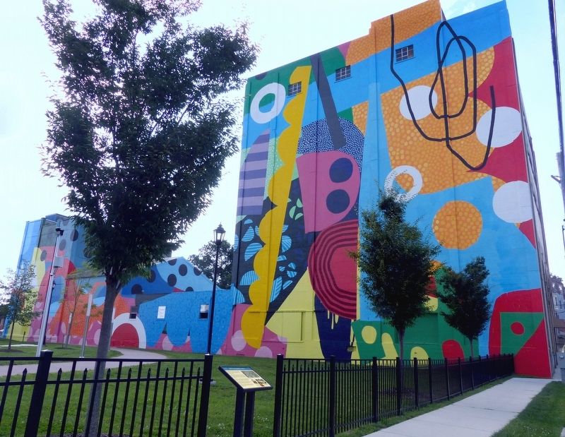
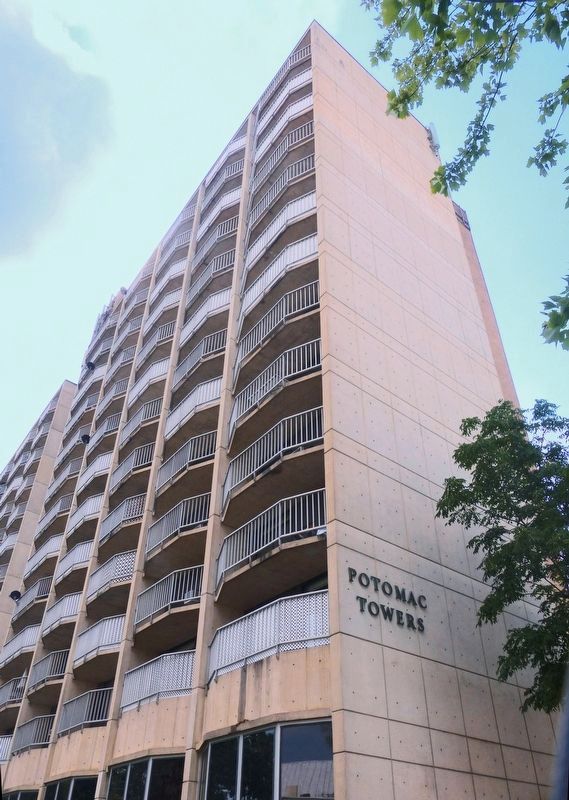
"Potomac Towers" was completed by the Housing Authority Board in 1972. The C. Williams Brooks mid-rise development was dedicated in 2011. It was named in honor of T. Andrew Williams and his granddaughter, Carolyn Williams Brooks.
Mr. Williams served on the Board of Commissioners of the Housing Authority Board from 1975 until his death in 1989. Ms. Brooks was appointed to the Housing Authority Board in 1990 and began
this page online
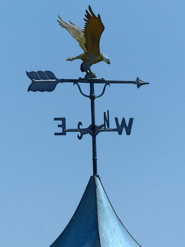
The cupola you see before you, now used as a centerpiece of this open space area, is the same cupola that stood for many years on the roof of the Mills building. This building was demolished in 2010.
Topics and series. This historical marker is listed in this topic list: Notable Places. In addition, it is included in the Baltimore and Ohio Railroad (B&O) series list.
Location. This marker has been replaced by another marker nearby. It was located near 39° 38.367′ N, 77° 43.458′ W. Marker was in Hagerstown, Maryland, in Washington County. It was at the intersection of West Baltimore Street (Alternate U.S. 40) and The Hagerstown Cultural Trail, on the right when traveling east on West Baltimore Street. Touch for map. Marker was at or near this postal address: 45 West Baltimore Street, Hagerstown MD 21740, United States of America. Touch for directions.

Regionally, this marker was in Western Maryland. It was also in the American Mid-Atlantic, in Appalachia, and specifically in Northern Appalachia. Globally, it was in North America, the Western
Photographed by Allen C. Browne, August 22, 2017
2. West Baltimore Street Marker
Other nearby markers. At least 8 other markers are within walking distance of this location: A different marker also named West Baltimore Street (here, next to this marker); Möller's Sustained Wind (here, next to this marker); Möller's Sustained Wind (a few steps from this marker); Milling (within shouting distance of this marker); Railroad Switch, 2017 (about 300 feet away, measured in a direct line); Elliott-Bester House (about 600 feet away); Baltimore & Ohio Railroad (about 700 feet away); Railroads (about 700 feet away). Touch for a list and map of all markers in Hagerstown.
Related marker. Click here for another marker that is related to this marker. This marker has been replaced with the linked marker. There are slight differences in the inscriptions.
Photographed by Allen C. Browne, August 22, 2017
3. The Cupola of the H. L. Mills building
Photographed by Allen C. Browne, August 22, 2017
4. Eagle Weather Vane
Photographed by Allen C. Browne, August 22, 2017
5. Potomac Towers
Credits. This page was last revised on January 11, 2026. It was originally submitted on September 7, 2017, by Allen C. Browne of Silver Spring, Maryland. This page has been viewed 628 times since then and 61 times this year. Photos: 1, 2, 3, 4. submitted on September 7, 2017, by Allen C. Browne of Silver Spring, Maryland. 5. submitted on September 8, 2017, by Allen C. Browne of Silver Spring, Maryland. • Bill Pfingsten was the editor who published this page.
