The Beaches in Jacksonville Beach in Duval County, Florida — The American South (South Atlantic)
Oesterreicher-McCormick Homestead
In Honor of Vic & Mary Lenoble
Photographed by Jay Kravetz, July 12, 2017
1. Oesterreicher-McCormick Homestead Marker
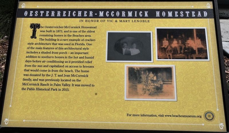
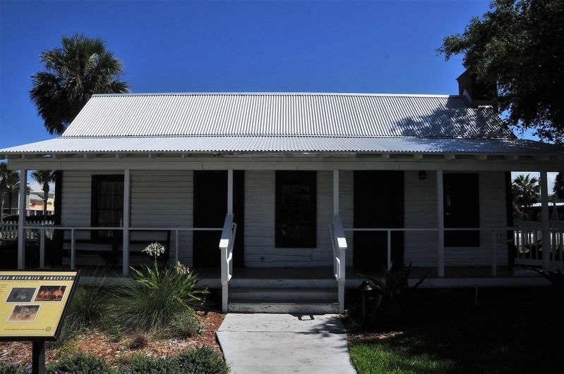
The Oesterreicher-McCormick Homestead was built in 1873, and is one of the oldest remaining homes in the Beaches area. The building is a rare example of cracker-style architecture that was used in Florida. One of the main features of this architectural style includes a shaded front porch – an important addition to southern homes in the hot and humid days before air conditioning as it provided relief from the sun and capitalized on access to breezes that could come in from the beach. The home was donated by the J.T. and Jean McCormick family, and was previously located on the McCormick Ranch in Palm Valley. It was moved to Pablo Historical Park in 2015.
Erected by Beaches Museum & History Park.
Topics. This historical marker is listed in these topic lists: Architecture • Settlements & Settlers. A significant historical year for this entry is 1873.
Location. This marker has been replaced by another marker nearby. It was located near 30° 17.312′ N, 81° 23.648′ W. Marker was in Jacksonville Beach, Florida, in Duval County. It was in The Beaches. It was at the intersection of Pablo Avenue (U.S. 90) and North 5th Street,
this page online

Regionally, this marker was in First Coast, in Greater Jacksonville, and on the Sea Islands. It was also in the American South and on the Eastern Seaboard. Globally, it was in the North Atlantic Region, North America, a Gulf of Mexico state, the Western Hemisphere, the Western World, and the Anglosphere. Historically, it found itself in what was once New Spain, the territory of the Mississippian Culture, one of the Confederate States of America, and the Antebellum South.
Other nearby markers. At least 8 other markers are within walking distance of this location: Oesterreicher-McCormick Cabin (a few steps from this marker); Beaches Museum Chapel (a few steps from this marker); Florida East Coast Foreman’s House (within shouting distance of this marker); Doolittle's 1922 Record Flight (within shouting distance of this marker); Porter Wood Burning Locomotive (within shouting distance of this marker); Florida East Coast Railway Depot
Photographed by Jay Kravetz, July 12, 2017
2. Oesterreicher-McCormick Homestead Marker
Another marker is no longer nearby. Pablo Beach FEC Foreman's House (was within shouting distance of this marker but has been replaced with another marker now near it).
Also see . . . Beaches Museum & History Park. (Submitted on September 11, 2017.)
Credits. This page was last revised on October 6, 2026. It was originally submitted on September 10, 2017, by Jay Kravetz of West Palm Beach, Florida. This page has been viewed 785 times since then and 79 times this year. Last updated on October 6, 2026, by Stephen Thomas White of Norfolk, Virginia. Photos: 1, 2. submitted on September 10, 2017, by Jay Kravetz of West Palm Beach, Florida. • Devry Becker Jones was the editor who published this page.
