Kingsport in Sullivan County, Tennessee — The American South (East South Central)
Suffering and Survival
Civil War in Sullivan County
Photographed by Mark Hilton, September 10, 2017
1. Suffering and Survival Marker
Inscription.
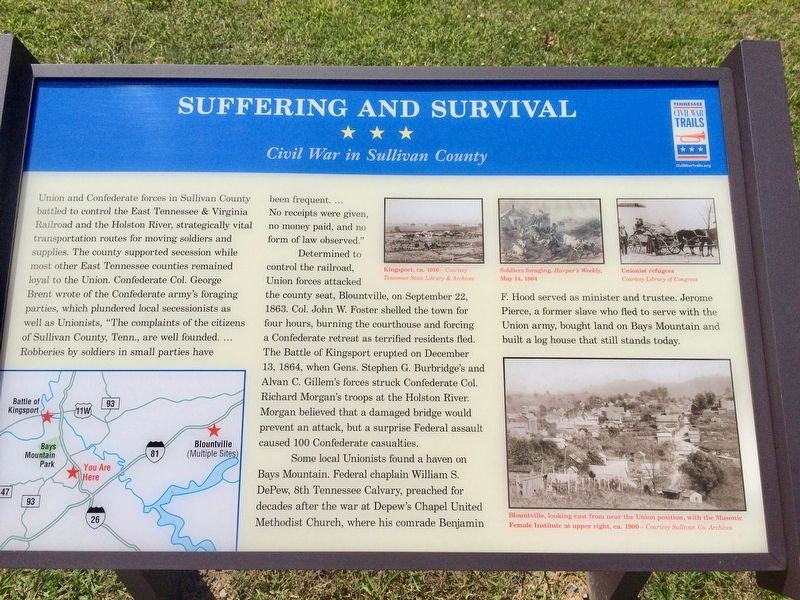
Suffering and Survival. Civil War in Sullivan County. Union and Confederate forces in Sullivan County battled to control the East Tennessee and Virginia Railroad and the Holston River, strategically vital transportation routes for moving soldiers and supplies. The county supported secession while most other East Tennessee counties remained loyal to the Union. Confederate Col. George Brent wrote of the Confederate army's foraging parties, which plundered local secessionists as well as Unionists, "The complaints of the citizens of Sullivan County, Tenn., are well founded. ... Robberies by soldiers in small parties have been frequent. ... No receipts were given, no money paid, and no form of law observed.", Determined to control the railroad, Union forces attacked the county seat, Blountville, on September 22, 1863. Col. John W. Foster shelled the town for four hours, burning the courthouse and forcing a Confederate retreat as terrified residents fled. The Battle of Kingsport erupted on December 13, 1864, when Gens. Stephen G. Burbridge's and Alvan C. Gillem's forces struck Confederate Col. Richard Morgan's troops at the Holston River. Morgan believed that a damaged bridge would prevent an attack, but a surprise Federal assault caused 100 Confederate casualties., Some local Unionists found a haven on Bays Mountain. Federal chaplain William S. DePew, 8th Tennessee Calvary, preached for decades after the war at Depew's Chapel United Methodist Church, where his comrade Benjamin F. Hood served as minister and trustee. Jerome Pierce, a former slave who fled to serve with the Union army, bought land on Bays Mountain and built a log house that still stands today. , [Photo captions] , Top right: Kingsport, ca. 1910 - Soldiers foraging. - Unionist refugees , Bottom right: Blountville, looking east from near the Union position, with the Masonic Female Institute at upper right, ca. 1900
Union and Confederate forces in Sullivan County
battled to control the East Tennessee & Virginia
Railroad and the Holston River, strategically vital
transportation routes for moving soldiers and
supplies. The county supported secession while
most other East Tennessee counties remained
loyal to the Union. Confederate Col. George
Brent wrote of the Confederate army's foraging
parties, which plundered local secessionists as
well as Unionists, "The complaints of the citizens
of Sullivan County, Tenn., are well founded. ...
Robberies by soldiers in small parties have been frequent. ...
No receipts were given,
no money paid, and no
form of law observed."
Determined to control the railroad, Union forces attacked
the county seat, Blountville, on September 22,
1863. Col. John W. Foster shelled the town for
four hours, burning the courthouse and forcing
a Confederate retreat as terrified residents fled.
The Battle of Kingsport erupted on December
13, 1864, when Gens. Stephen G. Burbridge's and
Alvan C. Gillem's forces struck Confederate Col.
Richard Morgan's troops at the Holston River.
Morgan believed that
Click or scan to see this page online
a damaged bridge would
prevent an attack, but a surprise Federal assault
caused 100 Confederate casualties.
Some local Unionists found a haven on
Bays Mountain. Federal chaplain William S.
DePew, 8th Tennessee Calvary, preached for
decades after the war at Depew's Chapel United
Methodist Church, where his comrade Benjamin F. Hood served as minister and trustee. Jerome Pierce, a former slave who fled to serve with the
Union army, bought land on Bays Mountain and
built a log house that still stands today.
[Photo captions]
Top right: Kingsport, ca. 1910 - Soldiers foraging. - Unionist refugees
Bottom right: Blountville, looking east from near the Union position, with the Masonic Female Institute at upper right, ca. 1900
Location. 36° 29′ N, 82° 32.945′ W. Marker is in Kingsport, Tennessee, in Sullivan County.
Photographed by Mark Hilton, September 10, 2017
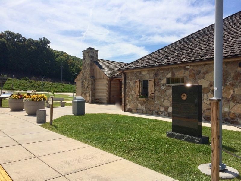
2. Suffering and Survival Marker, on far, left at Kingsport Welcome Center.
It can be reached from James H Quillen Parkway (Interstate 26 at milepost 5). Located at the State of Tennessee I-26 Kingsport Washington and Sullivan County Welcome Center. Touch for map. Marker is in this post office area: Kingsport TN 37664, United States of America. Touch for directions.
Regionally, this marker is in East Tennessee and in the Tri-Cities Area. It is also in the American South, specifically in the Upper South, in Appalachia, and specifically in Southern Appalachia. Globally, it is in North America, the Western Hemisphere, the Western World, and the Anglosphere. Historically, it finds itself in what was once the original Cherokee Nation, the territory of the Mississippian Culture, one of the Confederate States of America, the State of Franklin, and the Antebellum South.
Credits. This page was last revised on September 13, 2017. It was originally submitted on September 11, 2017, by Mark Hilton of Montgomery, Alabama. This page has been viewed 966 times since then and 38 times this year. Photos:1, 2, 3. submitted on September 11, 2017, by Mark Hilton of Montgomery, Alabama.