Colón, Querétaro, Mexico — The Central Highlands (North America)
The House of Amado de la Mota
| — | Ruta Cristera | — |
Photographed by J. Makali Bruton, September 10, 2017
1. The House of Amado de la Mota Marker
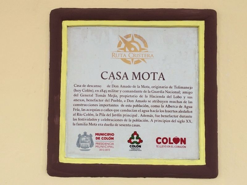
Casa Mota
Casa de descanso de Don Amado de la Mota, originario de Tolimanejo (hoy Colón), en 1845 militar y comandante de la Guardia Nacional; amigo del General Tomás Mejía, propietario de la Hacienda del Lobo y sus anexas, benefactor del Pueblo, a Don Amado se atribuyen muchas de las construcciones importantes de esta población, como la Alberca de Agua Fría, las acequias o caños que conducían el agua hacía los huertos aledaños al Río Colón, la Pila del Jardín principal. Además, fue benefactor durante las festividades y celebraciones de la población. A principios del siglo XX, la familia Mota era dueña de sesenta casas.
English translation
The Mota House
This was the rest house of Amado de la Mota, originally from Tolimanejo (today Colón), who in 1845 was a member of the military and commander of the National Guard. He was friends with General Tomás Mejía. He was also the owner of the Hacienda del Lobo (The Ranch of the Wolf) and its adjoining properties. As benefactor of the town, Amado contributed to many important town projects, like the Cold Water Pool, the irrigation projects that carried water to the orchards bordering
this page online
Erected by Municipio de Colón, Presidencia Municipal 2012-2015.
Topics. This historical marker is listed in these topic lists: Architecture • Charity & Public Work • Industry & Commerce. A significant historical year for this entry is 1845.
Location. 20° 47.29′ N, 100° 2.724′ W. Marker is in Colón, Querétaro. It is on Calle Héroes de la Revolución just east of Calle Sonora, on the right when traveling west. The marker is mounted to the left of the main entrance to the Colón Municipal Building. Touch for map. Marker is in this post office area: Colón QUE 76270, Mexico. Touch for directions.

Regionally, this marker is in Central Mexico and in the Bajío. Globally, it is in North America, specifically in Mesoamerica, on the Ring of Fire, and in the Western Hemisphere. Historically, it finds itself in what was once New Spain, a Spanish colony, and the Aztec Empire.
Other nearby markers. At least 8 other markers are

Photographed by J. Makali Bruton, September 10, 2017
2. An additional House of Amado de la Mota Marker
This additional marker is located in the interior patio of the building. It reads:
La Casa del Ayuntamiento
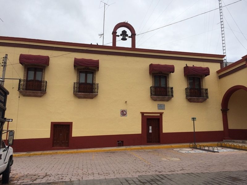
Data del siglo XVII, fue propiedad de la familia De la Mota y a partir de 1923 es ocupada por las oficinas del Ayuntamiento. Su gran portal distingue a esta casona y en uno de los muros del pasillo de acceso a este edificio, una gran pintura ilustra la historia del municipio; la fachada principal es al sur, frente a la plaza "Jardín Héroes de la Revolución". Las jambas y dinteles de sus balcones están ornamentados con motivos florales en altorelieve de piedra, distinguiéndose en el principal las iniciales A.M. de Don Armando De la Mota.
English:
Built in the XVII century; it was a property De la Mota's family and since 1923 it was occupied by the town council offices. It enormous door distinguish this big rambling house from the others and one of his access walls has a big picture which shows the municipality history; the main facade it is orientated toward the south, right in front of the square "Jardín Héroes de la Revolución". The jambs and lintels of its balconies are ornamented with flower motives on high relief made of stone, setting apart in the main one the initials A. M. Don Armando De la Mota. Año 2002
La Casa del Ayuntamiento
Data del siglo XVII, fue propiedad de la familia De la Mota y a partir de 1923 es ocupada por las oficinas del Ayuntamiento. Su gran portal distingue a esta casona y en uno de los muros del pasillo de acceso a este edificio, una gran pintura ilustra la historia del municipio; la fachada principal es al sur, frente a la plaza "Jardín Héroes de la Revolución". Las jambas y dinteles de sus balcones están ornamentados con motivos florales en altorelieve de piedra, distinguiéndose en el principal las iniciales A.M. de Don Armando De la Mota.
English:
Built in the XVII century; it was a property De la Mota's family and since 1923 it was occupied by the town council offices. It enormous door distinguish this big rambling house from the others and one of his access walls has a big picture which shows the municipality history; the main facade it is orientated toward the south, right in front of the square "Jardín Héroes de la Revolución". The jambs and lintels of its balconies are ornamented with flower motives on high relief made of stone, setting apart in the main one the initials A. M. Don Armando De la Mota. Año 2002
Additional commentary.
1. The Seal of the Municipality of Colón
The following text and English translation are from photo #3.
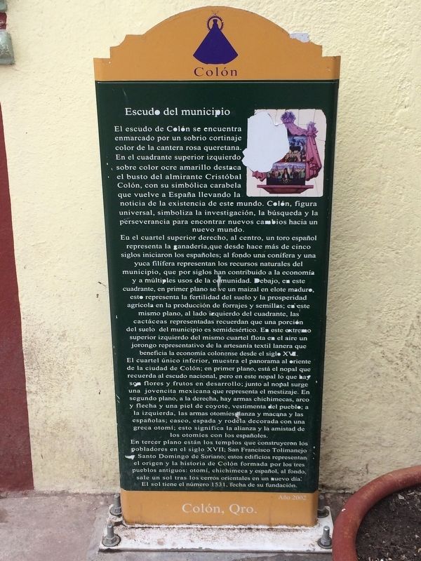
Escudo del municipio
El escudo de Colón se encuentra enmarcado por un sobrio cortinaje color de la cantera rosa queretana. En el cuadrante superior izquierdo sobre color ocre amarillo destaca el busto del almirante Cristóbal Colón, con su simbólica carabela que vuelve a España llevando la noticia de la existencia de este mundo. Colón, figura universal, simboliza la investigación, la búsqueda y la perseverancia para encontrar nuevos cambios hacia un nuevo mundo.
Photographed by J. Makali Bruton, September 10, 2017
3. An additional, nearby marker describing the seal of the Municipality of Colón
This additional marker is also found in the interior patio of the building. Its text and an English translation can be seen in the additional comments.
superior izquierdo del mismo cuartel flota en el aire un jorongo representativo de la artesanía textil lanera que beneficia la economía colonense desde el siglo XVI. El cuartel único inferior, muestra el panorama al oriente de la ciudad de Colón; en primer plano, está el nopal que recuerda al escudo nacional, pero en este nopal lo que hay son flores y frutos en desarrollo; junto al nopal surge una jovencita mexicana que representa el mestizaje. En segundo plano, a la derecha, hay
Photographed by J. Makali Bruton, September 10, 2017
4. The House of Amado de la Mota Marker
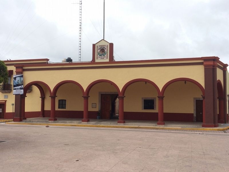
The building now houses the municipal government of Colón. The marker is to the left of the main entrance.
English translation:
The Seal of the Municipality of Colón
The seal of Colón is framed by a sober curtain, the color of the pink, quarried rock of Querétaro. In the upper left quadrant on a yellow-ocher background stands a bust of Admiral Christopher Columbus, with his symbolic caravel returning to Spain, carrying the news of the existence of this new world. Columbus, a universal figure, symbolizes research, investigation and the perseverance to find new changes as we move towards a
Photographed by J. Makali Bruton, September 10, 2017
5. An exterior balcony of the House of Mota
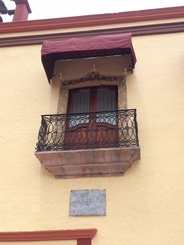
Note the decorative stone work around the balcony, especially the "AM" (for Amado de la Mota) mentioned on one of the additional markers. The lower, additional marker mentions that the Mexican President Adolfo Ruiz Cortines visited Colón in 1957.
Photographed by J. Makali Bruton, September 10, 2017
6. An additional view of the exterior balconies of the House of Mota, now the Colón Municipal Building.
— Submitted September 12, 2017, by J. Makali Bruton of Washington, District of Columbia.
Credits. This page was last revised on October 6, 2025. It was originally submitted on September 12, 2017, by J. Makali Bruton of Washington, District of Columbia. This page has been viewed 707 times since then and 36 times this year. Photos: 1, 2, 3, 4, 5, 6. submitted on September 12, 2017, by J. Makali Bruton of Washington, District of Columbia.
