Near Gordonsville in Louisa County, Virginia — The American South (Mid-Atlantic)
Orange County
⎯⎯⎯
Louisa County
Photographed by Craig Swain, January 12, 2008
1. South Facing Side
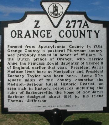
Orange County. Formed from Spotsylvania County in 1734, Orange County, a pastoral Piedmont county, was probably named in honor of William IV, the Dutch prince of Orange, who married Anne, the Princess Royal, daughter of George II of England, earlier that year. President James Madison lived here at Montpelier and President Zachary Taylor was born here. Some fifty square miles of the county comprise the Madison-Barbour Rural Historic District, an area rich in historic resources including the ruins of Barboursville, the home of Gov. James Barbour that was designed by 1817 by his friend Thomas Jefferson.
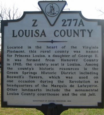
Louisa County. Located in the heart of the Virginia Piedmont, this rural county was named for Princess Louisa, a daughter of George II. It was formed from Hanover County in 1742; the county seat is Louisa. Among the county's historic resources is Green Springs Historic District including Boswell's Tavern, which was used on one occasion during the Revolution as headquarters of the Marquis de Lafayette. Other landmarks include the monumental Louisa County courthouse and the old jail.
Erected 1998 by Department of Historic
this page online
Topics and series. This historical marker is listed in this topic list: Political Subdivisions. In addition, it is included in the Former U.S. Presidents: #03 Thomas Jefferson, the Former U.S. Presidents: #04 James Madison, the Former U.S. Presidents: #12 Zachary Taylor, and the Virginia Department of Historic Resources (DHR) series lists. A significant historical year for this entry is 1734.
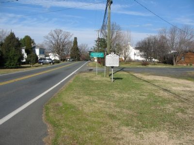
Location. 38° 7.661′ N, 78° 11.231′ W. Marker is near Gordonsville, Virginia, in Louisa County. It is on James Madison Highway (U.S. 15/33), on the right when traveling north. Touch for map. Marker is at or near this postal address: 210 Martinsburg Ave, Gordonsville VA 22942, United States of America. Touch for directions.

Regionally, this marker is in the Piedmont and in Central Virginia. It is also in the American South and specifically in the Upper South. Globally, it is in North America, the Western Hemisphere, the Western World, and the Anglosphere. Historically, it finds itself in what was once the territory of the Mississippian Culture, one of the original Thirteen Colonies, one of the Confederate
Photographed by Craig Swain, January 12, 2008
2. North Facing Side
Other nearby markers. At least 8 other markers are within 2 miles of this marker, measured as the crow flies: In Memory of the Soldiers, Both Confederate and Union (approx. 0.3 miles away); Gordonsville's Legendary Chicken Vendors (approx. 0.4 miles away); Welcome to The Exchange Hotel and Civil War Medical Museum (approx. 0.4 miles away); Gordon Inn (approx. one mile away); a different marker also named Orange County / Louisa County (approx. 1.1 miles away); Church of the Blind Preacher (approx. 1.4 miles away); The Maplewood Memorial Association (approx. 1½ miles away); General Thomas Sumter (approx. 1.8 miles away). Touch for a list and map of all markers in Gordonsville.
Also see . . .
1. History of Orange County. New River Notes website entry (Submitted on January 17, 2008, by Craig Swain of Leesburg, Virginia.)
2. Louisa County History. County website entry (Submitted on January 17, 2008, by Craig Swain of Leesburg, Virginia.)
3. Boswell's Tavern. Virginia Department of Historic Resources website entry (Submitted on January 17, 2008, by Craig Swain of Leesburg, Virginia.)
4. Green Springs.
Photographed by Craig Swain, January 12, 2008
3. Orange County / Louisa County Marker
5. Madison-Barbour Rural Historic District. Virginia Department of Historic Resources website entry (Submitted on January 16, 2013, by PaulwC3 of Northern, Virginia.)
Photographed by PaulwC3, September 20, 2014
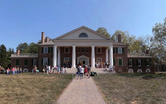
4. Montpelier (1764)
The home of President James Madison is one of the centerpiece estates of the Madison-Barbour Rural Historic District. Located near Montpelier Station, it was declared a National Historic Landmark in 1960 and listed on the National Register of Historic Places in 1966
Photographed by Craig Swain, April 17, 2010
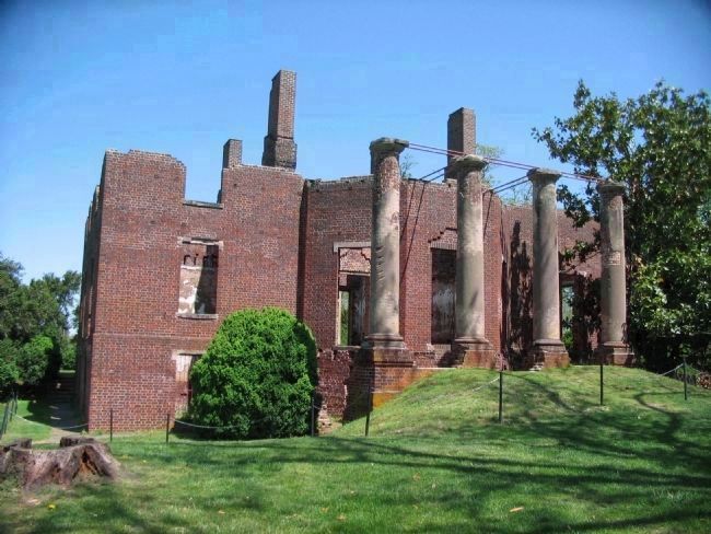
5. Barboursville (1822)
Designed by Thomas Jefferson and destroyed by fire in 1884, it is one of the centerpiece estates of the Madison-Barbour Rural Historic District. Located near Barboursville, it was listed on the National Register of Historic Places in 1969.
Photographed by PaulwC3, April 20, 2013
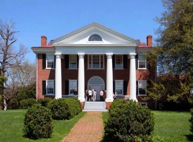
6. Frascati (1823)
The home is one of the centerpiece estates of the Madison-Barbour Rural Historic District. Located near Somerset, it was listed on the National Register of Historic Places in 1982.
Photographed by PaulwC3, April 20, 2013
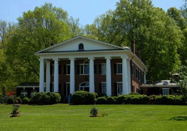
7. Rocklands (1851)
Built in 1851 and enlarged in 1905 it is one of the centerpiece estates of the Madison-Barbour Rural Historic District. Located near Gordonsville, it was listed on the National Register of Historic Places in 1982.
Credits. This page was last revised on November 16, 2022. It was originally submitted on January 17, 2008, by Craig Swain of Leesburg, Virginia. This page has been viewed 1,608 times since then and 71 times this year. Last updated on September 18, 2017, by Samuel Paik of Gainesville, Virginia. Photos: 1, 2, 3. submitted on January 17, 2008, by Craig Swain of Leesburg, Virginia. 4. submitted on September 22, 2014, by PaulwC3 of Northern, Virginia. 5. submitted on April 27, 2010, by Craig Swain of Leesburg, Virginia. 6, 7. submitted on April 20, 2013, by PaulwC3 of Northern, Virginia. • Bill Pfingsten was the editor who published this page.
